From Chambœuf to the banks of the Loire

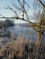
An easy circular walk taking you to the banks of the untamed Loire.

Details

16716100
Creation:
Last update:
Last review:
  • Walking
    Activity: Walking
  • ↔
    Distance: 13.59 mi
  • ◔
    Average duration: 6h 25 
  • ▲
    Difficulty: Moderate

  • ⚐
    Back to start: Yes
  • ↗
    Ascent: + 203 ft
  • ↘
    Descent: - 207 ft

  • ▲
    Highest point: 1,309 ft
  • ▼
    Lowest point: 1,125 ft

Photos

Description of the walk

Start from the Champ Vert stadium car park.

(S/E) Head to the right, following the footpath which leads to the D12 roundabout.

(1) Cross the road coming from Saint-Galmier with care, take the path on the right which runs alongside the Volvon and join the road.

(2) Follow the road to the left.

(3) Leave the return path on your right and continue straight on to cross the railway line. After the level crossing, follow the road to the left until you reach the path on the right.

(4) Take this path, which crosses the fields. Join the road (D1082), cross it carefully (heavy traffic) and continue to the next junction.

(5) Carry on straight ahead, passing alongside the castle grounds.
Join the path that runs alongside the Loire and head towards Rivas. When you reach the next road junction, cross straight ahead and continue for 100 m.

(6) Take the path on the left (car park) and continue along the banks of the Loire.

(7) Turn right and continue between the banks of the Loire and the pond. Then carry on straight ahead, still following the banks of the Loire, until you reach the picnic area.

(8) Turn back in the opposite direction, taking the path on the left and crossing the bridge.

(9) Take the road on the right until you reach the next Y-junction.

(10) Take the road on the right and head towards Cuzieu until you reach the junction with Rue du 19 Mars 62.

(11) Cross the street straight ahead and continue across Rue de Privas. Join the D1082 (Route de Veauche).

(12) Cross it carefully (heavy traffic) and, after 200 m, take the road on the right.

(13) At the T-junction, continue straight ahead along the track until you reach the D101.

(14) Follow it carefully to the left (heavy traffic). Cross a level crossing and continue for 150 m to the junction.

(15) Turn right onto Chemin de la Jourcière and follow it to the junction you passed on the way there.

(3) Turn left and continue for 200 m until you reach the other fork in the road, which you also passed on the way there.

(2) Turn right, taking the opposite route to the one taken on the way there, and this will take you to the stadium car park (S/E).


Waypoints

  1. S/E : mi 0 - alt. 1,309 ft - Stadium car park
  2. 1 : mi 0.67 - alt. 1,266 ft - D12. Giratoite
  3. 2 : mi 1.36 - alt. 1,253 ft - Junction used for both the outward and return journeys
  4. 3 : mi 1.48 - alt. 1,250 ft - Junction of the circular loop
  5. 4 : mi 1.75 - alt. 1,237 ft - Chemin du Bois Brulé
  6. 5 : mi 2.92 - alt. 1,257 ft - Crossroads
  7. 6 : mi 4.19 - alt. 1,155 ft - Car park
  8. 7 : mi 5.08 - alt. 1,152 ft - Path on the right - La Loire
  9. 8 : mi 7.47 - alt. 1,138 ft - Picnic area - La Loire
  10. 9 : mi 7.82 - alt. 1,132 ft - Bridge
  11. 10 : mi 8.33 - alt. 1,142 ft - Road junction on the edge of the - Coise (rivière)
  12. 11 : mi 8.97 - alt. 1,165 ft - Junction with Rue du 19 Mars 62
  13. 12 : mi 9.79 - alt. 1,243 ft - Junction with the D1082
  14. 13 : mi 10.34 - alt. 1,240 ft - Le Grand Clos
  15. 14 : mi 11.55 - alt. 1,250 ft - D101
  16. 15 : mi 11.92 - alt. 1,247 ft - Chemin de la Jourcière
  17. S/E : mi 13.59 - alt. 1,306 ft - Stadium car park

Notes

(8) Picnic area

Worth a visit

(6) Rivas
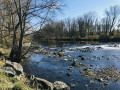
(7) The untamed Loire

Reviews and comments

4.1 / 5
Based on 3 reviews

Reliability of the description
4 / 5
Ease of following the route
4 / 5
Route interest
4.3 / 5
Pacaubert42
Pacaubert42

Overall rating : 3.7 / 5

Date of your route : Dec 29, 2024
Reliability of the description : ★★★★☆ Good
Ease of following the route : ★★★★☆ Good
Route interest : ★★★☆☆ Average
Very busy route : No

A lovely route at the start of the walk, when you’re along the banks of the Loire. However, there’s far too much tarmac on the second section (about 6 km of tarmac). You pass through rather uninteresting housing estates.

Machine-translated

Ananda
Ananda
• Edited:

Overall rating : 5 / 5

Date of your route : Dec 28, 2024
Reliability of the description : ★★★★★ Very good
Ease of following the route : ★★★★★ Very good
Route interest : ★★★★★ Very good
Very busy route : No

A lovely walk along the Loire

Machine-translated

@gmail.com
@gmail.com

Overall rating : 3.7 / 5

Date of your route : Oct 29, 2024
Reliability of the description : ★★★☆☆ Average
Ease of following the route : ★★★☆☆ Average
Route interest : ★★★★★ Very good
Very busy route : No

There were some details missing from the instructions, but thanks to the sat-nav I was able to follow the route

Machine-translated

Other walks in the area

For more walks, use our search engine .

The GPS track and description are the property of this route's author. Please do not copy them without permission.