From Chalonnes-sur-Loire to Beaulieu-sur-Layon

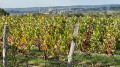
Set amongst the banks of the Loire, the GR®3 trail and the Layon valley, this stage offers spectacular views of the rivers, all punctuated by local heritage sites against a backdrop of vineyards characteristic of the Anjou region.

This walk is part of a multi-day hike: GRP® Au fil de l'Èvre et de l'Hyrôme

Details

99306734
Creation:
Last update:
Last review:
  • Walking
    Activity: Walking
  • ↔
    Distance: 10.17 mi
  • ◔
    Average duration: 5h 05 
  • ▲
    Difficulty: Moderate

  • ⚐
    Back to start: No
  • ↗
    Ascent: + 466 ft
  • ↘
    Descent: - 456 ft

  • ▲
    Highest point: 312 ft
  • ▼
    Lowest point: 36 ft
  • ⚐ Country: France
  • ⚐ City: Chalonnes-sur-Loire (49290)
  • ⚑
    Start: N 47.35357° / W 0.762224°
  • ⚑
    End: N 47.314017° / W 0.612711°
  • ❏
    IGN map(s): Ref. 1422SB, 1423SB, 1522ET, 1523SB
  • Hour-by-hour weather

Description of the walk

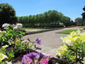
(S) From the bridge on the banks of the Loire, head towards Saint-Maurille Church and walk round it on the left along the riverbank to reach a small public park. Cross the park to the left.

(1) On leaving the park, cross the road and take the road bridge and the D751 over the Layon. At the end of the road, whilst still on the road, head towards the station on the right and cross at the first pedestrian crossing you come to, before continuing up a sloping street on the right.

(2) Follow this road and cross a bridge over the railway line before taking the next road on the right. Follow this road until you find a path leading through the trees and vineyards on the left. Carry on straight ahead until you reach the junction before the Moulin d’Ardenay.

(3) Turn left, then right. At the next road, continue to the left and quickly turn right to join the Route d’Ardenay D121.

(4) Follow it to the right, then turn left. Carry on straight ahead until you reach the D751 departmental road

(5) Cross it carefully, then keep to the right and rejoin it further on.

(6) Taking a left then a right, cross the D751 departmental road again (take care when crossing). Then continue straight ahead along the wide path until you reach the Fork in the road before the D54. Head up to the left and turn right to rejoin the D54 departmental road.

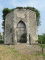
(7) Taking a left-right turn, cross this departmental road again. Continue straight on to reach the Moulin Guérin. Walk past it.

(8) At the junction of the GR® and GR® de Pays trails, turn right onto the path leading down towards Saint-Aubin-de-Luigné. At the first junction with a street, keep to the right. At a fork in the road, turn right again. Then turn left and you’ll arrive at the chancel of the church of Saint-Aubin-de-Ligné.

(9) Walk round the church on the left. Follow the D125 to the right, then immediately take the first left onto Rue Jean de Pontoise (still the D125) towards a campsite.

(10) From the campsite reception, cross the green space and follow the River Layon on your left until you reach a stony path.

(11) At the end of this path, level with the end of the bridge, take the road on the left then immediately turn right onto Chemin de Girouard. At the next junction, take the path on the right and follow the banks of the Layon until you rejoin the D209.

(12) Follow it briefly to the right for about 80 metres before turning onto a new path to the left. Follow this path, passing under a bridge on the D160, before reaching the Pont Barré (E).

Waypoints

  1. S : mi 0 - alt. 56 ft - Bridge on the D961 - La Loire
  2. 1 : mi 0.41 - alt. 59 ft - Exit from the park
  3. 2 : mi 0.81 - alt. 62 ft - Pierre Couts climb
  4. 3 : mi 2.46 - alt. 243 ft - Crossroads - Moulins d'Ardenay
  5. 4 : mi 3.02 - alt. 246 ft - D121 road
  6. 5 : mi 3.75 - alt. 220 ft - Cross the D751
  7. 6 : mi 3.99 - alt. 194 ft - Cross the D751
  8. 7 : mi 4.83 - alt. 282 ft - Cross the D54
  9. 8 : mi 5.85 - alt. 272 ft - GR x GRP
  10. 9 : mi 6.61 - alt. 79 ft - Église Saint-Aubin (Saint-Aubin-de-Ligné)
  11. 10 : mi 6.73 - alt. 59 ft - Entrance to a campsite
  12. 11 : mi 7.27 - alt. 66 ft - D125 road - Layon (rivière) à compléter
  13. 12 : mi 9.13 - alt. 85 ft - Route
  14. E : mi 10.17 - alt. 75 ft - Pont Barré (Saint-Lambert-du-Lattay)

Notes

Access to Beaulieu-sur-Layon: 2 km, 30 mins.
Continue along the GR® de Pays Coteaux du Layon et de la Loire and leave Pont-Barré on your right. Pass under the motorway bridge and head up the hillside via the next path on the left. Walk past the sports hall, turn left then right to reach the church square.

Worth a visit

Sainte Maurille Church

Guérin Mill

Angevine Corniche

Banks of the Layon

Pont-Barré Regional Nature Reserve
25 km south of Angers, the Coteaux du Pont-Barré Nature Reserve overlooks the Layon valley and its vineyards. The distinctive terrain, consisting of slopes interspersed with numerous small plateaus and rocky escarpments, and the geological complexity (a mixture of acidic and basic rocks) help to maintain a mosaic of natural habitats, to which the equally remarkable climatic conditions also contribute. The very sunny exposure, the very low rainfall, combined with the valley’s orientation and its connection to the Loire, explain the presence of numerous plant and animal species typically found in southern regions. At the contact zone between the Paris Basin and the Armorican Massif, the 27.40-hectare site hosts a wide variety of habitats: grasslands and heathland, forest edges, pioneer vegetation on rocky outcrops, fallow land, scrubland, wooded areas and wetlands.
As for the flora, 420 plant species have been recorded on the site to date. Among these are 50 vulnerable species, nine of which are protected at regional or national level, such as the Bohemian gagea, the wild tulip and the French rose. According to reserves-naturelles.org

Always be cautious and plan ahead when you're outdoors. Visorando and the author of this route cannot be held responsible for any accidents occurring on this route.

The GR® and PR® markings are the intellectual property of the Fédération Française de Randonnée Pédestre.

Other walks in the area

For more walks, use our search engine .

The GPS track and description are the property of this route's author. Please do not copy them without permission.