From Brayes to Port d’Agrès: between Occitanie and Auvergne

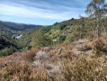
A route through the woods, but also at higher altitudes and alongside small streams, makes this hike a wild and shaded adventure, straddling two regions: Occitanie (Aveyron) and Auvergne (Cantal).
The GPX track may prove useful.
Please note: there are no signposts.

Details

n°18029950
Creation:
Last update:
Last review:
  • Walking
    Activity: Walking
  • ↔
    Distance: 7.99 mi
  • ◔
    Average duration: 4h 30 
  • ▲
    Difficulty: Average

  • ⚐
    Back to start: Yes
  • ↗
    Ascent: + 935 ft
  • ↘
    Descent: - 938 ft

  • ▲
    Highest point: 1,234 ft
  • ▼
    Lowest point: 630 ft

Photos

Description of the walk

Start at the junction of the Saint-Santin D72 and the D963 at a place called Brayes (park on the access road to Maspourquet).

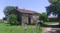
(S/E) Please note: no signposting. Maintenance is irregular. Take the tarmac road towards Brayès, then continue to the right, passing through the farmyards, and follow the tarmac road as it descends slightly to a solitary house decorated with wooden carvings; then take the dirt track to a fork in the road.

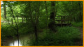
(1) Head down into the woods, keeping to the left along the main dirt track; at the bottom of the descent, turn right after crossing the small stream.

(2) After 50 m, carry on straight ahead, ignoring the path on the right. The single track climbs quite steeply through the woods and continues across two small meadows. You will then emerge onto the tarmac road at a place called Les Truels.

(3) Turn left, then left again onto the small tarmac road on the plateau, and follow it for about 2 km.

(4) Take the grassy track on the left between two meadows (on a clear day, you can see the bell tower of Livinhac).

(5) Turn left onto the track through the woods until you reach the road leading from Port d’Agrès to Livinhac.

(6) Continue left towards Port d’Agrès for about 200 m, then take the small tarmac road that climbs to the left and follow the dirt track alongside the stream. Ford the stream several times until you return to the crossroads you passed on the way out.

(2) Continue along the stream, then take the single track to the right, which climbs quite steeply through the heather. Cross two small meadows on the plateau, following the tracks left by farm machinery, until you reach a junction.

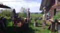
(7) Turn left onto a small grassy path (which can be very wet) that runs alongside a horse farm, leaving the main path which leads to a farm building.
This path leads out onto the D72 county road opposite the farm track: La Darse. Take the county road to the right for 100 m, then the track to the left towards the Berbezie farm.

(8) Just before the farm, turn right onto the tarmac track for 100 m, then take the track on the left next to the two agricultural silos.

(9) At the bottom of the descent, turn right onto the dirt track which climbs up to the hamlet of Mas del Bosc. Walk through the hamlet, which consists of two clusters of farm buildings, and at the last building, turn right onto the grassy path leading to the hamlet of Maspourquet. Turn right to return to the starting point (S/E).

Waypoints

  1. S/E : mi 0 - alt. 1,220 ft - Bus shelter
  2. 1 : mi 0.75 - alt. 1,119 ft - Start of the woodland
  3. 2 : mi 1.11 - alt. 922 ft - Stream. Junction of the circular loop
  4. 3 : mi 1.51 - alt. 1,161 ft - Les Truels
  5. 4 : mi 2.39 - alt. 1,102 ft - Crossroads. Stream
  6. 5 : mi 2.65 - alt. 1,014 ft - Descent through the woods
  7. 6 : mi 3.25 - alt. 630 ft - Route from Port d’Agrès to Livinhac
  8. 7 : mi 5.58 - alt. 1,122 ft - Horse farm
  9. 8 : mi 6.59 - alt. 1,086 ft - La Berbezie Farm
  10. 9 : mi 6.82 - alt. 997 ft - Small stream
  11. S/E : mi 7.99 - alt. 1,220 ft - Bus shelter

Notes

Some areas can be very wet in rainy weather. There are fords across small streams in winter.
As the route forms a figure of 8 ((2)), it is entirely possible to split it in two and complete it in two stages.

Worth a visit

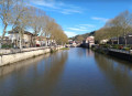
Livinhac bell tower, Saint-Santin warren, banks of the Lot. There are no tables or benches along the route, but there are several spots where you can have a picnic. For children, there are plenty of places to play in the stream in summer.
In Port d’Agrès, there is a small grocery shop. Restaurant (takeaway only as of January 2022).

Reviews and comments

3.3 / 5
Based on 4 reviews

Reliability of the description
3.3 / 5
Ease of following the route
2.8 / 5
Route interest
4 / 5
abornes
abornes

Overall rating : 3.7 / 5

Date of your route : Mar 06, 2024
Reliability of the description : ★★★★☆ Good
Ease of following the route : ★★★☆☆ Average
Route interest : ★★★★☆ Good
Very busy route : No

-At point 1, the description is correct but the route is wrong; you must continue along the dirt track and not venture into the brambles in the woods.
-At point 7, the path is impassable as it is flooded and very muddy; furthermore, an uprooted tree is lying across it, completely blocking the way.

Machine-translated

murded
murded

Overall rating : 1.7 / 5

Date of your route : Jun 28, 2023
Reliability of the description : ★☆☆☆☆ Very disappointing
Ease of following the route : ★☆☆☆☆ Very disappointing
Route interest : ★★★☆☆ Average
Very busy route : No

Never seen anything like it. No signposting at all… We just made up as we went along, turning off where the paths had disappeared (nature having reclaimed its territory), going round in circles and wading through brambles and stinging nettles – otherwise we’d have been off for a third lap… 6 km in 2 hours 30 minutes!! The written description didn’t match the route on the map! Let alone the one on the app? No signposting = no maintenance by the locals or the local council!! The weather was lovely, we’d brought a picnic, so we got back in the car and had a bite to eat by the water’s edge. We won’t be coming back to finish the other circular route. Oh well.

Machine-translated

lotois
lotois

Overall rating : 3.7 / 5

Date of your route : Jul 03, 2022
Reliability of the description : ★★★★☆ Good
Ease of following the route : ★★★☆☆ Average
Route interest : ★★★★☆ Good
Very busy route : No

Why go in a figure of 8?
At around the 2 km mark, you reach the bank of the stream; instead of turning right and crossing the stream, I followed the stream to reach Port d’Agrès directly. After Port d’Agrès, you head up to Le Truel (along a path and then a ridge). At Le Truel, take the path branching off to the right, which descends towards a small stream (dry at the start of July). Climb back up a little and you’ll find the return path (heading north) on the left.
This way, you follow the trail in a clockwise direction, without making a figure-of-eight.
A refreshing walk even in a heatwave.

Machine-translated

nanourom
nanourom

Overall rating : 4.3 / 5

Date of your route : Feb 07, 2022
Reliability of the description : ★★★★☆ Good
Ease of following the route : ★★★★☆ Good
Route interest : ★★★★★ Very good
Very busy route : Yes

The advantage of this route is that it can be completed in two stages. The downside is that there’s a slight problem where the two sections meet: the route isn’t clearly marked.:

Machine-translated

Other walks in the area

For more walks, use our search engine .

The GPS track and description are the property of this route's author. Please do not copy them without permission.