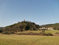
In the vicinity of Baerenthal

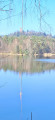
A lovely walk offering the chance to explore the surroundings of the pretty village of Baerenthal and its two ponds, one for fishing and the other for swimming.
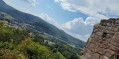
The walk takes you through the magnificent mixed woodland of the Northern Vosges Nature Park, following wide forest tracks as well as narrower, more technical paths, though these are not particularly difficult.

Details

26634114
Creation:
Last update:
Last review:
  • Walking
    Activity: Walking
  • ↔
    Distance: 10.87 mi
  • ◔
    Average duration: 6h 05 
  • ▲
    Difficulty: Moderate

  • ⚐
    Back to start: Yes
  • ↗
    Ascent: + 1,253 ft
  • ↘
    Descent: - 1,243 ft

  • ▲
    Highest point: 1,325 ft
  • ▼
    Lowest point: 682 ft

Description of the walk

Access: Coming from Zinswiller (from the south-east) or Philippsbourg (from the north-east), drive through Baerenthal along the main road and then continue along the Route de Mouterhouse. On leaving the village, turn right at the Daxhof farm. The car park is just after this on the right, opposite the fishing lake.

Red Ring signposting

(S/E) From the car park, head right, north-east, along Rue Rosselhof.

(1) Carry on straight ahead and, after about 200 m, leave the road to continue along the footpath to the Col du Petit Dunkelthal (heading north-east).

Green Ring and Yellow Disc markings

(2) At the Col du Petit Dunkelthal, turn left, heading north-west. Pass by the Source d’Argent or Silber Quelle.

Signposting: Green Disc

(3) At the junction with the forest track, continue to the right until you reach a road running at right angles.

Blue Triangle signposting

(4) Ignore the road and continue left along the path until you emerge onto Rue du Schmalental. Follow this street southwards, then continue straight on along Rue Hammerschless until you reach Route de Mouterhouse, which you should take carefully to the right, heading west for approximately 250 m.

(5) At the junction of Route de Mouterhouse and Route Forestière de la Kundschaft, continue along the path which climbs up to the ridge through the forest and passes one of the boundary stones erected in 1608 to mark the boundary between the lordships of Hanau and Lichtenberg and the Duchy of Lorraine. You’ll reach a fork in the path at the Carrefour de l’Arbre (alt. 396 m).

Marked with Green Cross and Yellow Cross

(6) Take the path on the left, heading south-east towards Offwiller/Reipertswiller, and reach the Col du Kammbül.

(7) Cross the road and continue straight ahead until you reach a junction, approximately 250 m before the Abri du Zollhaeusel

Signposting: Yellow Rectangle, Red Diamond

(8) Head up to the left (the signpost is almost behind you as you reach this junction) towards the north (GR® 532) and reach the Wolfskaul junction.

Signposting: Yellow Rectangle, Red Diamond, Blue Ring

(9) Continue straight ahead (GR®532) towards Baerenthal. You’ll reach the village after passing through an apple orchard/sheep pasture.

(10) Once you reach the main road through Baerenthal, which continues to the left along the Route de Mouterhouse, carefully follow this road to the right for about 60 metres, then turn left onto Rue de Ramstein.

Signposting: yellow diamond, red ring, green ring and blue ring

(11) After 150 m, just before the junction with Rue de l’École, turn left onto Allée des Bouleaux, heading north-west, along the path that runs alongside the southern shore of the recreational lake (leisure centre, Ramstein beach, campsite) and emerges onto Rue Rossel-Hof.

(1) Turn left and head for the fishing lake car park (S/E).

Waypoints

  1. S/E : mi 0 - alt. 686 ft - Fishing lake car park - Zinsel du Nord (rivière)
  2. 1 : mi 0.1 - alt. 692 ft - Junction at the end of the circular loop - Étang de Baerenthal
  3. 2 : mi 1.12 - alt. 974 ft - Col du Petit Dunkelthal (298m)
  4. 3 : mi 2.5 - alt. 978 ft - Forest track
  5. 4 : mi 2.8 - alt. 883 ft - Rue Schmalenthal, riding centre - Gare de Bannstein
  6. 5 : mi 4.12 - alt. 709 ft - Junction - Zinsel du Nord (rivière)
  7. 6 : mi 6.12 - alt. 1,299 ft - Tree Crossroads (Alt. 396 m)
  8. 7 : mi 6.94 - alt. 1,115 ft - Col du Kammbühl (340m)
  9. 8 : mi 7.78 - alt. 1,142 ft - GR532
  10. 9 : mi 8.63 - alt. 1,175 ft - Wolfskaul junction
  11. 10 : mi 10.17 - alt. 702 ft - Baerenthal main road
  12. 11 : mi 10.29 - alt. 692 ft - Allée des Bouleaux
  13. S/E : mi 10.87 - alt. 689 ft - Car park - Étang de Baerenthal

Always be cautious and plan ahead when you're outdoors. Visorando and the author of this route cannot be held responsible for any accidents occurring on this route.

The GR® and PR® markings are the intellectual property of the Fédération Française de Randonnée Pédestre.

Reviews and comments

4.3 / 5
Based on 3 reviews

Reliability of the description
4.7 / 5
Ease of following the route
4.7 / 5
Route interest
3.7 / 5
Lukowiak Michel
Lukowiak Michel

Overall rating : 4.3 / 5

Date of your route : Aug 23, 2025
Reliability of the description : ★★★★★ Very good
Ease of following the route : ★★★★★ Very good
Route interest : ★★★☆☆ Average
Very busy route : No

Forest and more forest! Only the start and the last kilometre offer a change of scenery. But it's well worth it for the 17.5 km and the peace and quiet.

Machine-translated

gizmo
gizmo

Overall rating : 3.7 / 5

Date of your route : Aug 15, 2024
Reliability of the description : ★★★★☆ Good
Ease of following the route : ★★★★☆ Good
Route interest : ★★★☆☆ Average
Very busy route : No

An easy walk; the route passes through the forest and goes past the fishing pond at the start and the swimming pond at the end; apart from that, there’s nothing in particular to see; however, some sections of the walk are in open country

Machine-translated

Luise
Luise

Overall rating : 5 / 5

Date of your route : Jun 08, 2024
Reliability of the description : ★★★★★ Very good
Ease of following the route : ★★★★★ Very good
Route interest : ★★★★★ Very good
Very busy route : No

A walk that isn’t too difficult and offers plenty of variety, allowing you to explore the forest of the Northern Vosges in all its diversity. It is particularly beautiful in early summer, when the purple foxglove flowers brighten up the clearings. Most of the route is shaded.

Machine-translated

Other walks in the area

For more walks, use our search engine .

The GPS track and description are the property of this route's author. Please do not copy them without permission.