In the hills between Sainte-Tulle and Corbières-en-Provence

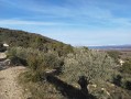
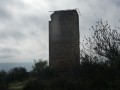
A walk through the hills, taking in the Sainte-Tulle cairn and the Saint-Brice Chapel in Corbières.

Details

n°41327556
Creation:
Last update:
Last review:
  • Walking
    Activity: Walking
  • ↔
    Distance: 6.46 mi
  • ◔
    Average duration: 3h 55 
  • ▲
    Difficulty: Moderate

  • ⚐
    Back to start: Yes
  • ↗
    Ascent: + 1,099 ft
  • ↘
    Descent: - 1,099 ft

  • ▲
    Highest point: 1,709 ft
  • ▼
    Lowest point: 1,043 ft

Photos

Description of the walk

Park at the side of the road (on an undeveloped plot) a few metres from the Chemin de Saint-Jacques.

(S/E) Cross the Chemin de Saint-Jacques and take the path along the old canal to a T-junction.

(1) Take the path to the left, slightly below the track, which joins a larger path.

(2) Turn right onto this main track and continue for 1 km on a relatively flat stretch. Pass under a power line and follow it for about 80 m until you reach a fork.

(3) Head up to the left and join a cross-path.

(4) Turn left as you climb, then follow a track for about 300 m until you reach a left-hand bend.

(5) Leave the track and take the path on the right, joining a track suitable for vehicles on the ridge.

(6) Turn left and continue for about 150 m.

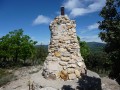
(7) Pass the Sainte-Tulle cairn and, further on, a cistern. Cut across a track and arrive at a junction with a footpath.

(8) Take this path uphill to the right. You’ll reach a junction where a track meets two paths. Follow the second path on the right, heading due south, and arrive at the summit, at the foot of an electricity pylon.

(9) Follow the path down to the right, heading due south, and you’ll come to a junction.

(10) Take the path on the left which runs alongside the track below and then joins it. Follow it for 20 metres to the left.

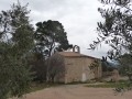
(11) Take the path on the right and head down to the Saint-Brice Chapel.

(12) Turn left to walk past it, then take the path that climbs past the 428-metre mark, beneath the power line. Join the track you took a short while earlier and follow it to the right for 20 metres.

(13) Turn onto the path on the left, pass under the various power lines and join Chemin Saint-Brice at a road junction (elevation 324).

(14) Take the road on the left (Chemin Saint-Brice). Further on, pass a street on the left and continue for a few dozen metres.

(15) Leave the road by climbing the embankment on the left, cross the olive grove to reach the path of the old Manosque Canal and follow it.

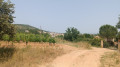
(16) Go round the houses on the right, passing through the vineyard. Once back on the path of the old canal, continue along it until you reach (S/E).

Waypoints

  1. S/E : mi 0 - alt. 1,076 ft - Car park: Chemin Saint-Jacques
  2. 1 : mi 0.18 - alt. 1,060 ft - T-junction, turn left
  3. 2 : mi 0.36 - alt. 1,142 ft - Junction with the path, on the right
  4. 3 : mi 1 - alt. 1,096 ft - At the junction, turn left uphill
  5. 4 : mi 1.62 - alt. 1,201 ft - Junction, turn left
  6. 5 : mi 1.89 - alt. 1,381 ft - Turn, path on the right
  7. 6 : mi 2.11 - alt. 1,470 ft - Vehicle-accessible track, on the left
  8. 7 : mi 2.22 - alt. 1,490 ft - Sainte-Tulle cairn
  9. 8 : mi 2.46 - alt. 1,490 ft - At the junction, turn right uphill
  10. 9 : mi 3.03 - alt. 1,709 ft - EDF pylon, on the right
  11. 10 : mi 3.43 - alt. 1,427 ft - Junction, turn left
  12. 11 : mi 3.84 - alt. 1,306 ft - Junction, path on the right
  13. 12 : mi 4.57 - alt. 1,175 ft - Saint-Brice Chapel
  14. 13 : mi 5.17 - alt. 1,306 ft - Junction, path on the left
  15. 14 : mi 5.56 - alt. 1,060 ft - At the junction, turn left onto Chemin Saint-Brice
  16. 15 : mi 5.72 - alt. 1,056 ft - Junction, embankment on the left
  17. 16 : mi 5.96 - alt. 1,073 ft - Bypassing the houses
  18. S/E : mi 6.46 - alt. 1,073 ft - Car park: Chemin Saint-Jacques

Notes

Parking available at the starting point.
IBP Index 41.

Worth a visit

Reviews and comments

3.5 / 5
Based on 2 reviews

Reliability of the description
3.5 / 5
Ease of following the route
3.5 / 5
Route interest
3.5 / 5
BCC
BCC

Overall rating : 3 / 5

Date of your route : May 09, 2024
Reliability of the description : ★★★☆☆ Average
Ease of following the route : ★★★☆☆ Average
Route interest : ★★★☆☆ Average
Very busy route : No

An interesting route through the hills in the central section between points 3 and 10, but the start of the route up to points 1 and 2 is difficult to find amongst the recent buildings, despite the help of a GPS. The return leg from 14 to 16 is also disappointing. The start and finish are located in expanding residential areas, and at point 16 you need to avoid what is undoubtedly unregulated development.

Machine-translated

Crapet
Crapet

Overall rating : 4 / 5

Date of your route : Nov 15, 2023
Reliability of the description : ★★★★☆ Good
Ease of following the route : ★★★★☆ Good
Route interest : ★★★★☆ Good
Very busy route : No

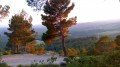
An interesting route with lovely views and a remarkable cairn. The route is a little tricky to follow because there are so many paths branching off, so you need to keep your wits about you.

Machine-translated

Nivalys
Nivalys

Hello
signposting along part of the route (around 50 per cent, if my IGN map is to be believed).
At one point, although the path is theoretically clear on the maps, it is occupied by a campsite, hence the need to go round it for 100 metres (point 16) at the end of the vineyard

Machine-translated

AUDO13
AUDO13

Hello, are the paths signposted or not? Are there any sections on private land? Thank you

Machine-translated

Other walks in the area

For more walks, use our search engine .

The GPS track and description are the property of this route's author. Please do not copy them without permission.