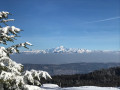
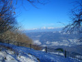
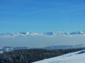
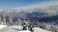
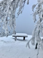
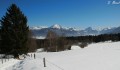
Grand Colombier ridge from Culoz

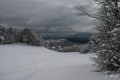
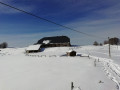
The ascent to the plateau and the Grand Colombier ridge through the snow follows an easy route, though it is relatively long due to the low starting altitude. The Grand Colombier offers a magnificent view over the Alps.

Details

1746983
Creation:
Last update:
Last review:
  • Snowshoeing
    Activity: Snowshoeing
  • ↔
    Distance: 12.21 mi
  • ◔
    Duration according to the author: 8 hrs 
  • ▲
    Difficulty: Moderate

  • ⚐
    Back to start: Yes
  • ↗
    Ascent: + 3,150 ft
  • ↘
    Descent: - 3,136 ft

  • ▲
    Highest point: 4,665 ft
  • ▼
    Lowest point: 1,549 ft

Photos

Description of the walk

Start from the Grand Colombier road north of Culoz. The road is not cleared of snow in winter, but the snowplough usually clears the road up to the Pont de la Source bend at 471m. If the end of the road is impassable, leave your car at one of the lower bends and walk the final few hundred metres.

(S/E) At the bend, take theGRP® path (accessible to 4x4s in summer) which climbs to Romagneux. It crosses the Pont de la Source bridge and then winds steadily upwards through the forest.

(1) On emerging from the forest, a junction leads to the Romagneux mountain pasture. Take the path that climbs to the right, straight up the slope. It gradually veers to the right along the hillside, then climbs in increasingly tight hairpin bends before crossing to the right to go round the ridges overlooking it.

It then heads north to follow the leeward side of the ridge and continues to climb, winding in wide bends through the forest until it reaches the end of the Route de Fenestré. Descend slightly to the left to reach the viewpoint.

(2) From the viewpoint, retrace your steps for 50 metres along the Route de Fenestré, then take a path on the left that curves northwards to join another forest track at the La Cornalle junction.

(3) Turn sharply left, still following theGRP®, and follow this track past Pré Sauvage to a house in the forest; go round it on the right and head westwards up a path with regular hairpin bends through the forest until you reach its end (La Côte aux Andrés).

(4) Enter through a gate into the mountain pastures which, at En Davoyard, form a plateau across which you walk to see the Crête du Grand Colombier opposite. Continue straight on at the same level past the Grange à Masse and, once in sight, join the Grand Colombier road at the Virage de la Frappe.

(5) Head up the road to the left, following theGRP®, northwards to the hamlet of Longechat. Leave the GRP®.

(6) From there, there are several options, depending on how much time you have:
- if you have more than 5 hours before nightfall, it is best to continue along the road to the Col du Colombier and from there, in 5 minutes, turn right to the Cross (1524m) and its orientation table;
- if you have slightly less time, climb to the highest point (1,534 m), which can be spotted by its high-voltage pylon, but the slopes between the road and the summit are steeper;
- If you only have 4 hours for the return journey, head as close as possible to the ridge (option described below).

Turn left at the start of a pastoral track and head uphill, either along this track or straight up the slope, to the Auberge du Colombier. Walk past the building and climb up the opposite slope to a pass marked by a signpost. Reach the ridge which slopes down towards “En Pryse” (1,430 m) in the direction of Chanduraz and Planapose.

(7) After enjoying the view, head back down towards the road and turn right onto it.

(5) At the Virage de la Frappe, you can either return via the route you took on the way up or choose to take a leisurely stroll along the Col road (this option, described here, is preferable in poor visibility, as the plateau is often covered in drift snow and tracks can quickly be blown away by the wind). Leavethe GRP® trail.

Turn left to head down the road, which is marked by coloured poles used for snow clearance in spring. It soon enters the forest and then veers from east to south at Crotublanc, for a fairly long flat section.

(8) 400 m before the Sapette junction, to break up the monotony of the road, turn right onto a roughly straight, level forest track which leads to the junction you passed on the way up.

(3) At this La Cornalle junction, continue straight ahead along theGRP® to reach Le Fenestré.

(2) Turn left to begin the descent (allow 2 hours), following the same route taken on the ascent via Romagneux.

(1) Turn left to reach the Pont de la Source. (S/E)

Waypoints

  1. S/E : mi 0 - alt. 1,549 ft - Turn-off at Pont de la Source on the CD 120
  2. 1 : mi 1.49 - alt. 2,487 ft - Romagneux mountain pasture
  3. 2 : mi 3.78 - alt. 3,875 ft - Fenestré viewpoint
  4. 3 : mi 4.29 - alt. 4,078 ft - La Cornalle junction
  5. 4 : mi 4.74 - alt. 4,331 ft - Entrance to the En Davoyard mountain pasture
  6. 5 : mi 5.56 - alt. 4,386 ft - The Virage de la Frappe
  7. 6 : mi 5.82 - alt. 4,488 ft - Longechat
  8. 7 : mi 5.99 - alt. 4,665 ft - Crête du Colombier at En Pryse
  9. 8 : mi 7.59 - alt. 4,131 ft - Start on the path to the right (near La Sapette)
  10. S/E : mi 12.21 - alt. 1,549 ft - Turn-off at Pont de la Source on the CD 120

Notes

There are no particular technical difficulties. Snow and wind can make it difficult to find your way around the En Davoyard plateau.

The first part of the ascent faces south-east and benefits from the sun, which warms this sheltered slope from early morning, making an early start easier.

Generally, given the altitude, you set off on foot and, depending on snow conditions, put on your snowshoes at Romagneux (1) or at Fenestrez (2).

Worth a visit

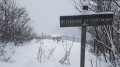
Much of the route (from (S) to (6)) follows theGR® 9,GR® 509 Grande Traversée du Jura and theGRP® Tour du Valromey. The numerous signposts indicate this, but the markings (red and white) are old and very faint.

From (1), it is a 10-minute walk south to the Romagneux viewpoint, which overlooks Culoz and the valley. As part of this route, this is optional, as the route then continues to the Fenestré viewpoint, which is higher up and on the same slope.

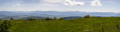
The view from the Fenestré viewpoint (2) (orientation table) offers unobstructed views over Culoz, the Rhône Valley, the Chautagne and the Marais de Lavours, Lake Bourget, the Dent du Chat and the Bauges mountains, as well as Mont Blanc in the distance.
(The spelling ‘Fenestré’ is used in this description to conform to the IGN maps’ nomenclature, but on the ground the signposts tend to read ‘Fenestrez’.)

From (7), the view is almost 360°, with a panorama of the Alps stretching from the Chablais to La Meije and L’Étendard, taking in Mont Blanc, the Vanoise, La Tournette and the Aravis, the Aiguilles d’Arves...

Always be cautious and plan ahead when you're outdoors. Visorando and the author of this route cannot be held responsible for any accidents occurring on this route.

The GR® and PR® markings are the intellectual property of the Fédération Française de Randonnée Pédestre.

Reviews and comments

4.4 / 5
Based on 3 reviews

Reliability of the description
4.7 / 5
Ease of following the route
4.7 / 5
Route interest
4 / 5
Girish
Girish

Overall rating : 4.7 / 5

Date of your route : Aug 14, 2021
Reliability of the description : ★★★★★ Very good
Ease of following the route : ★★★★★ Very good
Route interest : ★★★★☆ Good
Very busy route : No

A hike with an overnight stay, setting off just before 6 pm from Pont de la Source and arriving at around 7.30 pm at Fenestrez. The time given is completely inaccurate in my case, as it relates to a snowshoe hike.
I found the route too short for my fitness level, so I carried on to the Croix du Colombier along the ridge, passing over the summit.
Take care at point 3: make sure you carry on right up to the sign for La Cornalle, as it’s possible to turn off too early.
The view from Le Fenestrez is much more interesting than the one from the summit, in my opinion, especially at sunrise.

Machine-translated

Evie
Evie

Overall rating : 4.3 / 5

Date of your route : Aug 15, 2021
Reliability of the description : ★★★★☆ Good
Ease of following the route : ★★★★☆ Good
Route interest : ★★★★★ Very good
Very busy route : No

I set off from Culoz Town Hall. The path climbs steadily in a series of hairpin bends through the forest. Shaded. Long. Lovely view at the top. Quite a few people at the pass. Road and cyclists.

Machine-translated

andomir
andomir

Overall rating : 4.3 / 5

Date of your route : Jul 12, 2021
Reliability of the description : ★★★★★ Very good
Ease of following the route : ★★★★★ Very good
Route interest : ★★★☆☆ Average
Very busy route : No

A rather tedious walk, 90 per cent of which is through woodland
The path is very gradual
There are lovely views from time to time when the trees allow.
.

Machine-translated

Other walks in the area

For more walks, use our search engine .

The GPS track and description are the property of this route's author. Please do not copy them without permission.