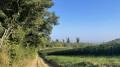
A circular walk from Blanot to Cortambert and Les Quatre Vents

A hike of moderate difficulty, climbing up to the heights and following paths that wind along the hillside, offering sweeping views over the Grosne and Grison valleys.

Details

n°111276491
Creation:
Last update:
Last review:
–
  • Walking
    Activity: Walking
  • ↔
    Distance: 10.23 mi
  • ◔
    Average duration: 5h 50 
  • ▲
    Difficulty: Moderate

  • ⚐
    Back to start: Yes
  • ↗
    Ascent: + 1,276 ft
  • ↘
    Descent: - 1,276 ft

  • ▲
    Highest point: 1,667 ft
  • ▼
    Lowest point: 1,030 ft

Description of the walk

Park in the small car park in the village of Blanot.

(S/E) With your back to the wash house, take the tarmac path known as ‘la Brosse ronde’, which runs alongside Le Coing (formerly L’Étape), towards the Bois de la Chassagne. At the junction, continue straight ahead until you reach the hamlet known as La Musette. The path becomes grassy: note the blue markings on a white background, which you should follow continuously until you reach the point (2).

(1) Take the path on the left, across the open field, before the descent begins. At the edge of the field, ignore the path leading down to the right and carry on straight ahead. At Les Echats Loups, turn right and you will very quickly reach the signposted junction for the Bois de la Chassagne.

(2) Leave the blue markings on a white background and head towards Cortambert opposite. At the Pierre de Balancin junction, take the track on the left, still heading towards Cortambert. Stay on this path for a long while until you reach

(3) At the “Bois de la Roche” junction, head down a relatively steep slope to the right. Once at the bottom, at the “Sous la Roche” signpost, continue to the left along the edge of the woodland. The path soon curves to the right and descends across fields: this section may be muddy.

(4) In the wide bend, at the foot of the vineyards, take the path that descends steeply to the left. Pass a small clearing on the right and continue downhill,passing between the town hall and the church.

(5) At the stop sign, cross the D117 at the pedestrian crossing and head down Rue de la Mairie to the left. Pass under anold fire hose reel. Head back up to the left and turn right onto Rue de Roussot, towards the cemetery and Varanges. Pass the cemetery and carry on.

(6) At a place called Vignes des Teiches, carry on to the left towards Les Quatre Vents. At the ‘give way’ sign, cross the junction and take the road opposite, then turn immediately left onto Rue des Colots, which leads to a waterworks. Stay on this street and then head uphill for a few metres alongRue du Four à Chaux.

(7) Leave this almost immediately to follow the Ban Sacré route along a path on the right, marked in yellow. At the end of this path, turn right, cross over a stream and take the path on the left as it climbs. Stay on this relatively straight path until it forms a T-junction at the Bois Galland signpost.

(8) Then turn left towards Les Quatre Vents. At the concrete junction at Sous la Roche, continue to the right towards Les Quatre Vents; stay on this path until you join the GR®76A: marked in white and red.

(9) Take this path to the left towards Mont-Saint-Romain. Pass the small house on the left and turn immediately left onto the path leading uphill. Follow it to the Alleu junction and head down to the right towards the Col de la Percée, onto the D117.

(10) Carefully walk up the road to the left for about 150 metres, then take the second path on the right. At the right-hand bend, carry straight on to reach the site of Notre-Dame des Anges, situated barely a hundred metres away.

(11) Turn back and rejoin the route to the left on the GR®.

(12) At the “Mollard Gros Jacques” signpost, continue straight ahead and slightly to the right towards Mont-Saint-Romain. Carry on straight ahead until you reach the D146, at a place called Le Poirier au Prêtre.

(13) Cross the road carefully and head straight ahead, turning left onto the Chemin des Moines. Walk past a large shed.
At the Peluzot junction, continue along the GR®. Do the same at L’Épinasse and carry on to the end of the path, marked by a T-junction.

(15) Leave the GR® and head down to the left towards Blanot. Pass the tennis courts, then take the tarmac path on the right.

(15) Take a detour to the right to walk past Sant-Martin Church, then return to the starting car park (S/E).

Waypoints

  1. S/E : mi 0 - alt. 1,158 ft - Car park
  2. 1 : mi 0.8 - alt. 1,135 ft - La Musette
  3. 2 : mi 1.27 - alt. 1,335 ft - Signpost at Bois de la Chassagne
  4. 3 : mi 2.23 - alt. 1,568 ft - Signpost at Bois de la Roche
  5. 4 : mi 2.9 - alt. 1,237 ft - Path on the left
  6. 5 : mi 3.05 - alt. 1,096 ft - Stop – D117
  7. 6 : mi 3.99 - alt. 1,043 ft - The Teiches vineyards
  8. 7 : mi 4.32 - alt. 1,066 ft - Sacred bench on the right
  9. 8 : mi 5.38 - alt. 1,322 ft - Bois Gaillard signpost
  10. 9 : mi 6.08 - alt. 1,604 ft - Quatre Vents signpost – GR®76A junction
  11. 10 : mi 7.08 - alt. 1,506 ft - Crossroads - Col de la Percée (475m)
  12. 11 : mi 7.53 - alt. 1,549 ft - Notre-Dame des Anges
  13. 12 : mi 7.72 - alt. 1,555 ft - Mollard Gros Jacques signpost
  14. 13 : mi 8.33 - alt. 1,483 ft - D146 road – Le Poirier au Prêtre
  15. 14 : mi 9.46 - alt. 1,532 ft - Junction – Exit GR®
  16. 15 : mi 10.1 - alt. 1,198 ft - Junction - Église Saint-Martin (Blanot)
  17. S/E : mi 10.23 - alt. 1,158 ft - Car park

Notes

Toilets in the car park in the village of Blanot and at the caves.

Walking shoes are essential.
Remember to bring water bottles and hats in summer.
Cool off at the bar: Le Coing or at the refreshment stand by the caves in summer.
Discover local produce: cheeses from Blanot Farm and cured meats from Mont-Rouge Farm.

Shelter is available at Cortambert Church or the Varanges washhouse.
Benches between Cortambert and Varanges and between the Col de la Percée and Notre-Dame de la Roche.
Picnic area and shelter at Le Poirier du Prêtre

Worth a visit

There are several options available to you:
- a visit to the caves in summer.
- a visit to the village of Blanot with its Merovingian tombs, church, priory, wash houses, communal oven and pottery.
- A walk to the Mont-St-Romain orientation point, situated on the highest peak in the Clunisois region.

Le Coing, today. L’Étape yesterday, or the former Café Jusseau: following an informant’s tip-off, five villagers who were members of the Resistance were arrested and deported on 23 January 1944. Their names, along with five others, appear on the war memorial erected to the left of the premises.

Between (S/E) and (1), note, on the right, the view over Mont-Saint-Romain. This is the highest peak in the Clunisois region. It rises to 579 metres and is said to have been a site of Druidic worship. Legend tells of a merciless struggle between the old and the new religions on this wooded and rocky site. A chapel was once built here, but it has since disappeared. The site is now private property and features an orientation board. Access is permitted on certain days.

(4) Note, high up on the left, Butte à Vent Castle. It was probably built in the first half of the 12th century by the Gros d’Uxelles, lords of Brancion. In 1237, Josseran IV of Brancion ceded the fortress of Boutavent and its castellany to Cluny Abbey. From the 14th to the 16th century, the castle was captured on several occasions before being permanently disarmed and re-established as an agricultural estate.

(5) The Church of Saint-Maurice in Cortambert, built in 1784, is particularly noted for its rose window.

The water complex consists of a fountain with a drinking trough and a covered washhouse; it was built to plans by the architect Jacquelot Cadet between 1845 and 1847.

(S/E) Blanot: three Merovingian tombs, the Priory, Saint-Martin’s Church, the communal oven, the fountain, the washhouse and the ‘book exchange’.

Always be cautious and plan ahead when you're outdoors. Visorando and the author of this route cannot be held responsible for any accidents occurring on this route.

The GR® and PR® markings are the intellectual property of the Fédération Française de Randonnée Pédestre.

Other walks in the area

For more walks, use our search engine .

The GPS track and description are the property of this route's author. Please do not copy them without permission.