


Clough Head Reservoir
Details
Creation:
Last update:
–
–
-
 Activity: Walking
-
 Distance: 3.90 mi
-
 Average duration: 2h 15
-
 Difficulty: Not specified
-
-
 Back to start: Yes
-
 Ascent: + 554 ft
-
 Descent: - 554 ft
-
-
 Highest point: 1,017 ft
-
 Lowest point: 676 ft
-
 Country:
United Kingdom
-
 City:
Borough of Rossendale
-
 Start/End: N 53.701691° / W 2.353528°
-


 Hour-by-hour weather


Waypoints
- S/E : mi 0 - alt. 771 ft - Start on Grane Road
- 1 : mi 0 - alt. 774 ft - Turn left onto Grane Road
- 2 : mi 0.23 - alt. 797 ft - Turn right
- 3 : mi 0.42 - alt. 791 ft - Turn right
- 4 : mi 0.75 - alt. 938 ft - Turn left
- 5 : mi 1.5 - alt. 1,017 ft - Turn left
- 6 : mi 1.77 - alt. 948 ft - Turn right onto Grane Road
- 7 : mi 1.78 - alt. 955 ft - Turn left
- 8 : mi 1.97 - alt. 869 ft - Turn slight right onto Calf Hey Road
- 9 : mi 2.01 - alt. 846 ft - Turn right
- 10 : mi 2.07 - alt. 863 ft - Keep right
- 11 : mi 2.14 - alt. 837 ft - Turn slight right
- 12 : mi 2.15 - alt. 837 ft - Turn left
- 13 : mi 2.42 - alt. 804 ft - Turn left
- 14 : mi 2.5 - alt. 883 ft - Turn sharp left
- 15 : mi 2.89 - alt. 896 ft - Turn slight left
- 16 : mi 3.13 - alt. 896 ft - Turn sharp right
- 17 : mi 3.69 - alt. 679 ft - Turn left
- 18 : mi 3.88 - alt. 774 ft - Turn left onto Grane Road
- S/E : mi 3.9 - alt. 778 ft
Other walks in the area
Rossendale from Water
 Visorando Member
 4.33 mi
+479 ft
-479 ft
2h 25
 Easy
 Departure from Borough of Rossendale (Lancashire)
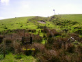
The walk starts from Dean Lane, Water in Rossendale (01Start) and follows the anticlockwise circular route via Small Shaw trig point.
Jumbles Country Park
 Association / Club / Walk leader4.19 mi
+502 ft
-531 ft
2h 20
 Moderate
Departure from Bury (Greater Manchester)
Descend through flowery pastures and then circumnavigate a scenic wooded reservoir.
Two Brooks Valley
3.77 mi
+505 ft
-505 ft
2h 10
Moderate
Departure from Bury (Greater Manchester)
Pleasant farmland walking with a pretty interlude along a wooded stream valley.
Top o’ th’ Knotts
1.78 mi
+217 ft
-220 ft
1h 00
Easy
Departure from Bury (Greater Manchester)
A contouring farmland stroll with wide views over Bolton to Winter Hill.
Turton & Entwistle and Wayoh Reservoirs from Jumbles
9.04 mi
+558 ft
-554 ft
4h 40
Moderate
Departure from Bolton (Greater Manchester)
This walk visits the three large reservoirs and an area of moorland to the north of Bolton.
Jubilee Tower Darwen from Ryal Fold
 4.33 mi
+600 ft
-610 ft
2h 30
Moderate
Departure from Tockholes (Lancashire)
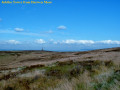
The walk starts from Ryal Fold, Tockholes Road and follows the anticlockwise circular route via Duckshaw Moor, Darwin Tower and Earnsdale Reservoir.
For more walks, use our search engine .
The GPS track and description are the property of this route's author. Please do not copy them without permission.

