


Circular 4 Mile
Details
Creation:
Last update:
–
–
-
 Activity: Walking
-
 Distance: 3.91 mi
-
 Average duration: 1h 55
-
 Difficulty: Not specified
-
-
 Back to start: Yes
-
 Ascent: + 98 ft
-
 Descent: - 98 ft
-
-
 Highest point: 187 ft
-
 Lowest point: 79 ft
-
 Country:
United Kingdom
-
 City:
Wigan
-
 Start/End: N 53.541972° / W 2.638611°
-


 Hour-by-hour weather


Waypoints
- S/E : mi 0 - alt. 89 ft - Start on
- 1 : mi 0.02 - alt. 89 ft - Turn left
- 2 : mi 0.03 - alt. 89 ft - Turn left onto Heritage Way
- 3 : mi 0.05 - alt. 89 ft - Turn right onto Pottery Road, A577
- 4 : mi 0.15 - alt. 98 ft - Keep left onto Wallgate
- 5 : mi 0.37 - alt. 135 ft - Turn right onto King Street
- 6 : mi 0.43 - alt. 128 ft - Turn right
- 7 : mi 0.44 - alt. 128 ft - Turn right onto King Street
- 8 : mi 0.51 - alt. 118 ft - Enter roundabout
- 9 : mi 1.21 - alt. 148 ft - Turn sharp left onto Birkett Bank
- 10 : mi 1.56 - alt. 161 ft - Turn right onto Scholes, B5238
- 11 : mi 1.7 - alt. 187 ft - Keep right onto Platt Lane
- 12 : mi 1.71 - alt. 187 ft - Turn sharp right onto Scholes, B5238
- 13 : mi 1.83 - alt. 164 ft - Keep right
- 14 : mi 1.87 - alt. 154 ft - Turn slight right onto Greenough Street
- 15 : mi 1.95 - alt. 128 ft - Keep right onto Greenough Street
- 16 : mi 2.03 - alt. 115 ft - Turn right onto Central Park Way, A49
- 17 : mi 2.1 - alt. 118 ft - Turn right
- 18 : mi 2.19 - alt. 115 ft - Turn slight right
- 19 : mi 2.2 - alt. 115 ft - Turn left
- 20 : mi 2.2 - alt. 112 ft - Turn right
- 21 : mi 2.39 - alt. 112 ft - Turn right
- 22 : mi 2.43 - alt. 115 ft - Turn left onto Hilton Street
- 23 : mi 2.45 - alt. 115 ft - Turn right onto Powell Street, B5375
- 24 : mi 2.66 - alt. 128 ft - Turn right onto Mesnes Street, B5376
- 25 : mi 2.75 - alt. 125 ft - Turn left onto Mesnes Park Terrace
- 26 : mi 2.87 - alt. 118 ft - Turn right onto Parson's Walk, B5375
- 27 : mi 2.96 - alt. 128 ft - Turn right onto New Market Street
- 28 : mi 3.25 - alt. 105 ft - Turn left onto Prescott Street
- 29 : mi 3.52 - alt. 79 ft - Turn right onto Miry Lane
- 30 : mi 3.52 - alt. 79 ft - Turn slight right onto Miry Lane
- 31 : mi 3.79 - alt. 92 ft - Keep left onto Miry Lane
- 32 : mi 3.81 - alt. 92 ft - Turn sharp right onto Wallgate, A577
- 33 : mi 3.82 - alt. 89 ft - Turn sharp left onto Wallgate, A577
- 34 : mi 3.85 - alt. 89 ft - Turn sharp left onto Wallgate, A577
- 35 : mi 3.86 - alt. 89 ft - Turn left onto Heritage Way
- 36 : mi 3.88 - alt. 89 ft - Turn right
- 37 : mi 3.89 - alt. 89 ft - Turn right
- S/E : mi 3.91 - alt. 89 ft
Other walks in the area
Wigan Flashes Circular
 Visorando Member
 5.03 mi
+20 ft
-20 ft
2h 20
 Easy
 Departure from Wigan (Greater Manchester)
The walk starts at Westwood Road Wigan in order to join the canal and head south. On leaving the canal the route passes through Wigan Flashes and Turners Flash before heading back to start.
Bryn Gates Lane Circular
 5.85 mi
+69 ft
-66 ft
2h 45
Easy
Departure from Wigan (Greater Manchester)
Circular walk starting from Wigan Flashes and including Bryn Gates Lane, Viridor Wood and canal towpath.
Crook Standish Circular
 6.25 mi
+302 ft
-302 ft
3h 10
 Moderate
Departure from Wigan (Greater Manchester)
Circular Walk starting from sports ground in Crook then North onto Birley Pond, Birley & Elnup Woods exiting over Mill Brook to gently ascend to Birch Walk. The route then follows the boundary of Standish Park before heading back to start via Giants Hall Farm and Standish Wood Lane. Good views of Beacon Park and Winter Hill ridges from high points.
Gathurst Dean Brook Circular
 6.71 mi
+262 ft
-262 ft
3h 20
Moderate
Departure from Wigan (Greater Manchester)
7 mile circular walk starting from Potters Wood Gathurst, joining Leeds Liverpool Canal before ascending to Bank Top then via Dean Brook back to start.
Shevington Standish Circular
 5.61 mi
+249 ft
-246 ft
2h 50
Moderate
Departure from Shevington (Greater Manchester)
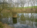
6m mile circular route starting from Shevington crossing Mill Brook into Elnup Wood, From here the route makes its way via Standish Park to cross Mill Brook and M6 motorway onto Shevington Vale. Having made its way around the vale the route heads back to start over Gathurst Golf course.
Pennington Green Circular via Borsdane Wood
 5.13 mi
+213 ft
-200 ft
2h 35
Moderate
Departure from Wigan (Greater Manchester)
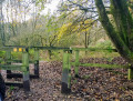
Walk starts from Hindley Mill Lane and follows anticlockwise circular route via Borsdane Wood, Pennington Green, Kirkless Wood and Hindley Hall.
For more walks, use our search engine .
The GPS track and description are the property of this route's author. Please do not copy them without permission.

