Southern route of La Villedieu-du-Clain

A walk to discover biodiversity in a rural setting. The route follows dirt tracks and short sections of tarmac-surfaced local roads.

Details

211195
Creation:
Last update:
Last review:
  • Walking
    Activity: Walking
  • ↔
    Distance: 6.95 mi
  • ◔
    Average duration: 3h 15 
  • ▲
    Difficulty: Moderate

  • ⚐
    Back to start: Yes
  • ↗
    Ascent: + 56 ft
  • ↘
    Descent: - 56 ft

  • ▲
    Highest point: 443 ft
  • ▼
    Lowest point: 374 ft

Photos

Description of the walk

Park in the car park by the community hall behind the church.

(S/E) Head south and take the Chemin des Ecoles, then turn right onto Rue de Pouzac. Cross the D741 (take care), then take the Chemin de la Grande Maison opposite.

(1) At the Fork in the road, turn left, heading due south, onto Chemin de Beaudet. Follow this road until you reach the D31.

(2) Cross the road and continue along the small road opposite until you reach the hamlet of La Sarmandière.

(3) At the junction, cross the road and follow the white track straight ahead for 1.5 km, ignoring several turnings to the left and right.

(4) Turn right onto the grassy path and carry on straight ahead at the junction to join a white track.

(5) Cross over and continue straight ahead to the T-junction.

(6) Turn right onto the gently sloping path and head uphill.

(7) Walk past the motocross track on your right and carry on to Bernuchet Farm.

(8) At the junction, follow the path straight ahead. When you reach the road, take the path on the right in front of the small stone monument consisting of a grave and a cross. Continue to Aslonnes.

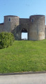
(9) At the end of the track, take the first road on the right towards the Fort.

(10) In front of the castle entrance, turn left onto the wide, tree-lined avenue, which leads to a small sawmill. Then take the road on the right for 200m and turn left at the first path.

(11) Take the wide white limestone track on the right. Ignore all the tracks on the left.

(1) At the fork you took on the way out, continue straight ahead until you reach the D741 road. Cross the road (take care), head straight ahead, then turn into the second street on the left to return to the car park (S/E).

Waypoints

  1. S/E : mi 0 - alt. 430 ft - Car park at the multi-purpose hall
  2. 1 : mi 0.33 - alt. 436 ft - Junction
  3. 2 : mi 0.98 - alt. 436 ft - Crossing the D31
  4. 3 : mi 1.52 - alt. 420 ft - La Sarmandière, at the junction, head straight ahead
  5. 4 : mi 2.46 - alt. 400 ft - Take the small grassy path on the right
  6. 5 : mi 2.99 - alt. 394 ft - Cross the white track
  7. 6 : mi 3.4 - alt. 400 ft - At the T-junction, take the path on the right
  8. 7 : mi 3.67 - alt. 374 ft - Motocross track
  9. 8 : mi 4.1 - alt. 394 ft - Bernuchet Farm, head straight on
  10. 9 : mi 4.92 - alt. 420 ft - On the right on the road towards Le Fort
  11. 10 : mi 5.22 - alt. 433 ft - At the castle entrance, turn left
  12. 11 : mi 5.73 - alt. 410 ft - At the junction, turn right onto the white limestone track
  13. S/E : mi 6.95 - alt. 430 ft - Car park at the multi-purpose hall

Worth a visit

(7) Motocross track

To “take to the skies”:
The site, near Le Fort Castle, is run by ASPTT Poitiers Parapente and is open to the public for tandem discovery flights, with introductory sessions available from the age of 14.

Reviews and comments

4.3 / 5
Based on 2 reviews

Reliability of the description
4.5 / 5
Ease of following the route
5 / 5
Route interest
3.5 / 5
DOM 86
DOM 86

Overall rating : 4.3 / 5

Date of your route : Nov 07, 2023
Reliability of the description : ★★★★☆ Good
Ease of following the route : ★★★★★ Very good
Route interest : ★★★★☆ Good
Very busy route : No

The first 3 or 4 km are on flat ground, so there’s little shelter from the wind or the sun, depending on the time of year. But even when it’s rained heavily, the paths remain passable, which is a real bonus. After that, there are hedgerows and sections through woodland. I’ve tweaked the end of the route slightly by following the white ‘cycle’ path to end up opposite the church, thus avoiding having to go back down the same street and cross the road again.

Machine-translated

upar
upar

not yet carried out

Machine-translated

rori3022
rori3022

Overall rating : 4.3 / 5

Date of your route : Jan 31, 2018
Reliability of the description : ★★★★★ Very good
Ease of following the route : ★★★★★ Very good
Route interest : ★★★☆☆ Average

An interesting walk through the wooded section between Médelle and Fort d'Aslonnes; the rest of the route is flat and not particularly interesting.

Machine-translated

Other walks in the area

For more walks, use our search engine .

The GPS track and description are the property of this route's author. Please do not copy them without permission.