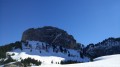
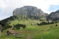
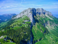
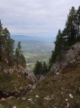
Route photo in Eteaux, through its woods and past its mill

A walk through woods and fields with lovely views of the surrounding mountains.

Details

n°34303172
Creation:
Last update:
Last review:
  • Walking
    Activity: Walking
  • ↔
    Distance: 6.69 mi
  • ◔
    Average duration: 4h 05 
  • ▲
    Difficulty: Moderate

  • ⚐
    Back to start: No
  • ↗
    Ascent: + 1,125 ft
  • ↘
    Descent: - 404 ft

  • ▲
    Highest point: 2,949 ft
  • ▼
    Lowest point: 2,008 ft
  • ⚐ Country: France
  • ⚐
    Area: Alps
  • ⚐ City: Etaux (74800)
  • ⚑
    Start: N 46.066015° / E 6.294019°
  • ⚑
    End: N 46.057373° / E 6.253934°
  • ❏
    IGN map(s): Ref. 3429ET, 3430ET, 3430ETR, 3430OT
  • Hour-by-hour weather

Photos

Description of the walk

Start from the car park at Eteaux Town Hall. For the rural section, use the pavements.

(S) Head towards the church and follow Route de Charny. Cross the bridge over the A410 motorway, then take the wooden footbridge to reach a roundabout.

(1) Turn left onto Route de Collonges, and at the wooden bus shelter, turn right onto Chemin des Hauts de Charny. Continue to the turning area at the end of the village houses.

(2) Take the path through the woodland and, after 200 m, follow the path to the left until you reach the Écuries de la Madeleine.

(3) Turn slightly left, then carry on straight ahead to the hamlet of Buisson Rond. Walk along the road for 500 m until you reach a fork just after the electricity pole supporting a transformer.

(4) Turn right uphill, then quickly take the path on the left which runs behind the houses. At the last house further down, turn right and climb up to La Molasse, in the middle of the Bois du Jura.

(5) Head straight ahead and, after 200 m, as you approach a fun information board on your left, take the small path to the left. Once you reach level ground, turn right until you reach a junction, then keep to the right and head down to the stream.

(6) Cross the stream, take the path on the right and continue keeping to the right. At the junction with a cross-country path, turn left and carry on until you reach the gate, which you can go through. Shortly after the gate, turn left onto the Chapelle-Rambaud country lane and continue straight on to reach the end of the Impasse des Champs de Berley.

(7) Cross the road (D5) and take the Chemin du Vuaz opposite. At the next junction, turn right and, when you reach the road, turn left.

(8) In front of the Grange farm, keep to the right and follow the Chemin des Longets. Pass a chalet on stilts, then a farmhouse. At the next junction, keep to the right and join a cross-path at the edge of the woods.

(9) Continue to the left between the fields. Ignore the turn-off to the farm on the right and, at the next three-way junction, head slightly to the left. Pass a fir forest, then head down to the right onto the Bellecombe country lane and arrive at the farm. Turn right straight away and carry on straight ahead for a round trip to the authentic Moulin Rosset : if you meet the owner, ask him for a tour – he’ll be delighted.

(10) Then return to the farm and carry on straight ahead. Walk past the farmhouse and head towards the 90° right-hand bend. Take the path on the left, enter the forest and you’ll reach a road as you come out of the woods.

(11) Carry on along this road and, at the next junction, turn right onto Route de chez Mugnier to reach the car park just past the school (E).

Waypoints

  1. S : mi 0 - alt. 2,073 ft - Eteaux Town Hall car park
  2. 1 : mi 0.83 - alt. 2,028 ft - Route de Collonges
  3. 2 : mi 1.2 - alt. 2,116 ft - Forest trail
  4. 3 : mi 1.54 - alt. 2,198 ft - Élevage de la Madeleine
  5. 4 : mi 2.01 - alt. 2,490 ft - Uphill path to the right
  6. 5 : mi 2.41 - alt. 2,776 ft - La Molasse
  7. 6 : mi 2.84 - alt. 2,818 ft - Stream, path on the right
  8. 7 : mi 3.62 - alt. 2,835 ft - Route
  9. 8 : mi 4.21 - alt. 2,812 ft - Chemin des Longets
  10. 9 : mi 4.89 - alt. 2,943 ft - Crossing path at the edge of the woods
  11. 10 : mi 5.93 - alt. 2,769 ft - Rosset Mill
  12. 11 : mi 6.48 - alt. 2,805 ft - Route
  13. E : mi 6.69 - alt. 2,789 ft - School car park

Notes

Arrange for two cars or walk back along the local roads, a distance of approximately 7 km.

Reviews and comments

3 / 5
Based on 3 reviews

Reliability of the description
3 / 5
Ease of following the route
2.7 / 5
Route interest
3.3 / 5
User 30159992

Overall rating : 3.7 / 5

Date of your route : Jul 19, 2026
Reliability of the description : ★★★★☆ Good
Ease of following the route : ★★★☆☆ Average
Route interest : ★★★★☆ Good
Very busy route : No

A lovely route. However, it’s very difficult to find your way around, especially at the start. The first road signposted is a long way from the car park.
There are a few ‘traps’ along the route when it comes to finding your way. For example, the path behind a private car park.

Machine-translated

Gaston Pernollet
Gaston Pernollet

Overall rating : 1 / 5

Date of your route : Apr 05, 2025
Reliability of the description : ★☆☆☆☆ Very disappointing
Ease of following the route : ★☆☆☆☆ Very disappointing
Route interest : ★☆☆☆☆ Very disappointing
Very busy route : No

No signage, no markings and no maintenance; the trees have been cut back in a proper mess and the route has become dangerous... It was supposed to be a 17 km round trip, but we ended up doing 25 km – and we’re locals!!! Thank goodness we had your GPS coordinates. Thank you

Machine-translated

Elia
Elia

Overall rating : 4.3 / 5

Date of your route : Jan 03, 2024
Reliability of the description : ★★★★☆ Good
Ease of following the route : ★★★★☆ Good
Route interest : ★★★★★ Very good
Very busy route : No

I downloaded this app specifically to find walks near me. The app is well designed and it’s quite easy to find your way around it. However, some of the information is occasionally incorrect, but nothing too serious. I would, however, advise anyone planning to go for a walk using the map to READ the tips and instructions carefully beforehand. I hadn’t paid attention, and the end point of the walk turned out to be 6 km from the starting point. So I had to walk an extra 6 km (it didn’t bother me, but it’s important to know).
I highly recommend this app.
P.S.: If Visiorando are reading this comment, please could you explicitly state before the start of the walk what type of footwear is required. I had to throw mine away on arrival as they weren’t suitable or appropriate.
Thank you very much

Machine-translated

Other walks in the area

For more walks, use our search engine .

The GPS track and description are the property of this route's author. Please do not copy them without permission.