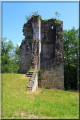
The Dunois Route on the Brulhois Trails

Whether on foot, by mountain bike or on horseback, with friends, family or on your own, set off to discover the charm of the Brulhois countryside!

Starting from the pretty village of Dunes, this short circular route invites you to explore the village’s surroundings, taking in country lanes, wooded areas and farmland.

An ideal route for enjoying a pleasant and accessible walk, combining nature, tranquillity and the chance to discover the rural heritage.

A wonderful opportunity to get some fresh air and savour the Brulhois countryside at your own pace!

This is Route 12 of the Sentiers du Brulhois

Details

n°111492623
Creation:
Last update:
Last review:
–
  • Walking
    Activity: Walking
  • ↔
    Distance: 5.50 mi
  • ◔
    Average duration: 2h 45 
  • ▲
    Difficulty: Easy

  • ⚐
    Back to start: Yes
  • ↗
    Ascent: + 243 ft
  • ↘
    Descent: - 236 ft

  • ▲
    Highest point: 420 ft
  • ▼
    Lowest point: 213 ft
  • ⚐ Country: France
  • ⚐ City: Dunes (82340)
  • ⚑
    Start/End: N 44.086145° / E 0.770335°
  • ❏
    IGN map(s): Ref. 1940O, 1941O
  • Hour-by-hour weather

Description of the walk

(S/E) From the car park at Place du Foirail, take the Promenade des Remparts and walk through the village of Dunes, turning right and then continuing left until you reach Impasse du Grangé.

(1) Leave Avenue André Vidalot by taking the cul-de-sac on the left and cross the Bois de Liher.

(2) On leaving the Bois de Liher, take the Chemin de Sannac on the right, then, just after the motorway tunnel, take the path that leads up to the right into the woods.

(3) Cross Route de Caudecoste and take Route de Bésodis opposite.

(4) Take the path on the right between the fields.

(5) When you reach the Route de Saint-Sixte, turn right onto it and follow it as far as the Avenue du Brulhois.

(6) Turn right onto the avenue, go under the motorway and head left up the path that runs alongside the orchard. Follow the motorway alongside the orchards, then turn right and head for the junction after the woodland.

(7) Turn right towards Garlin, then keep left and rejoin the path.

(8) Turn right and head down Chemin de Bonne, then take Route de Montardon on the right and continue along Rue des Peupliers on the right. Then head towards the cemetery on the left via Impasse du Pontets. Then turn right and head towards the square (S/E).

Waypoints

  1. S/E : mi 0 - alt. 397 ft - Place du Foirail
  2. 1 : mi 0.72 - alt. 390 ft - Fork in the road and dead end
  3. 2 : mi 1.52 - alt. 220 ft - Exit from the Bois de Liher
  4. 3 : mi 2.13 - alt. 289 ft - Crossroads
  5. 4 : mi 2.56 - alt. 233 ft - Junction with a path
  6. 5 : mi 3.09 - alt. 249 ft - Saint-Sixte Route
  7. 6 : mi 3.75 - alt. 285 ft - Avenue du Brulhois
  8. 7 : mi 4.58 - alt. 407 ft - Fork in the road
  9. 8 : mi 5 - alt. 420 ft - Chemin de Bonne junction
  10. S/E : mi 5.5 - alt. 397 ft - Place du Foirail

Notes

The ‘Sentiers du Brulhois’ comprise a network of short walking routes designed for walkers, mountain bikers and horse riders (some sections are accessible to horse-drawn carriages) in the southern part of the Communauté de Communes des Deux Rives area. A range of routes of varying lengths are available, starting from the villages of Donzac, Dunes, Sistels and Saint-Loup. On these walks, which take just a few hours, you’ll discover the rolling countryside of the Brulhois region, the architectural heritage of the Gascon bastides and the charm of the flower-filled villages.

Worth a visit

As you enjoy this pleasant ride, discover the charm of the bastide of Dunes, its narrow streets and its heritage typical of the Brulhois region.

As you leave the village, let yourself be enchanted by the countryside, the orchards and the natural areas surrounding this pretty Gascon bastide.

A wonderful opportunity to combine exploring our heritage, nature and tranquillity, whilst enjoying the peaceful atmosphere of our region.

Other walks in the area

For more walks, use our search engine .

The GPS track and description are the property of this route's author. Please do not copy them without permission.