The Brulhois Route: The Brulhois Trails

Fancy a wonderful adventure in the heart of our countryside? Whether on foot, by mountain bike or on horseback, set off to explore the Brulhois on this 34-kilometre route! Passing through the villages of Dunes, Donzac and Sistels, this route takes you through orchards, vineyards, forests and rolling countryside, allowing you to discover the full diversity of our region. As you make your way along the route, let yourself be charmed by our villages, the lovely panoramic views and the tranquillity of our country lanes. A magnificent route for lovers of nature and the great outdoors, combining discovery, enjoyment and a sporting challenge. A wonderful adventure to be enjoyed at your own pace! This is Route No. 1 of the Sentiers du Brulhois.
The .gpx track file can be very useful.

Details

n°111190655
Creation:
Last update:
Last review:
–
  • Walking
    Activity: Walking
  • ↔
    Distance: 21.71 mi
  • ◔
    Average duration: 11h 25 
  • ▲
    Difficulty: Very difficult

  • ⚐
    Back to start: Yes
  • ↗
    Ascent: + 1,614 ft
  • ↘
    Descent: - 1,624 ft

  • ▲
    Highest point: 627 ft
  • ▼
    Lowest point: 213 ft
  • ⚐ Country: France
  • ⚐ City: Sistels (82340)
  • ⚑
    Start/End: N 44.062082° / E 0.783891°
  • ❏
    IGN map(s): Ref. 1940O, 1941O
  • Hour-by-hour weather

Description of the walk

Start at the water tower car park.

(S/E) Walk through the village.

(1) On leaving Sistels, head down to the right towards the lake.

(2) Walk round Lake Ajelauque on the right, then head back up the opposite side until you reach a Fork in the road.

(3) Turn left, then head down the right-hand side of the woodland edge before entering the Bois de Cabos, a designated ONF area. Head towards Bernadet by keeping to the left, and continue along the dirt track until you reach a road.

(4) Cross it and carry on straight ahead towards the Tour des Templiers.

(5) At the junction, turn right, then left, towards the Tour des Templiers.

(6) When you reach the tower, take the dirt track that leads to La Pujade and carry on until you reach the Route de Cuq.

(7) Keep to the right. Follow the road, passing fields and orchards. After the Ruisseau du Métau, continue to the left to reach Dunes.

(8) When you reach Place du Foirail, take the street on the left and walk through the village of Dunes, keeping to the right at the junction, then turning left. Continue to Impasse du Grangé.

(9) Leave Avenue André Vidalot by turning left onto Impasse du Grangé and cross the Bois de Liher.

(10) On leaving the Bois de Liher, take the Chemin de Sannac on the right, then, just after the motorway tunnel, take the path that climbs up to the right into the woods.

(11) Cross the Route de Caudecoste and take the Route de Bésodis.

(12) At the Fork in the road on the right after Sancet, take the path on the right between the fields. When you reach the Route de Saint-Sixte, turn right until you reach the Avenue du Brulhois.

(13) Turn right onto the avenue, go under the motorway and turn left onto the path that runs alongside the orchard. Follow the motorway alongside the orchards until you reach the Route de Montardon.

(14) Take Route de Montardon on the left until you reach Chemin de Pauquet.

(15) Turn left onto Chemin de Pauquet and continue along it to the left.

(16) Turn right at the crossroads and follow the track alongside the fields and orchards, turning right twice and then left once.

(17) Take the farm track on the right that runs alongside the orchards until you reach Chemin de Couget.

(18) Take Chemin de Couget to the left until you reach the Domaine de Coujetou.

(19) Turn right and walk past the Chai du Domaine de Coujetou, then head up through the vineyards, turning right twice.

(20) Cross the road and follow it to the left, then turn right onto the path running alongside the vineyards and orchards, then turn left and right again.

(21) Cross the road and head right, then go down to the left along the edge of the woodland.

(22) Enter the woods and follow the path uphill to the Route du Vignoble at the edge of the forest.

(23) Follow the road to the right for about 50 metres, then take the path on the left and walk alongside the trees to go round the vineyards, turning right, then left and right again before reaching the Route de Côte Rouge.

(24) Take the Route de Côte Rouge on the left, then continue along the Route de Montardon until you reach the path.

(25) Turn left and head up the track, then continue through the woodland until you reach Route de Pérou.

(26) Turn right onto Route de Pérou.

(27) Follow the small track to the right and walk alongside the road past the fields, then continue to the left through the vineyards.

(28) Take Route de Pétrus on the left and continue along Route de Cloupet.

(29) Turn left and take the path leading down to the lake on the right.

(30) Carry on along the path and follow the lake to the Route du Roc, then rejoin the Route de Cloupet by heading up to the right.

(31) Leave the Route de Cloupet by taking the path on the left and head back up to the Route des Vergers, following the fields and the edge of the woods.

(32) Cross the D71 road at the junction and continue along the path to the lake.

(33) Walk all the way round the lake on the right-hand side and keep going straight on until you reach the woods.

(34) Continue along the edge of the woodland, then turn left along the vineyards, close to the road, to reach the village of Sistels (S/E).

Waypoints

  1. S/E : mi 0 - alt. 627 ft - Water tower car park
  2. 1 : mi 0.15 - alt. 591 ft - The village of Sistels
  3. 2 : mi 0.57 - alt. 371 ft - Lake Ajelauque
  4. 3 : mi 1.14 - alt. 443 ft - Crossroads
  5. 4 : mi 3.15 - alt. 581 ft - Coisement, road
  6. 5 : mi 3.81 - alt. 272 ft - Crossroads
  7. 6 : mi 4.58 - alt. 354 ft - Tour des Templiers (Dunes)
  8. 7 : mi 5.94 - alt. 397 ft - Route de Cuq
  9. 8 : mi 6.75 - alt. 394 ft - Place du Foirail
  10. 9 : mi 7.49 - alt. 390 ft - Fork in the road, dead end
  11. 10 : mi 8.29 - alt. 220 ft - Exit from the Bois de Liher
  12. 11 : mi 8.9 - alt. 289 ft - Crossroads
  13. 12 : mi 9.33 - alt. 233 ft - Fork in the road
  14. 13 : mi 10.52 - alt. 285 ft - Crossroads, avenue
  15. 14 : mi 11.52 - alt. 423 ft - Crossroads
  16. 15 : mi 12.1 - alt. 338 ft - Chemin de Pauquet
  17. 16 : mi 12.71 - alt. 289 ft - Crossroads
  18. 17 : mi 13.59 - alt. 269 ft - Farm track
  19. 18 : mi 13.95 - alt. 292 ft - Chemin de Couget
  20. 19 : mi 14.14 - alt. 292 ft - Chai du Domaine Coujetou
  21. 20 : mi 14.35 - alt. 361 ft - Crossing the Route Côte Rouge
  22. 21 : mi 14.92 - alt. 348 ft - Crossing the D71
  23. 22 : mi 15.37 - alt. 312 ft - Entrance to the woods
  24. 23 : mi 15.64 - alt. 390 ft - Emerging from the woods
  25. 24 : mi 16.13 - alt. 354 ft - Cote Rouge Route
  26. 25 : mi 16.86 - alt. 341 ft - Crossroads
  27. 26 : mi 17.66 - alt. 502 ft - Junction with the Route de Pérou
  28. 27 : mi 18.12 - alt. 531 ft - Junction
  29. 28 : mi 18.47 - alt. 518 ft - Crossroads, road
  30. 29 : mi 18.91 - alt. 433 ft - Path
  31. 30 : mi 19.28 - alt. 397 ft - Lake
  32. 31 : mi 19.74 - alt. 407 ft - Crossroads
  33. 32 : mi 20.27 - alt. 545 ft - Crossroads
  34. 33 : mi 20.51 - alt. 522 ft - Lake
  35. 34 : mi 20.99 - alt. 512 ft - Edge of the woodland
  36. S/E : mi 21.71 - alt. 627 ft - Water tower car park

Notes

The ‘Sentiers du Brulhois’ are a network of short walking routes designed for walkers, mountain bikers and horse riders (some sections are suitable for horse-drawn carriages) in the southern part of the Communauté de Communes des Deux Rives area. A range of routes of varying lengths are available, starting from the villages of Donzac, Dunes, Sistels and Saint-Loup. On these walks, which take a few hours, you’ll discover the rolling countryside of the Brulhois region, the architectural heritage of the Gascon bastides and the charm of the flower-filled villages.

Worth a visit

Set off to explore the treasures of the Brulhois region, through the villages of Dunes, Donzac and Sistels, amidst heritage, nature and rolling countryside.

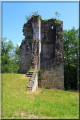
In Dunes: discover the charm of this ancient Gascon bastide, its central square, its old houses and its Templar Tower, a testament to its historical heritage.

In Donzac: let yourself be charmed by its flower-filled village, the Conservatoire de la Ruralité et des Métiers d’Autrefois, which houses a collection of nearly 20,000 objects, as well as the vineyards and the Vignerons du Brulhois wine cellar.

In Sistels: enjoy the charm and tranquillity of this small rural village, surrounded by farmland and unspoilt countryside.

All along the route: admire the diversity of the Brulhois countryside, with its orchards, vineyards, woods, meadows and lovely views of the surrounding hillsides.

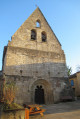
Also worth exploring nearby: the Church of Saint-Martial, the Chapelle des Mariniers, the old wash house and the Lac des Sources in Donzac.

A wonderful journey into the heart of our region, where nature, heritage and rural traditions come together!

Other walks in the area

For more walks, use our search engine .

The GPS track and description are the property of this route's author. Please do not copy them without permission.