Route between Lin and Vigne (medium-length circular route)

Lignière-Sonneville is a commune with the rolling countryside typical of the Grande Champagne region; it was formed by the merger of Lignières and Sonneville in 1845. Nestled in the heart of the Grande Champagne, it has a population of 613.

Details

n°407021
Creation:
Last update:
Last review:
  • Walking
    Activity: Walking
  • ↔
    Distance: 6.32 mi
  • ◔
    Average duration: 3h 20 
  • ▲
    Difficulty: Moderate

  • ⚐
    Back to start: Yes
  • ↗
    Ascent: + 482 ft
  • ↘
    Descent: - 502 ft

  • ▲
    Highest point: 417 ft
  • ▼
    Lowest point: 184 ft

Description of the walk

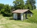
Start at the chapel in the hamlet of Sonneville. Green signposting with alternative yellow (19.6 km) and blue (8.7 km) signposting

(S/E) Head towards the road, turn right (north) and cross the bridge. At the junction, take the small road on your right which runs alongside the house (the second road on the right). Continue straight on through the vineyards until you reach the hamlet of Chez Ballet. Turn left at the end of the road to leave the hamlet. After about 200 metres, turn right to enter the woods.

(1) At the T-junction, take the path on the left. Carry on straight ahead, pass the house on your right and take the path on your left immediately afterwards. Turn right at the junction and head towards the houses at Maine Bois.

(2) Turn left at the junction, then, at the Fork in the road, follow the path on the right to walk alongside the row of trees. Cross the D1 road and take the path opposite. Carry on straight ahead along the path through the vineyards for about 500 metres. At the junction by the buildings at Maine Geais, turn left towards the trees. Turn right at the trees, then take the path on your left to enter the small wood. Walk through the wood, then turn right.

(3) At the edge of the woodland, turn left and carry on straight ahead along the small road towards Le Maine. Once you reach the hamlet, turn right towards the woodland.

(4) At the edge of the woods, turn right at the junction towards the vineyards and carry on straight ahead for about 800 metres. Just before reaching the D1, turn left, ignore a path on the left and enter the woods.

(5) At the first junction inside the woodland, turn left at a 90° angle. At the edge of the woodland, veer slightly to the right to cross a vineyard and carry on straight ahead (south) towards Saint-Palais. At a T-junction, turn left. After about a hundred metres, turn right.

(6) Turn right, then veer left onto a path. Carry on straight ahead alongside a vineyard and then a woodland. Turn left at the corner of the woodland and carry on for about 150 metres.

(7) Then turn left to walk alongside the row of trees and carry on straight ahead until you reach the road. Cross the road and take the path directly opposite you. Walk through the woodland until you find yourself amongst the vineyards and carry on straight ahead until you reach the hamlet known as ‘Chez Guillon’.

(8) Turn right, then immediately right onto a path. Keep slightly to the right at the corner of the building. At the junction, head left. Ignore a path on the left and, at the next junction, turn right. After the first house on your left, take the path on the right. Once you reach the road, turn left to head towards Sonneville. At the D1, turn right and cross the bridge to return to the starting point (S/E).

Waypoints

  1. S/E : mi 0 - alt. 233 ft - Chapel at the hamlet of Sonneville
  2. 1 : mi 0.79 - alt. 404 ft - At the junction, turn left
  3. 2 : mi 1.19 - alt. 351 ft - At the junction, turn left
  4. 3 : mi 1.89 - alt. 338 ft - At the edge of the woods, on the left
  5. 4 : mi 2.3 - alt. 318 ft - Edge of the woods
  6. 5 : mi 3.03 - alt. 407 ft - Crossroads in a wood
  7. 6 : mi 3.67 - alt. 213 ft - Saint-Palais
  8. 7 : mi 4.06 - alt. 302 ft - Junction
  9. 8 : mi 5.1 - alt. 308 ft - Right
  10. S/E : mi 6.32 - alt. 233 ft - Chapel at the hamlet of Sonneville

Notes

Picnic tables and a motorhome area are available at the Charmille site (Bourg de Lignière-Sonneville) at the start of the 19.6 km and 8.7 km routes.

Reviews and comments

3.2 / 5
Based on 3 reviews

Reliability of the description
2.3 / 5
Ease of following the route
2.7 / 5
Route interest
4.7 / 5
ladesiderienne
ladesiderienne

Overall rating : 2.7 / 5

Date of your route : Aug 20, 2022
Reliability of the description : ★☆☆☆☆ Very disappointing
Ease of following the route : ★★☆☆☆ Disappointing
Route interest : ★★★★★ Very good
Very busy route : No

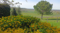
This walk “through fields of flax and vineyards” gave us the chance to get to know this beautiful region where we were to be spending our holidays. It was just as well we had our sat-nav and the Visorando app, as the signposting on the ground is often lacking, not to mention its complexity (three colours to indicate three different routes). The written instructions are completely unclear, as they repeatedly state that you should head towards the woods or the vineyards, yet throughout the entire route we were surrounded by nothing but woods and vineyards. It was a lovely walk nonetheless. Thank you

Machine-translated

babette162
babette162

Overall rating : 3 / 5

Date of your route : May 24, 2020
Reliability of the description : ★★☆☆☆ Disappointing
Ease of following the route : ★★★☆☆ Average
Route interest : ★★★★☆ Good
Very busy route : No

We went on this walk along the Lignières-Sonneville route, between flax fields and vineyards (medium-length circular route)
The route was marked with three colours, but the directions were rather confusing; in the end we got lost and had to be driven back to the car
At the waypoints, it would be helpful to mention the colour of the markings, especially when there are three colours
We lost our way on the route after checkpoint 8
This is definitely the first time we’ve failed to complete the circular route
Kind regards

Machine-translated

GCTourisme
GCTourisme

Hello,

Thank you for your feedback. For your information: this route is due to be fully re-marked shortly...
Kind regards
TOURISM DEPARTMENT

Machine-translated

henri57
henri57 ★

Hello,

The waymarking is incorrect from waypoint No. 7 onwards.

The waymarking is not managed by Visorando.

See you soon

Machine-translated

Babeth RAYMONDEAU
Babeth RAYMONDEAU

Overall rating : 4 / 5

Date of your route : Oct 08, 2018
Reliability of the description : ★★★★☆ Good
Ease of following the route : ★★★☆☆ Average
Route interest : ★★★★★ Very good

The signposting is faulty from marker No. 7 onwards.
A very pleasant walk, best enjoyed in spring or autumn

Machine-translated

Other walks in the area

For more walks, use our search engine .

The GPS track and description are the property of this route's author. Please do not copy them without permission.