


Permanent Blue Trail route from Profondeville


Discover a superb 16 km route, mostly through woodland, ideal for nature lovers and those who enjoy a bit of a climb.
Follow the grey arrow markings (main route) then the signs for the blue trail no. 16. The route alternates between challenging climbs and magnificent wooded sections, with nearly 80 per cent of the route through the forest, offering a pleasant, shaded setting.
Around the 10-kilometre mark, you can stop off at the restaurant Les 7 Meuses, the perfect spot for a drink or a bite to eat whilst enjoying an exceptional view.
The start and finish are on the village square, where you can enjoy a coffee before or after your walk.
Details
–
-
 Activity: Walking
 -
 Distance: 9.98 mi
 -
 Average duration: 6h 25
 -
 Difficulty: Moderate
 -
-
 Back to start: Yes
 -
 Ascent: + 2,129 ft
 -
 Descent: - 2,123 ft
 -
-
 Highest point: 892 ft
 -
 Lowest point: 266 ft
-
 Country:
Belgium
Country:
Belgium
-

-
 City:
Profondeville
City:
Profondeville -
 Start/End: N 50.377815° / E 4.870389°
 -


 Hour-by-hour weather


Waypoints
- S/E : mi 0 - alt. 289 ft - Car park
- 1 : mi 0.35 - alt. 312 ft - Rue de la Hulle
- 2 : mi 1.07 - alt. 325 ft - La Hulle Sports Centre
- 3 : mi 2.18 - alt. 876 ft - Start of the hairpin bends
- 4 : mi 3.21 - alt. 640 ft - On the Plain
- 5 : mi 3.66 - alt. 850 ft - Profondeville Woods
- 6 : mi 4.51 - alt. 387 ft - Route de Floreffe
- 7 : mi 5.25 - alt. 804 ft - Crossroads
- 8 : mi 6.3 - alt. 801 ft - Intersection
- 9 : mi 7.16 - alt. 318 ft - River
- 10 : mi 7.78 - alt. 571 ft - Tiennes de Burnot
- 11 : mi 8.69 - alt. 636 ft - Crossroads
- 12 : mi 9.07 - alt. 390 ft - Fork in the road
- 13 : mi 9.49 - alt. 315 ft - Namur Chimney
- S/E : mi 9.98 - alt. 289 ft - Car park
Other walks in the area
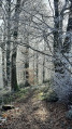
La Sibérie, La Couleuvrine and the banks of the Meuse at Profondeville
 Visorando Member
 8.72 mi
+1,070 ft
-1,079 ft
4h 55
Moderate
8.72 mi
+1,070 ft
-1,079 ft
4h 55
Moderate
 Departure from Profondeville (Province de Namur)
In the woods of Profondeville
 4.34 mi
+623 ft
-620 ft
2h 30
4.34 mi
+623 ft
-620 ft
2h 30
 Easy
Departure from Profondeville (Province de Namur)
Easy
Departure from Profondeville (Province de Namur)
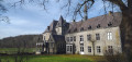
The Transmolignée
 14.46 mi
+1,407 ft
-1,385 ft
7h 50
14.46 mi
+1,407 ft
-1,385 ft
7h 50
 Difficult
Departure from Anhée (Province de Namur)
Difficult
Departure from Anhée (Province de Namur)
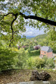
Woods and paths between Dave and Naninne
 5.26 mi
+636 ft
-636 ft
3h 00
Easy
Departure from Namur (Province de Namur)
5.26 mi
+636 ft
-636 ft
3h 00
Easy
Departure from Namur (Province de Namur)
Marlagne, the Meuse Plateau and the banks of the Meuse at Wépion
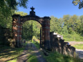 9.09 mi
+725 ft
-722 ft
4h 50
Moderate
Departure from Namur (Province de Namur)
9.09 mi
+725 ft
-722 ft
4h 50
Moderate
Departure from Namur (Province de Namur)
On the edge of the Namur Condroz, starting from Maillen
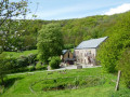 12.44 mi
+1,516 ft
-1,506 ft
7h 05
Difficult
Departure from Assesse (Province de Namur)
12.44 mi
+1,516 ft
-1,506 ft
7h 05
Difficult
Departure from Assesse (Province de Namur)
Circular between Ivoy and Godinne via Mont, Bauche and Crupet.
 11.78 mi
+1,552 ft
-1,578 ft
6h 45
Moderate
Departure from Assesse (Province de Namur)
11.78 mi
+1,552 ft
-1,578 ft
6h 45
Moderate
Departure from Assesse (Province de Namur)
Between Yvoir and Warnant via the Ravel
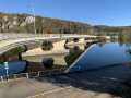 7.61 mi
+184 ft
-177 ft
3h 40
Moderate
Departure from Yvoir (Province de Namur)
7.61 mi
+184 ft
-177 ft
3h 40
Moderate
Departure from Yvoir (Province de Namur)
For more walks, use our search engine .
The GPS track and description are the property of this route's author. Please do not copy them without permission.

