


 Country:

 City:
City:


Starting from the Château-Ferme d’Arche, the route begins by descending towards Ivoy and then climbing back up to the Ferme de Coux: beautiful views of the countryside, which is particularly colourful in spring. Head towards Crupet, then Bauche, the Ferme de Vénalte, the Domaine d’Ahinvaux, the Ferme de Tricointe, the Bois de Godinne and its ‘oak of the image’. Return to the starting point by skirting Mont to the north.
On the edge of the Namur Condroz, starting from Maillen


Combining woodland and countryside in a delightfully undulating landscape between Bocq and Mont, this walk does not pass through the historic centre of Crupet – with its Carondelet keep, grotto and parish priest – but instead takes in the Domaine d’Ahinvaux and its disc golf course, as well as the unmissable (and well-hidden) Château de Tricointe and its beautifully renovated square-shaped farmhouse.
Details
Creation:
Last update:
Last review:
–
–
-
 Activity: Walking
 -
 Distance: 12.44 mi
 -
 Average duration: 7h 05
 -
 Difficulty: Difficult
 -
-
 Back to start: Yes
 -
 Ascent: + 1,516 ft
 -
 Descent: - 1,506 ft
 -
-
 Highest point: 942 ft
 -
 Lowest point: 387 ft
Photos
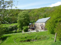
Description of the walk
Waypoints
- S/E : mi 0 - alt. 886 ft - Arche Castle and Farm
- 1 : mi 0.82 - alt. 787 ft - Ivoy Church
- 2 : mi 1.57 - alt. 843 ft - Coux Farm
- 3 : mi 2.01 - alt. 636 ft - Fork in the road towards Crupet
- 4 : mi 2.42 - alt. 551 ft - Crupet
- 5 : mi 4.33 - alt. 397 ft - Fork in the road near Le Bocq and the hamlet of Bauche - Bocq (rivière)
- 6 : mi 4.79 - alt. 620 ft - Ferme de Vénalte
- 7 : mi 5.55 - alt. 489 ft - Domaine d’Ahinvaux
- 8 : mi 6.87 - alt. 666 ft - Tricointe
- 9 : mi 9.07 - alt. 636 ft - Mont
- S/E : mi 12.44 - alt. 886 ft - Arche Castle and Farm
Worth a visit
Crupet is well worth a short detour for the magnificent Carondelet Keep and the intriguing Saint-Antoine Grotto
Other walks in the area
Circular between Ivoy and Godinne via Mont, Bauche and Crupet.
 Visorando Member
 11.78 mi
+1,552 ft
-1,578 ft
6h 45
11.78 mi
+1,552 ft
-1,578 ft
6h 45
 Moderate
 Departure from Assesse (Province de Namur)
Forest paths and trails, small country roads with little traffic, and paths connecting villages are sure to delight you in this part of the Namur Condroz. Large farms still in operation on the Assesse side, opulent houses on the banks of the Meuse and the Tricointe castle farm, completely renovated for housing and leisure on the Godinne side: the route allows you to discover a whole world of differences. The route offers a beautiful view of the Meuse valley from the heights of Mont-Godinne.
The cave and keep of Crupet
 8.18 mi
+948 ft
-968 ft
4h 35
Moderate
Departure from Assesse (Province de Namur)
8.18 mi
+948 ft
-968 ft
4h 35
Moderate
Departure from Assesse (Province de Namur)
Starting from the village of Maillen, set off to discover Crupet, one of the most beautiful villages in Wallonia. Visit its Saint Antoine cave and admire its Carondelet keep. Return via the village of Ivoy and its 13th-century church.
The Bocq de Bauche valley in Chansin, starting from Crupet
 9.78 mi
+1,158 ft
-1,161 ft
5h 30
Moderate
Departure from Assesse (Province de Namur)
9.78 mi
+1,158 ft
-1,161 ft
5h 30
Moderate
Departure from Assesse (Province de Namur)
After the magnificent view at the start of the walk over the Carondelet keep and its immediate surroundings, the walk passes by (and through) the surprising Crupet cave, built by the parish priest of the time (1866–1926), before heading towards Bauche along a lovely forest path.Just after the Bauche bridge, the route turns onto a path on the left, quickly joining the Bocq Tourist Railway, which it follows as far as the first level crossing.From there, the route begins to follow the River Bocq, passing under the railway line several times beneath the arches of beautiful stone bridges … or through tunnels, until it reaches the old Durnal-Dorinne station at Chansin.After the steep climb towards Durnal, the walk continues through the countryside towards Herbefays before turning left onto the small ridge road (this is the Condroz) and its northern viewpoint overlooking Maillen and Jassogne.Return to the starting point via the Bois des Comognes in Jassogne and the Insefy path.
From Crupet to Ronchine
 3.05 mi
+397 ft
-407 ft
1h 45
Moderate
Departure from Assesse (Province de Namur)
3.05 mi
+397 ft
-407 ft
1h 45
Moderate
Departure from Assesse (Province de Namur)
After approximately 960 metres, the slope is steep, then reasonably uphill for about 2.3 kilometres.From there, it is all downhill until the last 200 metres.Very steep descent at around 4 kilometres, with a chain provided as a handrail.Start and finish at the same place. Car park 30 metres away.
Along the wild Bocq from Crupet
9.41 mi
+1,093 ft
-1,093 ft
5h 15
Moderate
Departure from Assesse (Province de Namur)
A varied hike in the heart of the Namur Condroz, amidst deep forests, hidden valleys and Walloon heritage.
The route passes through magnificent wooded areas such as the Bois des Loges, the Bois du Sergent and the Bois d’Insefy, before reaching the superb Bocq Valley and its steep-sided landscapes. It also passes through the villages of Durnal, Evrehailles and Chansin, as well as near Harnoy Castle, the Niersant Cave and the remarkable site of Tienne du Hé. Crupet, listed among the most beautiful villages in Wallonia, reveals its famous medieval keep surrounded by water, as well as the Saint-Antoine Cave and its famous devil. The typical terrain of the Condroz, formed over 350 million years ago, alternates between limestone ridges, damp valleys, beech forests and hedgerow landscapes.
With its unspoilt nature, local history and wild atmosphere along the Bocq, this walk promises a wonderful immersion in one of the most beautiful regions of Wallonia.
Courrière Educational Woodland
 1.62 mi
+66 ft
-66 ft
0h 50
1.62 mi
+66 ft
-66 ft
0h 50
 Easy
Departure from Assesse (Province de Namur)
Easy
Departure from Assesse (Province de Namur)
Located in the village of Courrière (in the municipality of Assesse), this woodland has been developed to help visitors discover: the forest, local biodiversity and ecosystems. It is a short, fun and educational walk. The three walks through the woodland: green trail (1.6 km), blue trail (2.3 km) and red trail (2.8 km)
Jassogne to Crupet
4.73 mi
+846 ft
-840 ft
2h 55
Moderate
Departure from Assesse (Province de Namur)
A beautiful hike through woods and along quiet roads. The trail starts in the centre of the village of Jassogne, where there is a small car park for six cars. Alternatively, there is a larger car park next to a school, but it is best to use this outside school hours. There are beautiful views of the villages of Jassogne, Maillen and Ivoy.
Circular route from Courrière via Gesves
15.92 mi
+1,824 ft
-1,677 ft
8h 55
 Very difficult
Departure from Assesse (Province de Namur)
Very difficult
Departure from Assesse (Province de Namur)
Easy, with only two small steep hills. 74% of the route is on paths. Outward journey through the woods, return journey mainly through fields. Picnic possible at km 15 at the Samson cheese dairy in Gesves (081 583 666), possibility to bring your own meal (provided you purchase a drink) or order a cheese and/or charcuterie platter. Along the way, you can discover some of the sculptures on the Gesves art trail.
For more walks, use our search engine .
The GPS track and description are the property of this route's author. Please do not copy them without permission.

