


 Country:

 City:


Car park at Godinne station (Namur–Dinant line).
(S/E) From the station car park, head towards the tunnel.
(1) Go through the tunnel which takes you under the road and the railway lines. Cross Rue de Mont and head uphill towards Collège Saint-Paul (Godinne-Burnot) via Rue des Grands Saules.
(2) Turn right into the school grounds via Allée des Platanes, which leads to the Al-Faux district (access permitted).
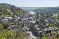
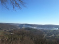
(3) Caution: cliff edge! The Croix d’Al Faux viewpoint offers an exceptional view of the Meuse and the Yvoir lock.
Caution: fairly steep descent. Head towards the railway line and follow it. You’ll reach Rue Puits du Champ; follow this road. Then, via Rue Colonel Tachet des Combes, head towards the centre of Yvoir, towards the church.
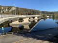
(4) Carry on and cross the Bocq via the road bridge, then continue for about 60 metres.
(5) Turn left at the school and go up the steps. Cross Rue du Launois. Continue along Rue des Vergers for 200 m.
(6) Turn right, heading south, then right again onto the path which curves to the left and joins Rue d’Evrehailles; follow this to the left for 50 metres.
(7) Turn right and enter the Champale Nature Reserve, with its various viewpoints. Stay on the path and take care. There are cliffs and slippery rocks in wet weather.
(8) Stop at the various viewpoints overlooking the Meuse Valley. Join the Allée de la Sapinière.
(9) Follow it to the right for 30 metres, then turn left to cross the Route d’Evrehailles (N937). Follow it to the left for 100 metres, then turn sharp right towards Fostrie.
(10) Turn left atthe first path on the left, then join a road and follow it to the right for 50 metres.
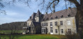
(11) Turn left and go round the Château du Buc farm. Continue left along Rue du Jauviat for about a hundred metres.
(12) Turn right, across the fields (north-west). Cross a signposted track and continue to a viewpoint overlooking the Yvoir quarries. It is not uncommon to spot peregrine falcons.
(13) Turn back and turn left, heading due north, onto the signposted path.
(14) A steep descent which can be a bit tricky on muddy ground.
(15) Cross the Bocq and join a road.
(16) Turn right onto this road (Rue du Redeau) and follow it for about 200 m. (Take care.)
(17) Take the path on the far left, before the old railway bridge, and head uphill towards Tricointe.
(18) At Tricointe, turn right to reach the Bois de Godinne. Continue to a crossroads.
(19) At the Forest House, turn left towards Mont Godinne until you reach the junction.
(20) Turn left, heading west, until you reach a multi-way junction.
(21) Chêne à l’Image. Continue westwards for 80 metres.
(22) Follow the trail signposts to the right and head down towards Godinne.
(23) Saint-Roch Chapel. Carry on straight ahead and return to a fork in the path you passed on the way there.
(2) Carry on straight ahead. Go back through the tunnel and return to Godinne station (S/E).

 Visorando Member
 Difficult

 Easy

