Route des Mines d'Or de la Forêt de Champvert

Along the way: Curzac Castle and village, the village of Saint-Vitte.
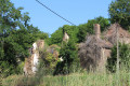
The burnt-down mill, the old Ozier mill and its pond, the views, the sunken paths, the Limousin countryside, the River Briance.

Details

n°44164
Creation:
Last update:
Last review:
  • Walking
    Activity: Walking
  • ↔
    Distance: 16.47 mi
  • ◔
    Average duration: 8h 55 
  • ▲
    Difficulty: Difficult

  • ⚐
    Back to start: Yes
  • ↗
    Ascent: + 1,572 ft
  • ↘
    Descent: - 1,594 ft

  • ▲
    Highest point: 1,749 ft
  • ▼
    Lowest point: 1,184 ft

Description of the walk

Access: 38 mins from Limoges. Take the A20 towards Toulouse, then take exit 42. Follow the RD7 bis and drive through Saint-Germain-les-Belles. Turn right onto the RD16.
Car park at the town hall in Saint-Vitte-sur-Briance.

(S/E) Head towards the sewage treatment works.

(1) Keep right after passing La Grande Briance. After the bend, turn right onto the dirt track, cross La Grande Briance and head up towards the village of Curzac.

2 – At the road, turn left, then right onto the RD16. Follow the track on the left leading to Latronche. Pass through the village.

(3) On leaving the village, take the path that climbs to the right, offering beautiful panoramic views. Join the D16. At the road, turn right and follow it for 300 metres.

(4) Turn left and head towards Ozier Bas. Walk through the hamlet. After the lake, take the path on the left and continue to a second lake.

(5) Turn north at the fork, then right at the junction, and continue to another junction.

(6) Turn north, cross the Amboiras stream and arrive at Foulenour.

(7) Turn right in the hamlet, then continue straight on along a grassy track. After the pond, turn left.

(8) At the star-shaped junction, take the RD16 to the right for 20 metres, then immediately follow the stony track to the right. At the Fork in the road, turn left again. Cross the plateau.

(9) Cross the D12 and continue along the grassy path opposite.
Follow the track, then turn right between two meadows, then left.

(10) At the crossroads, turn right, heading due south, and continue along this track, which becomes tarmac at the first house.

(11) Walk past the village of Amboiras and continue along the small road.

(12) At the bend, turn left onto the tarmac path which climbs.

(13) On the hilltop, at the crossroads, take the path on the right which leads back down towards the village of Plaisance.

(14) Turn left, then cross the RD12 and take the road opposite. Turn left at the first road and follow it due south.

(15) At the next junction, turn right – a hairpin bend – under the trees, then at the next junction turn left until you reach the RD31.

(16) Take the road on the left, then turn right. The road becomes a stony track, then a grassy path.

(17) At Le Mas, turn right, then left. Follow the road, which turns into a track.

(18) Then turn left, crossing the Briansoulet.

(19) At the Fork in the road, turn left again. The path descends towards the river.
Pass by the Moulin Brûlé and follow the track to the road

(20) Turn right, then turn right again at the next junction. Follow this road due south.

(21) Before the forest, take the path on the right and head towards Les Ages. After the village, at a wide bend, follow the grassy path.

(22) At the road, turn right, cross the Fournaud stream, then turn left between the road and the farm.

(23) At the crossroads, turn left. Turn right twice before reaching Le Peychaud.

(24) Follow the road to the left, then turn right onto the path that leads into the coppice.

(25) Turn right before reaching Coussac, following a hedge. In the woods, follow the stony path, which descends steeply in places. Take the right-hand bend to rejoin the road.

(1) Cross the Briance bridge again, then head back up towards the village to return to the town hall car park (S/E) .

Waypoints

  1. S/E : mi 0 - alt. 1,299 ft - Car park at the town hall in Saint-Vitte-sur-Briance
  2. 1 : mi 0.18 - alt. 1,240 ft - Crossroads at the end of the circular loop - Briance (rivière)
  3. 2 : mi 1.15 - alt. 1,230 ft - D31 at Curzac
  4. 3 : mi 1.94 - alt. 1,293 ft - Exit from Latronche
  5. 4 : mi 2.91 - alt. 1,371 ft - Turn left towards Ozier Bas
  6. 5 : mi 3.52 - alt. 1,348 ft - Junction heading due north
  7. 6 : mi 3.98 - alt. 1,401 ft - Heading due north towards the Amboiras stream
  8. 7 : mi 4.42 - alt. 1,447 ft - Turn right into Foulenour
  9. 8 : mi 5.36 - alt. 1,526 ft - Junction with the RD16
  10. 9 : mi 6.04 - alt. 1,601 ft - Crossing the D12
  11. 10 : mi 6.88 - alt. 1,719 ft - Junction heading due south
  12. 11 : mi 7.73 - alt. 1,693 ft - Village of Amboiras
  13. 12 : mi 8.1 - alt. 1,578 ft - Tarmac path on the left
  14. 13 : mi 8.3 - alt. 1,726 ft - Path on the right towards Plaisance
  15. 14 : mi 8.72 - alt. 1,591 ft - Turn left onto the RD12
  16. 15 : mi 9.32 - alt. 1,493 ft - A hairpin bend to the right
  17. 16 : mi 9.97 - alt. 1,480 ft - On the left: RD31
  18. 17 : mi 10.73 - alt. 1,427 ft - Le Mas
  19. 18 : mi 11.53 - alt. 1,302 ft - Turn left towards Le Briansoulet
  20. 19 : mi 11.9 - alt. 1,302 ft - Turn left towards the river
  21. 20 : mi 12.29 - alt. 1,312 ft - Road near Moulin Brûlé
  22. 21 : mi 12.85 - alt. 1,486 ft - Path on the right before the forest
  23. 22 : mi 13.68 - alt. 1,309 ft - Road on the right after Les Âges
  24. 23 : mi 14.2 - alt. 1,421 ft - Turn left at the crossroads
  25. 24 : mi 15.01 - alt. 1,503 ft - Peychaud
  26. 25 : mi 15.52 - alt. 1,562 ft - On the right before Coussac
  27. S/E : mi 16.47 - alt. 1,299 ft - Car park at the town hall in Saint-Vitte-sur-Briance

Reviews and comments

4.7 / 5
Based on 1 review

Reliability of the description
5 / 5
Ease of following the route
5 / 5
Route interest
4 / 5
MarJeaLou
MarJeaLou

Overall rating : 4.7 / 5

Date of your route : Apr 17, 2026
Reliability of the description : ★★★★★ Very good
Ease of following the route : ★★★★★ Very good
Route interest : ★★★★☆ Good
Very busy route : No

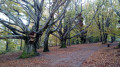
The first third is a very pleasant stretch along the Briance and through the hills, offering vast, open landscapes that can be admired in every direction. Discover the south-east of the Haute-Vienne department, its buildings and the Limousin countryside. The second third sometimes follows quiet country lanes and passes through small hamlets typical of traditional Limousin architecture (granite or rubble stone with thick walls and slate or flat-tiled roofs with steep pitches). The final third offers a return journey with pleasant views of pastures and forests of remarkable oak and beech trees. Numerous flocks of sheep watched over by Patou dogs.
The entire route follows beautiful, wide paths with little difficulty.
Point to note: the signposting is barely visible and, in places, non-existent. The Visorando app is very useful.
Hike completed in 6 hours 30 minutes.

Machine-translated

Other walks in the area

For more walks, use our search engine .

The GPS track and description are the property of this route's author. Please do not copy them without permission.