Country:
 City:


Village hall car park, Rue de l’Église.
Yellow-marked route
(S/E) Opposite the town hall, turn left onto Rue du Bourg. At Place des Rampeaux, cross the RD104 and head down Chemin du Prieuré on the right. Turn right at the bottom.
(1) Cross the D104 to follow the Route de la Reinerie; look out for the cross at the junction, then the Reinerie farmhouse. Turn right onto Rue du Châtelard, then left onto Rue de la Tranchade in the hamlet. At the end of the street, continue into the Bois de la Pue.
(2) At the bottom of the path, turn right and continue to the road. Walk carefully along the left-hand side of the road until you reach the first path on the right, after the bridge over the Anguienne.
(3) Further on, cross the Anguienne again and emerge to the left of the Lavoir du Château; note the castle on the hill opposite the washhouse. Follow the road to the left and walk alongside the ponds.
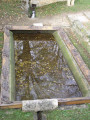
(4) After the well, turn right onto the small path in front of the first house. Ignore the Chemin des Lavandières and carry on past the house. Take a short detour to the right to see the Lavoir du Boisseau, a little further down on the left at the Fork in the road.
On your return, head back up into the village via the Chemin du Lavoir, then turn right onto Rue du Centre. Cross the Chemin des Abeilles and continue along the grassy path opposite.
(5) At the edge of the woods, take the path on the right. At the next junction, take the path on the left and continue uphill through the woods.
(6) Turn right before the houses on the left. You’ll come out onto the Route de Puyrajoux, which you follow to the right. In the centre of the village, turn left in front of the house, go through the gate and head down the path on the right to pass in front of the Grand Font washhouse.
(7) Turn right twice and head back up towards the village centre, catching a glimpse of the castle as you pass. At the end of the path, follow the pavement to the right to reach the Place des Rampeaux and the village hall car park (S/E).


 Tourist office


 Visorando Member

 Moderate