Country:
 City:
City:


Park in the car park to the right of Cambayrac Church.
(S/E) As you leave the car park, turn right, walk past the church porch, then follow Rue Saint-Perdoux to the right, which runs between the houses, until you reach the edge of the village at a place called Les Tuileries.
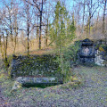
(1) Leave the road and head straight on along the grassy, tree-lined path, which descends gently into the Bourdouyre valley. You’ll reach the Fontaine de Saint-Perdoux and a cross, where a sign tells the legend.
(2) Carry on straight down into the valley and, at the bottom, you’ll reach a junction.
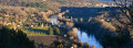
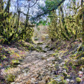
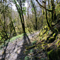
(3) Turn right towards the Landorre Gorges and continue along a wide path that winds its way through the moss-draped trees. On one side, the path runs alongside a dry stream (on days without rain), and on the other, alongside small cliffs.
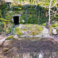
(4) Here, a sign points to a path on the left leading to an ancient wash house: the 150-metre round trip is well worth the detour. On your return, follow the path back to a junction after the stream.
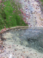
(5) Turn right, following the stream, onto the path that winds through the woods and even descends into the stony stream bed for the final 50 metres.
(6) Leave the stream bed on the right, just before a natural pool, and head up a path that curves slightly to the right and soon joins a tarmac road. Walk straight on along this road for 30 metres, then take the path on the right just before the bridge. This path climbs up the hillside before opening out into the meadows and reaching a junction in front of a half-ruined cart shed, hidden beneath the moss.
(7) Turn left, then right 50 metres further on. Follow the dry-stone wall, then pass between the fields. Ignore the various paths branching off to the left and continue to a crossroads with a sign for “Trébaïx”.
(8) Turn left and very soon you’ll find yourself facing straight ahead; continue on to Le Pech Sec. Turn left onto the road and pass between several beautiful stone houses. As you continue, looking towards the horizon on your right, you’ll begin to catch sight of the beautiful Trébaïx Tower (16th century), a remnant of a Templar castle. Keep to the right at the three-way junction that follows, then turn sharply right to reach the hamlet of Trébaïx. Turn right at the crossroads.
(9) It’s well worth stopping here to get a closer look at the Trébaïx Tower. Information boards provide details on the local architecture. Resume the route to the right along the Chemin de la Font Vieille, heading down the tarmac track. After the lovely gariotte on your left, turn left towards the first wash house (picnic table), then carry on to a second wash house situated at the side of a road.
(10) Turn right onto this road, then turn left at the next junction to follow the Chemin de la Rouquette towards the beautiful church. Carry on straight ahead to reach the Lapradasse three-way junction.
(11) Turn right. Then carry on straight ahead along a wide dirt track that winds its way through vineyards and woodland.
(12) At the junction, turn slightly right then immediately left to join a tree-lined path leading onto a road at the start of a bend.
(13) Follow the road to the left, then turn right, following the sign for “le Bourg”, to reach the village of Cambayrac. You’ll see the church on your left, followed by the car park (S/E).


 Visorando Member
 Easy
Easy 
 Association / Club / Walk leader