Country:

 City:
City:


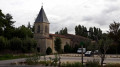
(S/E) Park in the Tour du Prince car park. Take the footpath alongside the media library and head towards the church via the Venelle de la Tour du Prince. Cross Rue Giannésini, walk past the church, go round it via Place des Halles, then, behind the apse, head up Rue Fournier. Walk past the town hall and rejoin Rue Giannésini. Turn left onto Rue Giannésini. About 100 metres further on, turn right onto Rue de la Grande Fontaine.
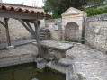
A little further on, on your left, turn into Rue du Lavoir, then take the path on the far right which leads to a small washhouse built right beside the stream. Retrace your steps and continue along Rue de la Grande Fontaine. This street is on your left.
(1) Carry on straight ahead along Rue de la Grande Fontaine. After 250 metres, turn left onto Rue du Bignon. A few hundred metres further on, you’ll come across the Fontaine de la Mariée, one of the main springs feeding the Leat Chabot.
(2) Continue along Rue du Bignon. At the end, turn left onto Rue de l’Île. After several hundred metres, take Impasse des Lavandières on your left. Right at the end, you’ll find the small Lavoir des Lavandières, built right next to the stream.
(3) Retrace your steps, turn left, then take Rue de la Souche on your right. At the end, turn left onto Rue des Chambeaux. Continue to the Ouche washhouse. Turn back and turn right. Walk up Rue de l’Ouche and enjoy the view of the Leat Chabot in the Four Grenier garden.
Cross Rue de l’Île, first turn left then right, and continue along Rue du Four Grenier. Turn right into Rue du Bief Chabot. Walk past one of the oldest houses in the village, then discover the washhouse.
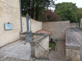
(4) Turn right onto Rue Migault, then immediately left onto Rue Soubise. At the end of Rue Soubise, turn slightly left and take Rue Boucicault straight ahead. Cross Rue du Rivaud and take Rue du Gué. You’ll go round the Logis municipal park on your left. Walk up the street, then turn left onto Rue du Logis. Discover the “Fontaine à Guillaume”, a stone-built column covering a well. Continue on to Rue Giannésini. Turn left. Enter the Parc du Logis through the large gate to see the fountain, the pond and the remarkable trees. As you leave the park, turn left onto Rue Giannésini, then immediately left onto Rue du Rivaud. The Fontaine d’Ayron is located below.
(5) Retrace your steps along Rue Giannésini and carry on to the left. A few steps further on, go through the archway of the Espace Jean Monet on the right. Return to your car by crossing the square (S/E).
 Visorando Member
 Moderate
 Association / Club / Walk leader