Route of the two churches and three chapels around Plozévet

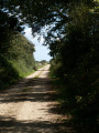
Discover two churches, three chapels, picturesque hamlets, valleys and a curious menhir in the countryside between Plozévet and Pouldreuzic via a greenway, idyllic footpaths and quiet country lanes.

Note: this route includes a few potentially tricky sections. See Practical Information.

Details

30192389
Creation:
Last update:
Last review:
  • Walking
    Activity: Walking
  • ↔
    Distance: 15.62 mi
  • ◔
    Average duration: 7h 40 
  • ▲
    Difficulty: Difficult

  • ⚐
    Back to start: Yes
  • ↗
    Ascent: + 591 ft
  • ↘
    Descent: - 587 ft

  • ▲
    Highest point: 279 ft
  • ▼
    Lowest point: 26 ft
  • ⚐ Country: France
  • ⚐ City: Plozévet (29710)
  • ⚑
    Start/End: N 47.987478° / W 4.424896°
  • ❏
    IGN map(s): Ref. 0419ET, 0519OT
  • Hour-by-hour weather

Photos

Description of the walk

Park in the town hall car park or nearby.

No signposting

(S/E) Leave the car park, go round the town hall on the left via Rue Jules Ferry, turn left into Rue du Stade and follow it to its junction with Rue des Ajoncs.

GRP® signposting (Yellow and Red)

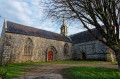
(1) Take this street to the right, then turn left into Rue des Pervenches to reach the Chapel of the Trinity.

(2) Go round the chapel on the right and ignore a small road on the right. Turn right, then left, pass the hamlet of Ménez Kergabet and look out for the start of a footpath on the right.

(3) Continue along this path, which leads to a small road. Follow it to the left and take a farm track on the right after the hamlet of Kergabet. Continue along this track, which narrows as it crosses a wetland area and then joins a wide track near the Kerziouret farm.

(4) Carry on along this track, ignoring all the paths branching off to the left or right, and pass the imposing Kermenguy farm to reach a small road. Follow this road to the left; it curves to the right before crossing a track near Ty Moguell farm.

(5) Follow this wide path to the right and, at the top, turn right towards the wind turbines. Ignore a path on the left (GRP® signposted) and continue for a few metres until you reach a crossroads of paths.

Unmarked

(6) Take the path on the left, ignore a path on the right leading to the wind turbines and turn right at the end of the path. Continue along this path, which leads to a disused road. Follow it to the left to reach the D784 at Kervern Vihan.

(7) Cross the road with care, continue straight ahead along a small road and turn left into the hamlet of Kerlaéron. Cross a small road, turn right then left towards the hamlet of Trébrévan until you reach the start of a path on the right.

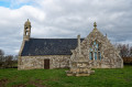
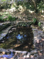
(8) Follow this path through the woods – which is also a fitness trail – then turn left to reach the Chapel of Saint-Ronan (Saint-Renan on the IGN map) and its fountain (note the stone sarcophagus at the back of the chapel).

(9) Retrace your steps, turn left onto the path leading to the chapel, ignore a farm track on the left, turn left onto a small road near the hamlet of Mespirit and follow it to reach the greenway.

PR® signposting (yellow)

(10) Follow the greenway to the left until it intersects with the D2 (along the way, note on the left, at the start of a path, an old stone bridge called the Pont de la Jument Blanche).

(11) Walk alongside the D2 on the left for about twenty metres, then cross it carefully and take a gently ascending path on the left. Continue for about a hundred metres, then turn right onto a fairly steep, inconspicuous path. Climb this path through the woods until it meets a track. Follow it to the left, pass three electricity poles standing close together and reach the hamlet of Keruguel.

(12) Turn left, then right, and turn left onto Rue de Croas Vao (note the wayside cross on the right) to reach the Church of Saint-Paban in Lababan.

(13) Retrace your steps to the wayside cross, continue straight ahead along a track, ignore the first path on the left and reach another path on the left.

(14) Follow this path, which descends gradually whilst curving to the right, then climbs in a hairpin bend to the left before descending again, then climbing once more to reach the rear of the hamlet of Lesneut.

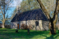
(15) Take the path on the right before the first houses, reach a small road, follow it to the left then turn right (lovely view over Audierne Bay) to arrive at the Chapel of Saint-Démet.

(16) Walk past the chapel, take a path on the right leading down towards a wetland area and cross a stream via a footbridge. Head back up via a path that joins a small road and walk past the hamlet of Merros Huella.

(17) Cross a small road, then take a path opposite that descends into a small valley and follow it until it meets the road you have just crossed again.

(18) Follow this road to the right, turn right onto a path, then right again and continue along the other side of the valley to a small road. Turn right onto it to reach the hamlet of Lezavrec.

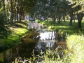
(19) Turn right onto Route de Lezarvec, then right again onto a road that continues as a relatively narrow footpath on the right bank of the valley. Carry on along this path, cross the stream via a rather rudimentary footbridge and continue along the left bank (note the beautiful Meil Kerzuot Mill on the opposite bank) until you reach a disused stretch of road.

(20) Carry on to the left along this road, which turns into a track before crossing a stream via a footbridge (note a curious split menhir on the left). Continue along this track, which winds its way through the fields before joining a small road. Follow it to the right to reach the D2.

(21) Cross it with care, then take a small road opposite which turns into a path skirting the hamlet of Kerguivic before crossing a stream via a footbridge and reaching the greenway near a picnic area.

(22) Follow the greenway to the left; it continues along Rue des Saules, then Rue de la Gare, and leads to Rue de Quimper.

No signposting

(23) Follow it to the left, turn right into Rue du Centre, then right again into Rue d’Audierne to reach Saint-Démet Church (note the statues of the Bell-Ringers on the right and the War Memorials on the left).

(24) After the church, turn right onto Rue des Figuiers, cross Rue du 11 Novembre 1918 (note the fountain on the left) and turn left onto Rue Jules Ferry. Follow this road to the roundabout and turn right to return to the starting car park (S/E).

Waypoints

  1. S/E : mi 0 - alt. 233 ft - Town Hall car park
  2. 1 : mi 0.32 - alt. 256 ft - Rue des Ajoncs
  3. 2 : mi 0.63 - alt. 272 ft - Chapelle de la Trinité (Plozévet)
  4. 3 : mi 1.08 - alt. 269 ft - Ménez Kergabat
  5. 4 : mi 1.75 - alt. 226 ft - Kerziouret – Junction
  6. 5 : mi 2.76 - alt. 233 ft - Ty Moguell – Start of the trail
  7. 6 : mi 3.21 - alt. 262 ft - Crossroads – Leave the GRP
  8. 7 : mi 4.36 - alt. 266 ft - Crossing the D784
  9. 8 : mi 4.95 - alt. 240 ft - The trail starts on the right
  10. 9 : mi 5.29 - alt. 213 ft - Chapelle de Saint-Ronan (Plozévet)
  11. 10 : mi 6.12 - alt. 217 ft - Greenway
  12. 11 : mi 7.33 - alt. 49 ft - D2 road
  13. 12 : mi 7.93 - alt. 125 ft - Keruguel
  14. 13 : mi 8.56 - alt. 69 ft - Église Saint-Paban (Lababan)
  15. 14 : mi 9.16 - alt. 108 ft - The trail starts on the left
  16. 15 : mi 9.69 - alt. 108 ft - Lesneut
  17. 16 : mi 10.31 - alt. 118 ft - Chapelle Saint-Démet (Saint-Démet)
  18. 17 : mi 11.09 - alt. 131 ft - Merros Huella
  19. 18 : mi 11.55 - alt. 66 ft - Junction with a minor road
  20. 19 : mi 12.41 - alt. 151 ft - Lezavrec
  21. 20 : mi 13.27 - alt. 174 ft - Section of disused road
  22. 21 : mi 13.67 - alt. 210 ft - Crossing the D2
  23. 22 : mi 14.1 - alt. 197 ft - Greenway
  24. 23 : mi 15.13 - alt. 240 ft - Rue de Quimper
  25. 24 : mi 15.48 - alt. 230 ft - Église Saint-Démet (Plozévet)
  26. S/E : mi 15.62 - alt. 233 ft - Town Hall car park

Notes

Between (19) and (20), the route follows a small valley along narrow paths and crosses a stream twice via makeshift footbridges.

Between (3) and (5), and between (16) and (17), the paths pass through wetlands which can be very muddy in winter or after heavy rain. High-top walking boots are strongly recommended.

The wind turbines are visible from a great distance and serve as an excellent landmark for the first part of the route.
Once past the wind turbines, the Kerlaéron water tower can serve as a new landmark.
From this point (10), the route largely follows thePR® Circuit de Saint-Démet, which is very well signposted (yellow).

It is possible to split this route into two separate circular loops, each about a dozen kilometres long:
- A first circular route to the north via the Chapelle de la Trinité, the wind turbines and the Chapelle Saint-Ronan, returning to Plozévet via the greenway.
- A second circular route to the south, starting from the Lostallen picnic area, then following the greenway towards Pouldreuzic, Saint-Paban Church and Saint-Démet Chapel.

Other car parks are available in Plozévet or near the Chapelle de la Trinité, the Chapelle Saint-Ronan, the Church of Saint-Paban and the Lostallen picnic area.

Picnic tables are available at the chapels of La Trinité, Saint-Ronan and Saint-Démet, at Saint-Paban Church and at Lostallen near the greenway. The picnic area at Saint-Paban Church, situated halfway along the route, is ideal for a snack break to recharge your batteries before continuing on the more undulating paths.

Toilets are available at the starting point and near the churches of Saint-Démet and Saint-Paban.

Worth a visit

The 16th-century Saint-Démet parish church in Plozévet, built on the site of a structure probably dating back to the 12th century.

Calvary, war memorials, a fountain and the ‘Sonneurs’ statues around Saint-Démet Church.

Saint-Paban parish church in Lababan (15th and 17th centuries), with its Calvary and cemetery.

Chapel of the Trinity (14th century, remodelled in the 16th and 18th centuries).

St Ronan’s Chapel (18th century), with its sarcophagus and fountain.

Saint-Démet Chapel (16th century) and its calvary.

The split menhir at Kerzuot.

Greenway, a former railway line between Pont-l’Abbé and Audierne known as the ‘Train Carottes’, which operated from 1912 to 1935.

Wind farm stretching across the municipalities of Plozévet, Mahalon and Guiler-sur-Goyen.

A rich architectural heritage (mills, old manor houses, bridges, wells, wash houses, crosses and calvaries) in the rural villages.

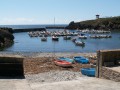
Beautiful views over Audierne Bay.

Always be cautious and plan ahead when you're outdoors. Visorando and the author of this route cannot be held responsible for any accidents occurring on this route.

The GR® and PR® markings are the intellectual property of the Fédération Française de Randonnée Pédestre.

Reviews and comments

4.7 / 5
Based on 2 reviews

Reliability of the description
5 / 5
Ease of following the route
5 / 5
Route interest
4 / 5
MatthieuGD
MatthieuGD

Overall rating : 4.5 / 5

Date of your route : Jun 15, 2025
Reliability of the description : Not used / Not applicable
Ease of following the route : ★★★★★ Very good
Route interest : ★★★★☆ Good
Very busy route : Yes

A walk I went on today; no particular difficulties, taking in hamlets, paths, woods and streams – quite pleasant!

Machine-translated

Arthur 29
Arthur 29

Overall rating : 4.7 / 5

Date of your route : Nov 25, 2024
Reliability of the description : ★★★★★ Very good
Ease of following the route : ★★★★★ Very good
Route interest : ★★★★☆ Good
Very busy route : No

A lovely, easy walk. Perfect for a day out. Ideal for a stroll in autumn.

Machine-translated

Other walks in the area

For more walks, use our search engine .

The GPS track and description are the property of this route's author. Please do not copy them without permission.