Country:
 City:
City:


Park in the car park opposite the cemetery.
(S/E) Take the Chemin du Sarrot Grand, which runs perpendicular to the main road and runs alongside the car park. After the bridge over the Cier, continue to the second path branching off to the right.
(1) Turn right onto this uphill path, continue to the junction with the road, turn right and carry on along the Chemin du Sarrot Grand. Ignore the first dead-end path on the left and continue to the second junction with a path on the left that goes round a house.
(2) Turn left onto this track. After a steep descent, you’ll come to a T-junction of country lanes. Turn left and carry on straight ahead. Pass the hamlet of La Rousse on the Chemin du Priou and continue to the junction with the Route d’Arpajan.
(3) Take this road straight ahead and continue to the junction with the Chemin de Qualihourcade.
(4) Turn right, pass the hamlet of Auzon, then leave a path on your left and fords the Cier. Continue along this uphill forest track until you reach the Gimone and Arrats Canal. Do not cross it.
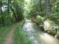
(5) Turn left and find the path that runs alongside the canal: take care on this narrow path. Continue along this path until you come to a path leading downhill on the left towards the village of Villemur.
(6) Leave the canal bank and take this downhill path, passing the hamlet of Hauret and continuing along the Chemin du Hauret. Ignore a path branching off to the left and carry on to the first house on the right. Take care here: just beside the house, a path branches off to the right and heads uphill
(7) Turn right onto this path, which leads to the centre of the village of Villemur. Walk past the town hall and head for the junction further down. Turn left, walk downhill to the junction at the bottom of the village and turn right. Continue to the junction with the D28.
(8) Turn left onto this departmental road, then, at the next junction, turn right. At the end of the stone path, ignore the dirt track straight ahead and turn onto the dirt track on the right. You’ll come to another stone path; pass the hamlet of Sabatier and head for the next junction with a track on the left.
(9) Turn left and continue to the left-hand bend in the road. Leave the road and take the dirt track opposite. Carry on to the ridge and look for a dirt track on the left.
(10) Turn left and follow this track carefully, avoiding the path leading to the hamlet of Terrade. Continue to the next fork.
(11) Turn left and head towards the edge of the woods. Stay on this path along the edge of the woods and carry on straight ahead until you come to a tarmac road and a small chapel on the right. Continue until you come to a small path branching off to the right, the Chemin de la Piété.
(12) Take this small path uphill and carry on straight ahead, then head down towards the village centre. Before the junction with the Chemin Terrero, a path on the right leads to a square.
(13) Turn right, cross the square and take the path opposite which leads down to the village. Continue to the junction with the Chemin Terrero.
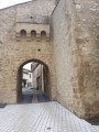
(14) Turn right, then left, and pass through the gateway to the fortified village. At the junction with Chemin la Carrau, take the main road straight ahead and continue to the village exit to reach the car park opposite the cemetery (S/E).

 Association / Club / Walk leader

 Visorando Member



 Easy
Easy  Tourism professional