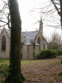
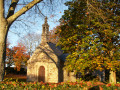
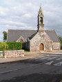
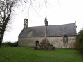
Route of chapels starting from Quimper and passing through Plogonnec

Discover part of the religious heritage of the area around Quimper via a hilly route mainly following small country lanes.

Details

151219
Creation:
Last update:
Last review:
  • Touring/Gravel
    Activity: Touring/Gravel
  • ↔
    Distance: 20.61 mi
  • ◔
    Duration according to the author: 3 hrs 
  • ▲
    Difficulty: Moderate

  • ⚐
    Back to start: Yes
  • ↗
    Ascent: + 1,467 ft
  • ↘
    Descent: - 1,467 ft

  • ▲
    Highest point: 584 ft
  • ▼
    Lowest point: 30 ft
  • ⚐ Country: France
  • ⚐ City: Quimper (29000)
  • ⚑
    Start/End: N 48.020583° / W 4.098371°
  • ❏
    IGN map(s): Ref. 0518OT, 0519ET, 0519OT

  • ◶
    Type of surface:
  •  
     
     97% Road  3% Path
  • Hour-by-hour weather

Photos

Description of the route

Access: Leave Quimper via the north on the D39 towards the Ty Pont Kerroué roundabout. At the roundabout, take the third exit towards Plogonnec-Locronan. The Ty Mam Douè Chapel (Chapel of the Mother of God) is situated about 200 m on the right. An information sign indicates its location. Parking is available there.

(S/E) Start with an uphill stretch and join the old Roman road.

(1) Turn left, then left again at the first road by a bus shelter on Route de Penvern. Follow this road, which crosses the bypass via a bridge and turns left to join the D39.

(2) Follow it to the right for about 200 m and turn right onto Route du Brieux.

(3) At the first junction, turn right and continue along the same road. The Kernilis Chapel comes into view as you emerge from a bend.

(4) Carry on and, at the Roman road, turn left near the bar ‘Le Tchello Bar’. Continue for about 1.5 km until you reach the next three-way junction.

(5) Turn left towards Pont Quéau – Saint-Albin (signposted). Follow this road, which passes close to the Chapel of Men Foues.

(6) Carry on along the same road, which descends towards the railway line, which you cross.

(7) Cross the bridge over the River Steïr and begin a long climb. Pass the sign for Quéméneven on your right and carry on to the village of Saint-Albin, where the chapel of the same name is situated.

(8) Pass through this hamlet, which is part of the parish of Plogonnec.

(9) After about 400 m, at a junction, turn left and head west then north-west (signposted Plogonnec + Super U supermarket). Carry on, ignoring all other roads to the right or left.

(10) At the junction with a main road, turn left heading west-south-west, then turn right towards Staven – Kergueven Nevet. Opposite the farm, turn left and follow the road to reach the Saint-Thélau Chapel, whose tall, openwork bell tower is easily spotted. It is situated in an enclosure a few metres from the road: an ideal spot to take a break after the various climbs.

(11) Continue along the road, now descending, until you reach a main road.

(12) Ignore the sign for Plogonnec on the right and continue left for about 1.5 km. At Lezmel, pass a horse boarding stable and carry on to the next crossroads.

(13) Turn right and head towards the hamlet of Pen ar Voëz, where you turn left and then take the first road on the right.

(14) Follow this road as it descends to the Kerganape Stream. Pass Meïl Butel, where you’ll begin a fairly steep climb. Pass the Keradily farm on your left and turn right (signposted for Quimper).

(15) Then turn left towards Kernou and join the D39.

(16) Follow it to the left for about 400 m.

(17) Turn left then right to reach the Seznec Chapel, situated in a grassy enclosure a few metres from the road.

(18) With your back to the chapel, head towards the D39 and cross it carefully. Continue to the next junction, where you turn left.

(19) Begin a lovely descent. The Notre-Dame-de-la-Lorette Chapel is 500 metres further down on the left.

(20) Continue down the slope and cross the railway line.

(21) Cross the bridge over the River Steïr. Follow the road as it climbs, following theGR®®38markings.

(22) At the end of the hairpin bend, turn right onto Traverse de Kerzu. Pass near Bolhoat and Kermeuzin and continue to the junction with the next road.

(23) Turn right, pass under the power line and go past Troheïr.

(24) Carry on, leaving theGR®® which turns right towards the water treatment plant, and continue to the next roundabout where there is a metal sculptor’s workshop.

(25) Turn slightly right, go under the bypass, then turn left at the first junction.

(26) Continue along this road heading east. Pass through the long residential area and reach the Ty Pont Kerroué roundabout.

(27) At the Goyat company, just as you enter this roundabout, turn left onto the small road on the left and join the D39.

(28) Cross with care and finish with the short climb up to the starting chapel (S/E).

Waypoints

  1. S/E : mi 0 - alt. 115 ft - Ty Mam Douè Chapel
  2. 1 : mi 0.44 - alt. 279 ft - Turn left at the Roman road
  3. 2 : mi 1.28 - alt. 305 ft - Junction with the D39
  4. 3 : mi 1.74 - alt. 331 ft - Turn right towards Kernilis
  5. 4 : mi 2.26 - alt. 312 ft - Kernilis Chapel
  6. 5 : mi 3.27 - alt. 348 ft - Turn left towards Pont Quéau
  7. 6 : mi 4.01 - alt. 322 ft - Men Foues Chapel
  8. 7 : mi 4.61 - alt. 148 ft - Pont Quéau, railway line
  9. 8 : mi 6.24 - alt. 377 ft - Saint-Albin Chapel
  10. 9 : mi 6.54 - alt. 417 ft - Road junction
  11. 10 : mi 7.69 - alt. 456 ft - Junction with a main road
  12. 11 : mi 9.31 - alt. 584 ft - Saint-Thélau Chapel
  13. 12 : mi 10.11 - alt. 384 ft - Main road for 1.5 km
  14. 13 : mi 11.08 - alt. 486 ft - Turn right towards Pen ar Voëz
  15. 14 : mi 11.68 - alt. 420 ft - Descent towards the Kerganape stream
  16. 15 : mi 13.59 - alt. 443 ft - Turn left towards Kernou
  17. 16 : mi 13.92 - alt. 420 ft - Junction with the D39
  18. 17 : mi 14.3 - alt. 384 ft - Turn left off the D39
  19. 18 : mi 14.53 - alt. 394 ft - Seznec Chapel
  20. 19 : mi 15.61 - alt. 394 ft - Road junction, descent to the left
  21. 20 : mi 16.02 - alt. 344 ft - Notre-Dame-de-la-Lorette Chapel
  22. 21 : mi 16.49 - alt. 105 ft - Crossing the railway line
  23. 22 : mi 16.83 - alt. 171 ft - Turn right through Kerzu
  24. 23 : mi 18.1 - alt. 256 ft - Turn right
  25. 24 : mi 18.56 - alt. 125 ft - Troheïr
  26. 25 : mi 19.09 - alt. 39 ft - Metal sculpture workshop
  27. 26 : mi 19.27 - alt. 30 ft - Turn left after passing under the bypass
  28. 27 : mi 20.28 - alt. 102 ft - Turn left, just before the roundabout
  29. 28 : mi 20.51 - alt. 92 ft - Final stretch along the D39
  30. S/E : mi 20.61 - alt. 115 ft - Finish at the starting chapel

Notes

This route is best tackled on a road bike as it follows minor roads.
Refreshments available in the village of Saint-Albin.
From the start to (11): a succession of climbs and descents.
Between (15 and 16) there is a long descent followed by a fairly steep climb.

The duration of the route does not take into account any time spent stopping at each chapel.

Worth a visit

Always be cautious and plan ahead when you're outdoors. Visorando and the author of this route cannot be held responsible for any accidents occurring on this route.

The GR® and PR® markings are the intellectual property of the Fédération Française de Randonnée Pédestre.

Reviews and comments

1.7 / 5
Based on 1 review

Reliability of the description
2 / 5
Ease of following the route
1 / 5
Route interest
2 / 5
FLOCH
FLOCH ★

Thank you for your message.
As I mapped out the route on a map after I’d completed it, I’m unable to answer your question.
Please post your question on the forum, where I think you’ll find an answer.
Kind regards

Machine-translated

le quay
le quay

Overall rating : 1.7 / 5

Date of your route : Apr 12, 2024
Reliability of the description : ★★☆☆☆ Disappointing
Ease of following the route : ★☆☆☆☆ Very disappointing
Route interest : ★★☆☆☆ Disappointing
Very busy route : No

Hello, Ihad the route on my phone but couldn’t follow it – it’s a route tracker rather than a GPS. It doesn’t tell you if you’re on the route; only much later does it simply tell you that you’re 200 metres from the route, and that’s it – you’re left to figure out how to get back on the route and start all over again. It’s a bit of a shame; I’d need to transfer the route to my Garmin GPS to get it right, but how do I do that? Thanks

Machine-translated

For more walks, use our search engine .

The GPS track and description are the property of this route's author. Please do not copy them without permission.