Country:
 City:
City:


Park in the car park by the community hall.
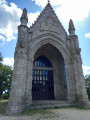
(S/E) Start by walking alongside the cemetery along Rue du Stade, then, at the end of this street, turn right onto Rue des Primevères and follow it for about fifty metres.
(1) Turn left and follow the grassy path behind the stadium. Continue along the footpath, then take another grassy path alongside a meadow until you reach Rue des Prunelles. Cross the road and carry on straight ahead through the housing estate until you reach the hedge.
Turn right and walk alongside this hedge until you reach Rue de la Mairie. Turn left onto the footpath running alongside the road until you reach the hamlet of La Boule. After the sign marking the entrance to the hamlet, take the first road on the right and follow it for about 50 metres.
(2) Turn right, in front of a gate, onto a path marked in yellow. Continue straight on along this path, ignoring the yellow signpost that turns right, until you reach the D53 road. Cross this road and continue straight ahead to reach the crossroads in the hamlet of Casterneau.
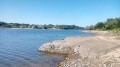
(3) Take the road on the left to cross the hamlet, then continue along the path leading to the shore of Lac de la Tricherie.
(4) Join the road on the left leading to the other side of the lake: you can either follow the lake as closely as possible or take the parallel path which, turning right after about a hundred metres, provides access to the road via a small footbridge. At the end of the road, follow the lake’s shore to the right until you reach a picnic area.
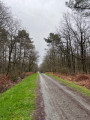
(5) Leave the lake on your right and cross the road to enter the meadow next to the mini-golf course. Walk along the right-hand side of the hedge until you reach the Bois du Défend car park. The woodland is criss-crossed by several numbered and signposted paths, which are not necessarily followed in this description.
After about a hundred metres, as you enter the woodland, take the path on the left. Follow it for 400 metres and, at the first junction, take the path on the right until you reach a three-way junction at a place called “Pierres Blanches” (wooden sign on the right).
(6) At this junction, take the path on the right; then, just past a bench at the side of the path, turn right for 50 metres, then right again to follow a long straight stretch to the edge of the campsite.
(7) Turn left onto a path – which isn’t always very visible – that runs alongside the campsite fence; then, continuing along this path and after passing a large picnic area, follow the fence of the adventure park (tree-top adventure course). You’ll come out onto the road that goes round the pond.
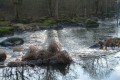
(8) Turn left and walk round the pond.
(4) Follow the path you took on the way there to reach the Casterneau crossroads.
(3) At the crossroads, take the road on the left for about 1 km (alas...). After crossing a road, when you reach the village of Saint-Charles, continue along the path opposite until you reach the edge of the housing estate.
(9) Turn right onto the path running alongside the hedge surrounding the castle grounds and skirting the field; at the end of the field, turn left and then left again to rejoin a footpath.
(10) Take the path on the left leading towards the château, which then opens out onto the church square. Cross the square and continue straight ahead along Rue des Tulipes; turn left and then right to return to the starting point via Rue de la Vieille Église (S/E).



 Visorando Member

 Moderate