A route taking in two of the Toy region’s gems, Viey and Sers

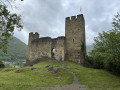
A short, very easy walk which, by following the paths once used by the area’s former inhabitants, allows you to discover two magnificent little villages in the Toy region near Luz-Saint-Sauveur.

Details

n°43960050
Creation:
Last update:
Last review:
  • Walking
    Activity: Walking
  • ↔
    Distance: 2.43 mi
  • ◔
    Average duration: 1h 55 
  • ▲
    Difficulty: Moderate

  • ⚐
    Back to start: Yes
  • ↗
    Ascent: + 879 ft
  • ↘
    Descent: - 879 ft

  • ▲
    Highest point: 3,707 ft
  • ▼
    Lowest point: 3,038 ft

Description of the walk

Starting from Viey: park in the centre of the village in a small designated car park.

(S/E) Head right, following the road which, after a left-hand bend, climbs up to the top of the village. You’ll find the wash house with a lovely fountain flowing from it. On the wall near the fountain, you’ll see a signpost pointing towards the village of Sers. Turn right and follow this path until it splits into two.

(1) Take the left-hand path and follow this trail up a fairly steep slope which will take you to Sers. Once you reach this lovely little village, you will have covered about half the route.

(2) Head down to the right towards the town hall and the church. Once you’re in front of the church, turn right onto a narrow lane, then right again to reach the end of the small road leading to the houses at the bottom of the village.

(3) Take the path opposite, which then takes a sharp bend to the right. Continue along this path, which descends through a wood, and, after two more hairpin bends, you’ll reach a large meadow by the Ruisseau du Bastan.

(4) Turn right onto a track suitable for vehicles, which will take you to a farm building.

(5) Go round it on the right, continue across the meadow to the woods and head back up to the first junction.

(1) Then follow the route back in the opposite direction to return to the village of Viey. Head towards the fountain, then turn left to reach the town hall and finally the car park (S/E).

Waypoints

  1. S/E : mi 0 - alt. 3,110 ft - Car park
  2. 1 : mi 0.37 - alt. 3,205 ft - Junction of the circular loop
  3. 2 : mi 1.04 - alt. 3,684 ft - Sers
  4. 3 : mi 1.12 - alt. 3,652 ft - End of the tarmac road, opposite
  5. 4 : mi 1.58 - alt. 3,176 ft - Vehicle-accessible track
  6. 5 : mi 1.78 - alt. 3,061 ft - Farm building.
  7. 6 : mi 2.42 - alt. 3,133 ft - Car park
  8. S/E : mi 2.43 - alt. 3,110 ft - Car park

Notes

A short walk on loamy ground, very pleasant and safe, with a good elevation gain and a few narrow sections that should only be tackled in good weather and on dry ground.
To be avoided at all costs if the ground is waterlogged, slippery or in wet weather, or if conditions are likely to become so during the walk, as some sections may be tricky.

At the fork in the path at (1), do not forget to close the animal gates.

Worth a visit

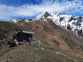
There are magnificent views to admire throughout the route as you climb towards Sers. The village of Betpouey lies close by on the right, at eye level, on the other side of the Bastan Valley, as do the surrounding peaks, particularly those to the east that separate us from the Néouvielle nature reserve and lakes.

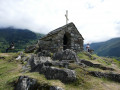
The beauty of the two villages of Viey and Sers, with their gleaming stone staircases, is remarkable. The little churches are magnificent, with their porches adorned with ‘chrismes’ and, as in Sers, a tiny cemetery adjoining the building. A well-documented mini-exhibition explains the history of the chrismes and their significance in the antechamber just inside the church porch, which houses a magnificent altarpiece.

Reviews and comments

4.2 / 5
Based on 2 reviews

Reliability of the description
4 / 5
Ease of following the route
5 / 5
Route interest
3.5 / 5
lemarcheur65
lemarcheur65 ★

Hello User 13592775

I see.
Could you please specify the locations, junctions, etc. where you encountered difficulties, so that we can provide further details (directions, etc.)?
Thank you in advance.

Machine-translated

User 13592775

Well, if you don’t take the signposting into account, the route description is as brief as can be, and the only other walkers doing the same route were just as lost as we were.

Machine-translated

lemarcheur65
lemarcheur65 ★

Hello User 13592775

When you fill in the comment, it clearly states:

Visorando aims to guide walkers using a route description and an extract from an IGN map, rather than relying on signposting, over which it has no control. When completing this questionnaire, please therefore focus your comments on the quality of the route description and the route itself, without mentioning the signposting.

Machine-translated

User 13592775
• Edited:

Overall rating : 3 / 5

Date of your route : Aug 30, 2026
Reliability of the description : ★★★☆☆ Average
Ease of following the route : Not used / Not applicable
Route interest : ★★★☆☆ Average
Very busy route : No

Inconsistent signposting, tricky sections.

Machine-translated

User 9890494
• Edited:

Overall rating : 4.7 / 5

Date of your route : Oct 17, 2025
Reliability of the description : ★★★★★ Very good
Ease of following the route : ★★★★★ Very good
Route interest : ★★★★☆ Good
Very busy route : No

A short, very easy walk through the woods on the way to the pretty village of Sers.
No difficulty, unless it is wet or raining, as the path is unpaved and can become very slippery on the short, steep climbs.

Machine-translated

Other walks in the area

For more walks, use our search engine .

The GPS track and description are the property of this route's author. Please do not copy them without permission.