


 Country:
 City:



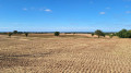
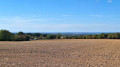
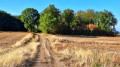
Park near Urciers church. The starting point is at the signpost for walking trails, near a small square next to the war memorial. Several sets of markings overlap: follow the yellow or green markings (the latter are more common but can sometimes be confusing).
(S/E) Walk round the war memorial and head down to the D26, which you should follow to the right towards Chateaumeillant.
(1) On leaving the village, just before the bridge over the Igneraie, turn left to follow the old railway line (be careful to take the path furthest to the left, not the one leading up to a farm).
Once on the D71, turn left and, at the sign marking the village entrance, turn immediately right onto a grassy path between two hedges.
(2) At the next junction, turn left to join the D26, which you should follow to the right. Ignore the blue signpost heading left, then a path on the right. The road curves. Ignore a path on the right.
(3) Just before the hamlet of Les Goulets, head down the farm track on the left. It curves to the left.
At the next junctions, take the GR® 654 – GRP® ‘Sur les Pas des Maîtres Sonneurs’ to the right, cross the Breuil stream, walk alongside a pond hidden behind thuja trees and reach La Ranche.
(4) Follow the small road to the left until you reach the first farms in the hamlet of Le Breuil.
(5) At the junction with Impasse du Levant, turn left onto a farm track. Cross the Breuil stream again and head straight up to a small road. Cross it and head straight on towards the Bellevue farm.
(6) At the junction after the farm, follow the green signposting to the right. The track reaches the hamlet of Les Arbres. Take the road on the right, then follow the small road to the left. Pass a track on the right, then another on the left. At the bend, turn left and head up the farm track between the trees.
(7) At La Loge Sagrolle, turn left and carry on straight ahead until you reach the rear of Bellevue Farm, which you passed earlier.
(6) Take the path on the right ( yellow and green markings). Pass the path leading to Les Chaumes on your left and walk alongside a pond. Cross the Bois de Bougazeau and join the D71.
(8) Cross it and continue straight ahead along a track, passing two paths on the right until you reach a small road. Turn right (GR® 654 signpost) to go under an old railway bridge and take the path on the right. Pass a path on the left and reach house no. 2 in the hamlet of Malterre. Continue straight ahead at the first junction.
(9) At the next junction, follow the small road to the left (green signposting), leaving the GR® straight ahead. Carefully cross the D54E to take the grassy track.
Follow the small road to the left until you reach the junction with the road leading to La Sauzat.
(10) Take the farm track on the left, cross the small road and take the tree-lined path opposite. This leads onto a small road; follow it to the left. Pass houses nos. 7.5 and 3 in Le Petit Sioudray on your right, then head up the lane on the left leading to Le Grand Sioudray.
(11) Take the small road on the left towards No. 12, which you’ll pass on your left 400 m further on. At the next junction, follow the road to the right until you reach the D54E. Cross it carefully and head towards Urciers. Pass a small road on your left and house No. 3 on your right.
(12) At the bend to the right, turn left onto a farm track. 100 m further on, at the crossroads, take the track on the right, which is the old railway line.
Carry on straight ahead and, 100 metres before reaching the D26, turn left onto a grassy track to descend to the Ruisseau d’Urciers; cross it, then climb back up to the Lignerolles road and follow it to the right. At the Stop sign, turn left onto the D26 for 40 metres, then turn left again at the small square near the church (S/E).
 Association / Club / Walk leader
 Easy

 Difficult
 Visorando Member

 Very difficult

