Baechlé – Lameysberg route

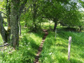
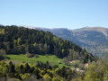
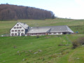
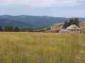
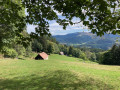
A walk designed for an afternoon, from the upper village towards Lameysberg, through the forest. The viewpoint is at the highest point of the walk. The return route also takes you through the woodland, with the option of stopping for a bite to eat at the Christlesgut farmhouse inn.

Details

51127552
Creation:
Last update:
Last review:
  • Walking
    Activity: Walking
  • ↔
    Distance: 4.80 mi
  • ◔
    Average duration: 3h 25 
  • ▲
    Difficulty: Moderate

  • ⚐
    Back to start: Yes
  • ↗
    Ascent: + 1,348 ft
  • ↘
    Descent: - 1,345 ft

  • ▲
    Highest point: 2,920 ft
  • ▼
    Lowest point: 1,637 ft

Photos

Description of the walk

Access to the starting point by car: park near Baechlé.

(S/E) Return to the crossroads.

(1) Turn right, following the Blue Disc signposts.

(2) Once you reach the village of Eckersberg, turn left onto Rue du Réservoir. Cross a bridge and take the tarmac road on the left, until you reach a sign on the right indicating the direction of a new path restored by the villagers.

(3) Take this path and you’ll come to a track suitable for vehicles.

(4) Turn right, following the ‘Blue Cross’ signposts.

(5) At the junction with the tarmac road, turn right, then keep left at the two closely spaced junctions that follow. Then turn left to stay on the Blue Cross path. Cross a forest track, continue straight ahead, then turn right onto the path at Saesserlé.

(6) Cross the tarmac road and head up the dirt track opposite, towards Thannmatt. Keep left at the three-way junction.

(7) Turn left, following the Yellow Cross markings, continue to the Lameysberg farm and carry on. You’ll reach a crossroads.

(8) First turn left then right to stay on the Yellow Cross route until you reach the Christelsgut junction.

(9) Take the path leading down to the left, go straight on at the junction and you’ll come out onto a path marked with a Green Saltire sign.

(10) Turn right, then left, following the Blue Disc markings, and return to the original fork.

(1) Follow the path on the right towards Baechlé and head back to the car park (S/E).

Waypoints

  1. S/E : mi 0 - alt. 1,864 ft - Baechlé Kilb
  2. 1 : mi 0.11 - alt. 1,864 ft - Junction of the circular loop
  3. 2 : mi 0.33 - alt. 1,640 ft - Rue du Réservoir
  4. 3 : mi 0.6 - alt. 1,709 ft - Trail restored
  5. 4 : mi 0.75 - alt. 1,903 ft - Vehicle track, on the right
  6. 5 : mi 1.24 - alt. 2,221 ft - Crossroads, turn right
  7. 6 : mi 1.89 - alt. 2,625 ft - Saesserlé – Thannmatt crossing
  8. 7 : mi 2.4 - alt. 2,920 ft - Junction to the left
  9. 8 : mi 2.8 - alt. 2,818 ft - Crossroads
  10. 9 : mi 3.3 - alt. 2,684 ft - Christlesgut junction
  11. 10 : mi 3.86 - alt. 2,343 ft - Chemin Green Saltire, on the right
  12. S/E : mi 4.8 - alt. 1,864 ft - Baechlé Kilb

Notes

Please note that the Lameysberg farmhouse inn is closed.

(9) If you wish, you can continue straight on to the Christlesgut farm inn and have something to eat there if you like.

Worth a visit

The Christlesgut farm inn is worth a detour from the walk.

Reviews and comments

4.2 / 5
Based on 4 reviews

Reliability of the description
4 / 5
Ease of following the route
4.5 / 5
Route interest
4 / 5
rv068
rv068

Overall rating : 4 / 5

Date of your route : Sep 16, 2024
Reliability of the description : ★★★★☆ Good
Ease of following the route : ★★★★☆ Good
Route interest : ★★★★☆ Good
Very busy route : No

The start of the route needs reviewing: the starting point is in the car park of a municipal lodge, which is closed off by a barrier; what’s more, it forces you to walk back down towards the hamlet of Eckersberg to follow part of the road you had driven up.
Otherwise, it’s a pleasant walk with lovely views of the Petit and Grand Honneck.

Machine-translated

Orev16
Orev16

Overall rating : 3.3 / 5

Date of your route : Jul 21, 2024
Reliability of the description : ★★★☆☆ Average
Ease of following the route : ★★★★☆ Good
Route interest : ★★★☆☆ Average
Very busy route : No

A lovely, unpretentious walk through the woods, in the shade. A few lovely views, with encounters with goats, cows, a beautiful donkey and a harmless wild boar 😁

Machine-translated

Tykini
Tykini

Thanks for the photos – they’re brilliant 👍

Machine-translated

Helmbacher Michel
Helmbacher Michel

Overall rating : 5 / 5

Date of your route : Jun 24, 2024
Reliability of the description : ★★★★★ Very good
Ease of following the route : ★★★★★ Very good
Route interest : ★★★★★ Very good
Very busy route : No

:great ---> the slideshow: 16 June 2024 Hike: Eckersberg (68) / Lerchenfeld / Thannmatt / Lameysberg / Braeschenberg / Christlesgut / Stemlisberg / Waterfall… ‘Google Photos’

https://photos.app.goo.gl/CJjaDHWM5pgr3A...

Machine-translated

Tykini
Tykini

Thank you for your feedback

Machine-translated

Le Geromois
Le Geromois

Overall rating : 4.3 / 5

Date of your route : Jun 17, 2024
Reliability of the description : ★★★★☆ Good
Ease of following the route : ★★★★★ Very good
Route interest : ★★★★☆ Good
Very busy route : No

No complaints – a great help.

Machine-translated

Other walks in the area

For more walks, use our search engine .

The GPS track and description are the property of this route's author. Please do not copy them without permission.