Refine your search for walks in Cime Plate (2770 m)
Cime Plate (2770 m) walks
 From Restefond to Sestrière via Cime de la Plate and Col de la Braïssa

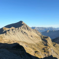
A very beautiful high-mountain hike at the foot of Cime de la Bonette between the Alpes Maritimes and Alpes de Haute Provence. Very little traffic. Magnificent, rocky landscape. The upper Braissette lake is a very beautiful spot for bivouacking.
 Cime de la Plate and Lacs de la Braissette

A beautiful hike in a wild environment, with no technical difficulties despite 50% of the route being off-trail. Orientation is not a problem either, despite the few cairns along the route; just follow the contours of the terrain and the streams at the edge of the meadows.The Visorando app may be useful.
Walks near Cime Plate (2770 m)
 Mont Pelat - Allos via Le Cimet

Second part of the circular. This second stage will take you to the village of Allos, starting from Mont Pelat, via the Trou de l'Aigle, the Cimet and its many waterfalls, including the Cascade du Pich and the Bois de Vacheresse.
 Camp des Fourches - Ferrere Refuge

This first stage of the Tour du Mont Aiga starts from Camp des Fourches on the Bonette road and, via the Col des Fourches, descends into the large Salso Moreno valley, which you climb back up to the Col de Pouriac. From the Col de Pouriac, you quickly reach Bassa di Colombart and then, after a long descent through the mountain pastures, the charming village of Ferrere. You may encounter flocks of sheep in Salso Moreno and, at night, the wolves that prey on them.
 Saint-Étienne-de-Tinée - Rabuons Refuge

This first stage will take you to the Rabuons refuge, on the shores of the largest lake in the Alpes Maritimes.
The landscape is very rocky. You will meet many Italians, as there are several refuges just across the border offering beautiful routes via the nearby Pas de l'Ischiator.
 Refuge de Vens - Camp des Fourches

Thisthird and final stage of the Tour du Mont Aiga starts from the Refuge de Vens and crosses a balcony below the slopes of the Aiguilles de Tortisse to the north-east of the Lacs de Vens. After passing the Crête de la Côte and descending to the Maisons Forestières de Tortisse, you will walk along a balcony path beneath the slopes of the Tête des Mourres to reach the Morgon plateau and climb back up to Laussets and finally to the Lacs de Morgon. At the large Morgon lake, you will descend eastwards into Salso Moréno to rejoin the path of thefirst stage and Camp des Fourches. It is possible to see chamois early in the morning and, of course, marmots throughout the day.
 Allos - Mont Pelat

The first part of this two-day circular is challenging and breathtaking, taking you through the heart of Mercantour National Park from the village of Allos, via Lac d'Allos and its refuge, Mont Pelat, Lac du Trou de l'Aigle, Le Cimet and its many waterfalls, including Cascade du Pich and Les Bois de Vacheresse.
 Bacchi Rossi Refuge - Vens Lakes Refuge

On thissecond day of the Tour of Mount Aiga from the Ferrere Refuge, you will pass through Plan de Belvédère, where there is a tin shelter overlooking the Rio Forneris valley and a fountain. You will also pass below Lake Emma, Monte Peiron at 2,796 m and Pointe Testa di Garbe at 2,749 m, to arrive, after a few hairpin bends, at Col de Fer at 2,584 m. You will then head towards Small Pass of Tortisse and the Vens Refuge, the end of this stage.
