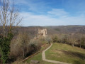
Château Rocher as seen from Saint-Rémy-de-Blot

Walk organised by the village association. Quite challenging with some elevation gain and a distance of almost 16 km.

Details

n°48758704
Creation:
Last update:
Last review:
  • Walking
    Activity: Walking
  • ↔
    Distance: 9.55 mi
  • ◔
    Average duration: 6h 15 
  • ▲
    Difficulty: Moderate

  • ⚐
    Back to start: Yes
  • ↗
    Ascent: + 2,129 ft
  • ↘
    Descent: - 2,126 ft

  • ▲
    Highest point: 1,913 ft
  • ▼
    Lowest point: 1,152 ft

Description of the walk

Starting point next to the town hall/community centre. Car park on the square.

(S/E) With your back to the car park, turn right onto the street that runs alongside the town hall until you reach the first path on the right.

(1) Leave the road and take this path which leads into a wood, following it until you reach a stream.

(2) Cross the stream, follow it to the left, then turn right to join the D2144 at Chomeil.

(3) Cross with care and follow the road to the right until you reach the T-junction.

(4) Turn left, then take the first path on the right and you’ll come to another fork.

(5) Continue along the path on the left to rejoin the D2144.

(6) Cross it carefully and follow the road to the banks of the Sioule. Join the D109.

(7) Head left towards the Roman Bridge at Menat, keeping to the right along the banks of the Sioule, and join the D109.

(8) Follow this road along the banks of the Sioule until you reach a bend in the D109.

(9) Leave the D109 by taking a small road on the right which leads to Rochocol. Continue along the track which joins the D109.

(10) Cross the road with care and continue along the path through the woods towards the Château Rocher car park. Turn right to reach the château.

(11) With your back to the château, set off again and follow the path which rejoins the D109.

(12) Cross the road, taking care as always, and continue along the path that runs alongside the River Sioule. Near Chez Barthonier, follow a small road until you reach a Fork in the road.

(13) Turn right and carry on, still following the Sioule. Join the D109 and follow it to the right for a good hundred metres.

(14) Leave the road, continue along a footpath, cross an old drawbridge and carry on along the road leading to Lisseuil.

(15) Turn left, then follow the path that climbs to the right into the Bois de Vérines. Continue to a junction just before the hamlet of Les Fontantes.

(16) Turn left towards the north-west, then right and finally left, heading due north, to reach Malmouche.

(17) Turn right onto the access road to the hamlet and, at the junction with the D99, turn left. Follow this road, which leads to the car park near the town hall of Saint-Rémy-de-Blot (S/E).


Waypoints

  1. S/E : mi 0 - alt. 1,749 ft - Car park near the town hall
  2. 1 : mi 0.22 - alt. 1,785 ft - Path on the right
  3. 2 : mi 0.91 - alt. 1,365 ft - Stream
  4. 3 : mi 1.55 - alt. 1,713 ft - D2144 at Chomeil
  5. 4 : mi 1.92 - alt. 1,739 ft - T-junction
  6. 5 : mi 2.32 - alt. 1,555 ft - T-junction to the right
  7. 6 : mi 2.62 - alt. 1,332 ft - D2144
  8. 7 : mi 3.01 - alt. 1,188 ft - Edge of the - Sioule (la)
  9. 8 : mi 3.16 - alt. 1,155 ft - D109 - Le pont roman de Menat
  10. 9 : mi 3.55 - alt. 1,158 ft - T-junction
  11. 10 : mi 4.06 - alt. 1,306 ft - D109
  12. 11 : mi 4.52 - alt. 1,542 ft - Château-Rocher
  13. 12 : mi 4.84 - alt. 1,368 ft - D109
  14. 13 : mi 5.6 - alt. 1,335 ft - Fork in the road
  15. 14 : mi 6.79 - alt. 1,398 ft - Fork in the path
  16. 15 : mi 7.4 - alt. 1,230 ft - Lisseuil - Église Notre-Dame (Lisseuil)
  17. 16 : mi 8.19 - alt. 1,909 ft - T-junction before Les Fontantes
  18. 17 : mi 9.06 - alt. 1,778 ft - Malmouche
  19. S/E : mi 9.55 - alt. 1,749 ft - Car park near the town hall

Worth a visit

Reviews and comments

4.5 / 5
Based on 2 reviews

Reliability of the description
5 / 5
Ease of following the route
4.5 / 5
Route interest
4 / 5
User 28805321

Overall rating : 4.3 / 5

Date of your route : Oct 03, 2026
Reliability of the description : ★★★★★ Very good
Ease of following the route : ★★★★☆ Good
Route interest : ★★★★☆ Good
Very busy route : No

A lovely walk, with beautiful views to enjoy as you pass Château Rocher, where we stopped for lunch. Classified as intermediate, there is a significant elevation gain
A few brambles between points 16 and 17.
It’s a shame I can’t post any lovely photos

Machine-translated

bader
bader

Overall rating : 4.7 / 5

Date of your route : Mar 20, 2025
Reliability of the description : ★★★★★ Very good
Ease of following the route : ★★★★★ Very good
Route interest : ★★★★☆ Good
Very busy route : No

Completed in 5 hours 30 minutes

Machine-translated

Other walks in the area

For more walks, use our search engine .

The GPS track and description are the property of this route's author. Please do not copy them without permission.