Country:
 City:
City:


(S/E) The church in the village of Routes; on your right, continue along the street which turns into a path.
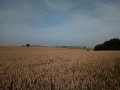
(1) At the crossroads, take the left-hand path which crosses the plains and ignore the side paths. Keep following this path, which will branch off to the right and then to the left into a small copse.
On emerging from the copse, continue across the plain until you reach a road on the left – do not take this road.
(2) Continue along the path opposite, which descends into the woods. Cross the railway line and follow the path to the right. It passes through the woods, then across the plain, and joins a road.
(3) Turn left onto this road. Walk past a few houses until you reach the first path on the left. Follow this path, cross the plain and then walk alongside the woods until you reach the next road. Here, ignore theGR® which turns left.
(4) Follow Route de La Valette to the right. At the first junction, take the path on the left, which then turns right and passes the sewage treatment plant on your left. Continue to the church at Hautot-l’Auvrray.
(5) After the Town Hall, at the junction, turn right, walk past the church and turn left onto Rue de l’École. Continue to the second junction, where you should turn right. There is a building on your left. Carry on along this road until it becomes a track.
(6) Follow this track straight ahead at the junction, cross the open land and head into the woods. Follow the first path leading down to the left. Ignore the side paths (some of which are not shown on the map) and continue on to Vautuit.
(7) At the road junction, turn left onto Rue du Montrouge, then take the first path on the right. At Rue Saint-Éloi, turn right at the right-angled bend, then take the next street on the left.
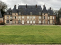
(8) At the junction, cross the road to take the path opposite which passes by the Moulin de Galleville. This path ends opposite the Doudeville cemetery (behind a high wall); turn right onto Rue de Bad Nenndorf. Walk past the sports ground, then past the secondary school, and continue to the junction with Rue du Val d’Auge.
Turn left onto this street and follow it until you cross the main road, Rue Georges Renault.
(9) Opposite, take the D110 (Rue de la Chambrette), then turn into the first street on the right, Rue du Petit Pont. Go under the railway bridge and continue to the junction.
(10) Turn left onto Route de Pichemont, then at the next junction, turn left again onto Rue du Manoir. When the manor house is on your left, cross the road and take the path opposite. Follow it across the plain, then after passing under a high-voltage power line, turn right onto Chemin de la Barrière à Bascule. Pass a substation on your right, then turn left onto the D110.
Follow this road until you come to a track on the right. Please note that the signpost has been dug up and may not be facing the right way.
(11) Turn right onto the first track you come to. Continue straight on, skirting Quievremont.
At the Calvary of the Virgin, head straight on along Rue de l’Église de Harcanville. Pass the town hall on your left, then the church.
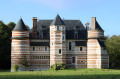
(12) At the church, turn right onto Rue des Faubourgs; there is a castle on your left. Pass the Marquets farm, go past the cul-de-sac on your left, then turn left. Follow the track across the plain until you reach the D149.
Cross this road and continue straight ahead, following the Bois Robert on your right.
(13) At the end of the woodland, take the path on the left, passing the Mare du Maroc on your left.
(14) At the junction with a road, follow it to the right. Continue straight on along Rue Paisible.
Turn right onto Rue de l’Espoir, then right onto Rue de La Vie and finally left onto Rue du Labeur, which leads to the church in Routes (S/E).


 Visorando Member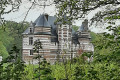
 Easy
Easy 
 Difficult
 Association / Club / Walk leader