Country:

 City:
City:


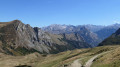
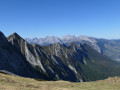
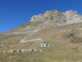
After Les Eaux-Chaudes, continue along the D934 for 1 to 2 km, pass the little Route de Goust on the right, then take the easily passable forest track signposted ‘Gorges du Bitet’. Follow it to a car park by the side of the track, just before a small bridge on the right over the Gave.
(S/E) The start of the path is on the left, a few metres before the bridge. It is well signposted (yellow markings). The path climbs north-west through the woodland to a large water intake.
(1) Pass under the pipeline, then turn left onto the path which climbs steeply to a clearing. Continue to the right, overlooking the stream, and take care a little further on at a stream crossing where the path has partially collapsed.
(2) The path continues through the woodland, following the right bank of the stream; you’ll need to cross it in an area of rocks and large boulders until you come face to face with the forest track coming from the bridge near the car park at the start (possible return route).
(3) Turn left onto this track for about 100 metres until you reach the start, on the right, of a new path which climbs and passes close to a second water intake.
(4) Continue climbing until you reach the fern-covered plateau as you emerge from the undergrowth, then carry on north-west along the clearly visible track. As you pass, admire the waterfall on your left cascading from Lac d’Isabe at 2,000 m.
(5) Pass above and to the right of the Cabane Cujalate – a good spot for a break – and you’ll soon reach a large, solitary tree offering welcome shade.
(6) The path soon enters the Bois du Métoura, then reaches the foot of a ridge which it follows, gradually climbing up to the Laiterine hut at 1,675 m, occupied by a shepherd during the summer. The path continues on to the Col d’Iseye (1,829 m).
(7) Turn back along the same route depending on your fitness and preference.
(3) You can follow the forest track which leads to the bridge near the car park where the walk starts (S/E).

 Visorando Member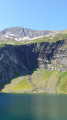
 Very difficult
 Difficult
 Tourist office