


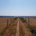
Set off from Hove Park towards the Chattri Memorial. The route then follows largely open country through fields to Devils Dyke.
Walk through the heart of Devils Dyke (read the history and legend).
You can take a break and have a bite to eat at the Devils Dyke Inn Pub.
Return via the fields with views over Brighton.
Walking time: 5 hours at a brisk pace (excluding breaks). The walk can easily be shortened or adapted.
Brighton Devils Dyke from Hove Park


Walk from Brighton & Hove to Devils Dyke. The walk offers a stunning view of the region (Brighton on one side and Sussex on the other) as you pass through the English countryside and its fields.
Details
Creation:
Last update:
Last review:
–
–
-
 Activity: Walking
 -
 Distance: 14.73 mi
 -
 Average duration: 8h 50
 -
 Difficulty: Difficult
 -
-
 Back to start: Yes
 -
 Ascent: + 2,388 ft
 -
 Descent: - 2,398 ft
 -
-
 Highest point: 696 ft
 -
 Lowest point: 118 ft
-
 Country:
United Kingdom
Country:
United Kingdom
-
 Area: South Downs
 -
 City:
Brighton and Hove
City:
Brighton and Hove -
 Start/End: N 50.843033° / W 0.170659°
 -


 Hour-by-hour weather
Photos

Description of the walk
Waypoints
- S/E : mi 0 - alt. 141 ft - Hove Park
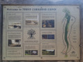
- 1 : mi 0.79 - alt. 299 ft - Three Cornered Course
- 2 : mi 1.36 - alt. 404 ft - The Green
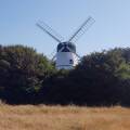
- 3 : mi 1.65 - alt. 367 ft - Windmill
- 4 : mi 3.89 - alt. 476 ft - Chattri Memorial
- 5 : mi 5.42 - alt. 571 ft - South Downs Way
- 6 : mi 6.52 - alt. 318 ft - Bridge over the motorway
- 7 : mi 8.25 - alt. 407 ft - Saddlescombe
- 8 : mi 9.05 - alt. 338 ft - Devils Dyke
- 9 : mi 9.68 - alt. 696 ft - Viewpoint
- 10 : mi 11.95 - alt. 279 ft - Monarch’s Way
- 11 : mi 13.97 - alt. 197 ft - Route
- S/E : mi 14.73 - alt. 141 ft - Hove Park
Notes
You can return to or travel to Brighton on the number 77 bus.
Worth a visit
Chattri Memorial
Walk through Devils Dyke
View from the top of Devils Dyke
Other walks in the area
South Downs Way circular walk from Pyecombe to Ditchling Beacon
 Visorando Member6.97 mi
+768 ft
-774 ft
3h 50
Visorando Member6.97 mi
+768 ft
-774 ft
3h 50
 Moderate
 Departure from Pyecombe (West Sussex)
A walk along one of the best sections of the ridge of the South Downs with excellent views to the north. It then returns through one of its dry valleys. The route is easy to follow and, being on chalk, is generally firm and dry (apart from a few short sections on farm tracks).
Upper Beeding circular
 7.22 mi
+600 ft
-604 ft
3h 50
Moderate
Departure from Upper Beeding (West Sussex)
7.22 mi
+600 ft
-604 ft
3h 50
Moderate
Departure from Upper Beeding (West Sussex)
A nice variety - up high on the Downs, and back down to woodland, countryside, riverside - with Chanctonbury Ring frequently in view in the distance.
From Lewes to Alfriston via the Ouse and the Downs
 11.23 mi
+781 ft
-751 ft
5h 50
Moderate
Departure from Lewes (East Sussex)
11.23 mi
+781 ft
-751 ft
5h 50
Moderate
Departure from Lewes (East Sussex)
From lovely Lewes in East Sussex along the River Ouse valley, then up onto the South Downs for a bracing downland stretch with views across the Weald, gorgeous South Downs Way and the sea, ending up in the delightful village of Alfriston, where there are afternoon buses back to Lewes.
Southease, Rodmell and Lewes Brooks
 5.97 mi
+299 ft
-285 ft
3h 00
5.97 mi
+299 ft
-285 ft
3h 00
 Easy
Departure from Beddingham (East Sussex)
Easy
Departure from Beddingham (East Sussex)
Using a part of the South Down Way, this circular walk goes through Southease, Rodmell, along the River Ouse and include one steep hill.
Cissburry Ring
4.11 mi
+489 ft
-489 ft
2h 20
Moderate
Departure from Worthing (West Sussex)
This is a nice little 4 mile walk up to Cissbury Ring with amazing views over looking the sea and coastal towns of Worthing and Brighton from Cissbury Ring. Best attempted on a clear fine weather day so as to make the most of the views from the peak. This is a moderate walk that is not wheelchair friendly.
Charleston Farm & Firle Beacon from Firle
 4.63 mi
+653 ft
-627 ft
2h 40
Moderate
Departure from Firle (East Sussex)
4.63 mi
+653 ft
-627 ft
2h 40
Moderate
Departure from Firle (East Sussex)
This East Sussex walk takes you onto the South Downs for spectacular views north at Firle Beacon. The walk also offers the opportunity to visit Charlestown Farmhouse with its bohemian decor and associations with the Bloomsbury set. This walk has un challenging climb.
Seven Sisters From Seaford to Eastbourne
13.02 mi
+1,617 ft
-1,611 ft
7h 25
Difficult
Departure from Lewes (East Sussex)
Sea, Sun and … the Seven Sisters walk of course! When the weather is nice and the temperatures are rising, lace up your hiking boots (or trail runners, it’s summer after all), apply the sunscreen and get the brim out of the closet. It is time to enjoy a walk by the South Coast, and who knows, maybe even take a dip in the bright blue English Channel.
South Downs Storrington to Pulborough
 8.55 mi
+423 ft
-512 ft
4h 20
Easy
Departure from Storrington and Sullington (West Sussex)
8.55 mi
+423 ft
-512 ft
4h 20
Easy
Departure from Storrington and Sullington (West Sussex)
An easy, varied and beautiful nine-mile walk taking in small paths, Parham House grounds, woodland, Rackham, more woodland, Wiggonholt and Pulborough Brooks. Plenty to see and enjoy
For more walks, use our search engine .
The GPS track and description are the property of this route's author. Please do not copy them without permission.

