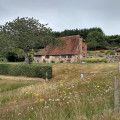
South Downs Way circular walk from Pyecombe to Ditchling Beacon

A walk along one of the best sections of the ridge of the South Downs with excellent views to the north. It then returns through one of its dry valleys. The route is easy to follow and, being on chalk, is generally firm and dry (apart from a few short sections on farm tracks).

Technical sheet

65553929
Creation:
Last update:
Last review:
  • Walking
    Activity: Walking
  • ↔
    Distance: 11.21 km
  • ◔
    Calculated time: 3h 50 
  • ▲
    Difficulty: Moderate

  • ⚐
    Return to departure point: Yes
  • ↗
    Vertical gain: + 234 m
  • ↘
    Vertical drop: - 236 m

  • ▲
    Highest point: 244 m
  • ▼
    Lowest point: 94 m

Description

Start: A23 sliproad

(S/E) Go under the road bridge, then turn right onto the road going over the bridge. As this curves right, turn left onto Church Hill (blocked to traffic by a large planter), where you join the South Downs Way. Go past the church, then continue straight down the hill to the A273. Turn left onto the path adjacent to the road for around 150m, then cross the road to the access road to Pyecombe Golf Course.
The South Downs Way continues through the golf course, starting at the far left of the course car park. This is initally a worn concrete track which turns to gravel then grass.

(1) At the junction of bridleways, the South Downs Way turns left and onto a surfaced track (mainly for the benefit of cyclists). Turn left if you would like to make a detour to see the Jack and Jill windmills, otherwise continue straight on, on a grassy bridleway. Turn right to rejoin the South Downs Way, which is an obvious path.

(2) After a section between or along fields, the path emerges onto the open grassland of Ditchling Beacon, which is grazed by sheep. Just after the gate, there is a dewpond on the left which is fenced off and rather overgrown. A few hundred metres further on the right there is another dewpond, still in use. The South Downs Way continues along the ridge to the high point of Ditchling Beacon - the triangulation pillar is a short distance to the right of the path.

(3) After perhaps taking a short break, retrace your steps a short distance to a gate on the left with a bridleway finger post. Take this path, which continues between or alongside fences, with a stunning view of Hogtrough Bottom on the right, then descends into North Bottom and through its two fields.

When you reach a fence with a track on the far side, after around 100m go through the gate (this is sooner than shown on the map). Continue along this track, which goes diagonally right up the slope.

(4) Near the top of the slope there is a finger post; continue along the track which the finger describes as 'registered bridleway' (the public bridleway to its left is overgrown in parts). When you reach the main farm track, turn right and continue up the hill and through a gate (the public bridleway through the small wood is also overgrown). Turn left, then follow the hedge round and cross the Sussex Border Path.

At the end of the field, go through the gate then turn right between fences. At the end turn left onto a track between two open fields. Continue straight on, across the golf course fairway towards a small gap in the wood. Cross a second fairway, then through another small wood.

(5) Descend the hill towards Pyecombe. Just before the road, turn right after the chalk mound onto the permissive bridleway (the brick structure on the mound is an airshaft for the Clayton railway tunnel). Continue to the end (ignoring the gate on the left, as this is not a safe road crossing). Cross the A273 with care (the visibility is not good), then go up the lane into Pyecombe. At the top of the hill, turn left at the road junction.
At the botttom of the hill, turn right by The Plough pub to return to your car.(S/E)

Waypoints

  1. S/E : km 0 - alt. 96 m - A23 sliproad
  2. 1 : km 2.01 - alt. 173 m - Junction of bridleways
  3. 2 : km 3.47 - alt. 217 m - Dewponds
  4. 3 : km 4.85 - alt. 244 m - Ditchling Beacon
  5. 4 : km 7.45 - alt. 123 m - Above Lower Standean
  6. 5 : km 9.79 - alt. 155 m - Edge of wood above Pyecombe
  7. S/E : km 11.21 - alt. 96 m - The Plough pub and A23 sliproad

Practical information

There is free parking on the sliproad between the A23 and the A273, south of the overbridge. If you are coming from Brighton, turn off towards the A273 and Pyecombe, go under the A23, then turn left at the petrol station onto the sliproad. There are no parking places in the village itself.

There is also free parking at Jill Windmill, which gives a shorter walk if you return to waypoint (1) rather than descending to Pyecombe.

Pyecombe is served by Metrobus numbers 270, 271 and 272 (between Brighton and Crawley or East Grinstead).

Cattle are sometimes grazed in the fields of North Bottom. They seem very docile - and are probably used to walkers. If you encounter them, this is the advice given by The Ramblers:

  • Keep a good distance from the animals. If they are on the path, then you’re allowed to go off path to walk around them. Walk quickly and quietly. Animals in a field may approach you, especially groups of cows which can be quite intimidating. If you panic, or run from them, they may also start running.
  • If you have a dog, always keep it dog close and on a lead. If cattle run towards you, or you feel in any way in danger, then let your dog off the lead. Your dog will be able to get to safety and removing the dog from the situation will calm the cattle.

In the nearby area

(S/E) the Church of the Transfiguration in Pyecombe dates from the 12th century, and is constructed from flint. It is generally open from 10am to 6pm in summer and from 10am to 4pm in winter. Its cemetery includes Commonwealth war graves. https://en.wikipedia.org/wiki/Church_of_...

(1) Jill windmill is a fully functional windmill, dating from the 19th century. It is maintained by a charity, and is generally open to the public on Sunday afternoons in the summer. https://www.jillwindmill.org.uk/ The adjacent Jack windmill is now a private residence, and is largely hidden by trees.

(2) Dewponds are historic small, round ponds, to provide water for livestock in places without natural sources of water. A natural or excavated hollow was lined with clay, which was "puddled" (wetted and trampled) until it made a watertight seal. https://www.brighton-hove.gov.uk/librari...

(3) The scarp slope to the north of Ditchling Beacon is a Nature Reserve, and the surrounding grassy downland is owned by the National Trust. The herb-rich chalk grassland provides valuable foodplants and nectar for a range of butterflies and insects including the Chalkhill Blue and the uncommon Silver-spotted Skipper. It is home to skylarks and several types of orchid. https://sussexwildlifetrust.org.uk/visit...

(S/E) The Plough is open all day, every day, from midday. http://www.theploughpyecombe.co.uk/

Reviews and comments

Other walks in the area

For more walks, use our search engine .

The GPS track and description are the property of the author.