


Refine your search for walks in Briançon (rivière)
Briançon (rivière) walks


 The Petit Poucet trail on the Cham des Bondons
 Visorando Member
 9.07 mi
 +1,250 ft
 -1,237 ft
 5h 15
5h 15
 Moderate
 Departure from Les Bondons (Lozère)
Menhirs are found in Brittany. The proof: the name itself is of Breton origin (maen hir = long stone). And even more so when they are made of granite.
But if I told you that one of Europe's main megalithic sites is in Lozère, would you believe me?
The standing stones along this route at the foot of Mont Lozère are like those scattered by Tom Thumb: just follow them to find your way.
Walks near Briançon (rivière)
Florac - Cassagnas
 12.36 mi
+1,818 ft
-971 ft
7h 15
12.36 mi
+1,818 ft
-971 ft
7h 15
 Difficult
Departure from Florac (Lozère)
Difficult
Departure from Florac (Lozère)
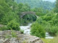
Tenth stage of a complete journey on the Chemin de Stevenson between Le Puy-en-Velay and Alès. This stage may involve significant changes to the GR®70 signposting. This stage essentially follows the Mimente valley before it flows into the Tarnon at Florac.
Pont-de-Montvert - Florac
 13.33 mi
+1,276 ft
-2,323 ft
7h 15
Difficult
Departure from Le Pont-de-Montvert (Lozère)
13.33 mi
+1,276 ft
-2,323 ft
7h 15
Difficult
Departure from Le Pont-de-Montvert (Lozère)
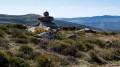
Ninth stage of a complete journey on the Chemin de Stevenson between Le Puy-en-Velay and Alès. This stage features significant changes to the GR®70 signposting, taking an alternative route to the GR®70 for much of the way. This means that the stage is substantially shorter than the official route. This stage marks the entry of the Chemin de Stevenson into the Cévennes region.
From Pont-de-Montvert to Florac via the Signal du Bougès
 15.52 mi
+2,457 ft
-3,668 ft
10 hrs
15.52 mi
+2,457 ft
-3,668 ft
10 hrs
 Very difficult
Departure from Le Pont-de-Montvert (Lozère)
Very difficult
Departure from Le Pont-de-Montvert (Lozère)
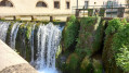
Of the various routes on offer, this one is a compromise: it first follows the Stevenson Trail via the high point of Le Bougès, then stays on the left bank of the Tarn all the way to Florac
Le Bleymard - Pont-de-Montvert
 10.59 mi
+1,821 ft
-2,523 ft
6h 25
Difficult
Departure from Le Bleymard (Lozère)
10.59 mi
+1,821 ft
-2,523 ft
6h 25
Difficult
Departure from Le Bleymard (Lozère)
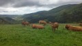
Eighth stage of a complete journey on the Chemin de Stevenson between Le Puy-en-Velay and Alès. This stage may involve significant changes from the GR®70 signposting, and corresponds to the North-South crossing of the Mont Lozère massif.
Cassagnas - Saint-Étienne-Vallée-Française (Lébou)
 11.81 mi
+1,204 ft
-3,015 ft
6h 30
Difficult
Departure from Cassagnas (Lozère)
11.81 mi
+1,204 ft
-3,015 ft
6h 30
Difficult
Departure from Cassagnas (Lozère)
Eleventh stage of a complete journey on the Chemin de Stevenson between Le Puy-en-Velay and Alès. This stage includes significant changes to the GR®70 signposting. This stage lies in the heart of the Cévennes National Park.
 Canoe descent from Sainte-Enimie to La Malène
8.85 mi
+417 ft
-495 ft
4 hrs
 Easy
Departure from Sainte-Enimie (Lozère)
Easy
Departure from Sainte-Enimie (Lozère)
This descent between the two beautiful villages of the Gorges du Tarn is ideal for those who want to explore the gorges at a leisurely pace, with an easy route and plenty to see.
From Sainte-Enimie to La Malène
 9.13 mi
+1,483 ft
-1,572 ft
5h 30
Moderate
Departure from Sainte-Enimie (Lozère)
9.13 mi
+1,483 ft
-1,572 ft
5h 30
Moderate
Departure from Sainte-Enimie (Lozère)
Stage 5 in the heart of the Gorges du Tarn via the Sentier des Gorges du Tarn (left bank) from Sainte-Enimie to La Malène, passing through the picturesque hamlet (with no road access) of Hauterives.
From Sainte-Énimie to Les Vignes
 17.11 mi
+2,864 ft
-3,097 ft
10 hrs
Very difficult
Departure from Sainte-Enimie (Lozère)
17.11 mi
+2,864 ft
-3,097 ft
10 hrs
Very difficult
Departure from Sainte-Enimie (Lozère)
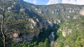
On this fifth stage, we’ll follow the River Tarn as closely as possible, often right by the water’s edge in a rural setting or on a riverside terrace, always on the left bank. If you want to enjoy it at a leisurely pace, you’ll need to split it into two stages, heading towards La Malène, for example.