Country:

 City:
City:


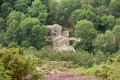
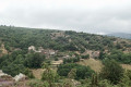
Heading towards Le Pujol-sur-Orb on the D908, after passing Colombières-sur-Orb and a sharp right-hand bend, you’ll find a large car park on the right-hand side of the road. There is also another car park with picnic tables opposite, next to the oratory of Sainte-Colombe.
Red and yellow markings forthe GRP® Haut-Languedoc et Vignobles _ Greenway
(S/E) Follow the verge on the right-hand side of the road for 50 metres. Turn right, heading down below the road. Join theGRP®, which is in fact the old railway line, and continue to the left until you reach Le Pujol-sur-Orb.
Pass under the main D908 road, still following theGRP® or Greenway.
An alternative route I took, but which is a bit crowded towards the end. See § Practical information (²).
(1) Pass over the access point to La Borie Basse. See § Practical information (²). Continue over the renovated railway bridges.
Red and white markings forthe GR®787, which has now replaced theGRP®
(2) Leave the Voie Verte, turn right for a few metres and climb up to the left alongside the houses via a large flight of steps, then finally cross the road bridge onto the Voie Verte. Turn left onto Rue de la Clastre, which becomes tarmac and climbs up through the old terraced fields.
(3) At the fork in the two paths, carry on straight ahead, still following theGR®787®. Follow the Cami Ferrat. The track deteriorates and becomes stony.
Red and white markings forthe GR®7
(4) At the Croix des Baussels, take the path to the left at a 90° angle onto theGR®7®.
(5) Torteillan, a magnificent hamlet well worth a visit. Continue along theGR® and leave the hamlet. The correct path turns due north, passes Trabès, then two valleys, and joins the D180 road. Turn left, then immediately right, heading due north into the heart of the hamlet of Combes.
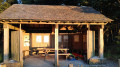
(6) Leave Combes and the D180 – the access road to this hamlet – and head up to the left into the forest. The view overlooking the hamlet is lovely. Continue to follow theGR®7. You’ll reach a rest area with a shelter on your left and picnic tables.
(7) Take the track on the right, which climbs slightly. A slightly rutted path allows you to cut across two bends in the tarmac track. Continue along this track for about 100 metres.
Unmarked
(8) Head up to the right along a lovely grassy track, heading due east. Leave theGR®7temporarily.
Alternative route: you can continue straight ahead, still on theGR®7, and head directly to the Monument de La Forêt des Écrivains.
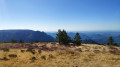
(9) Reach Cap des Agasses in an open area overlooking the landscape (altitude 691m). This is a lovely spot for a well-deserved break. Head north-west, descending slightly along a straight grassy track.
Red and white markings forthe GR®7.
(10) The Writers’ Forest monument. Numerous plaques, engraved with the names of various famous writers, are set into the ground. The site is accessible to people with reduced mobility. Straight, concrete paths criss-cross the area. Information boards are on display. Continue due west for 100 metres from the monument.
(11) Leave the road and take a good path on the right which climbs along the edge of the forest towards a high point.
(12) At Montagne de Conil, enjoy the stunning view from this spot. There is a central lay-by with a large tree.
On 20 July 2019, a campervan was parked in this protected area – how on earth did it get up there… via the track?
Warning: the signposting is extremely poor. Head south-west along the open track at the edge of the forest. Ignore the track on the left into the forest which leads towards a forest roundabout?
(13) Turn right at a 90° angle onto a rough track that descends slightly towards a fire hydrant on your right. Look out for the red and white markings and head straight ahead, keeping the hydrant on your right. Do not go down to the right. The view over the hamlet of Madale is lovely.
Caution: the path is very rutted. Follow the markings carefully, taking great care not to cut across the hairpin bends. Cross the Madale Stream and head back up.
(14) At the Col de Jaquet, cross the D180E2 road. Continue straight ahead uphill, still following theGR®7. It is perfectly possible to make a round trip to this typical hamlet, lost in the middle of nowhere.
Cross a trough and begin a climb due west. At an altitude of around 800m, the path levels out. You’ll emerge into an open, cultivated area. Leave the red and white markings ofthe GR®7.
Yellow markings.PR®
(15) Turn left onto the wide track and follow it for about a hundred metres. Leave the wide track and turn right onto a well-maintained path. This is a very pretty spot with a lovely view. Right at the far end, at the same level, stands a large building which is the Auberge des Avels. To the right, slightly below, lie the slate-roofed houses of the hamlet of La Fage. Continue along this lovelyPR® route, heading due south.
(16) At the junction with the signpost (July 2019), keep left onto the well-marked yellow path. Pass the Arête de la Fage. The view is stunning.
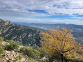
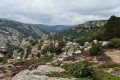
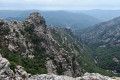
At a barely visible fork (at around 840m), take a short detour to the right towards a natural promontory amongst the rocks to look out over the Gorges de Colombières. The view is magnificent and the same question always arises: how were all these paths – still in good condition and clearly marked on the IGN maps – created in this very steep terrain?
Countless enormous boulders dot this mountainous landscape. Go round the Roc de Brétouyre, heading eastwards.
(17) Turn right towards the south onto the very pretty Chemin des Fleisses, a wide, stony track that descends towards the valley. Numerous hairpin bends allow you to descend comfortably by 200 metres initially, before reaching the Source du Carouch. A few more hairpin bends and you’ll cross the right bank of the Ruisseau du Thérondet. The descent becomes gentler. On your right, you’ll find a water intake fitted out at the Source de Borie, a drystone shelter. You’ll reach the tiny hamlet of Les Seilhols at around 300 m.
(18) Ignore a path leading uphill to the right and head to the end of the access road to the hamlet. On your right, you’ll find a small, very steep path – really steep – running between the houses. The path descends very steeply and joins the end of a road. Continue along this road for 20 metres and turn right towards the D908.
Unmarked
(19) D908: take care – despite the pedestrian crossing, do not step out without looking first, as this is a bend in the road and traffic is heavy. Carry on straight ahead along the D14E26, heading due south.
Turn left onto the small road, or Chemin du Bois Delmas, which becomes Chemin de la Carrierasse. Take care: after a tennis court on your right, you’ll need to leave this road. Turn left onto Rue du Puits, heading due east, through a neighbourhood of new houses. The road curves sharply, heading due south, until you reach a cross.
(20) Turn left onto a small concrete road heading due east. Leave the well-maintained tarmac road and wade across the Ruisseau de Madale. Continue between stone walls. Join the D908 at a memorial stone. Turn left and keep to the left-hand side of the road towards the car park (S/E).


 Visorando Member
 Moderate
 Difficult