Country:

 City:
City:


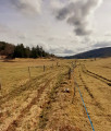
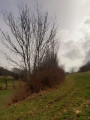
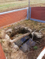
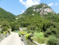
There’s no car park in the small hamlet of Saint-Sulpice-le-Vieux, but the locals are very friendly and will be able to tell you where to park when you arrive. One local even offered us a bit of his land to park on. You’ll certainly find a place to park in the village without any difficulty, provided there aren’t about twenty cars there.
(S/E) Head south along the road leading down to Jailloux and La Charbonnière.
(1) At the three-way junction, turn left and leave the main road to start the climb.
(2) Turn sharply right to skirt the forest and the meadow on your left, with magnificent views all along the way.
(3) Turn left onto the track and carry on straight ahead to reach La Charbonnière and an orientation table – which is unfortunately rather hard to spot – but which offers a superb panoramic view of the Hauteville Plateau.
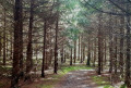
(4) Carry on straight ahead to cross a magnificent high-altitude nursery set amongst a carpet of moss – a truly magical sight.
(5) Turn right. Carry on straight ahead at the three-way junction, despite the Yellow Cross, and begin a long descent along the forest track known as the Chemin de Saint-Sulpice:a fairly steep and muddy descent. You’ll reach a junction near the Jailloux Forest House.
(6) Head straight ahead to go round it and descend straight down the tarmac road. Pass the path leading to the ruins of Saint-Sulpice Abbey – which are of little interest – on your left, and join the departmental road.
(7) Turn left towards Les Catagnolles.
(8) Turn left again to cross the entire hamlet, passing the wash house.
(9) Carry on straight ahead, leaving the turn-off for Gros Jean on your right: this is the tarmac section of the route, but it’s still pleasant as there’s very little traffic.
(10) Leave the road and head left towards Lavant, where you’ll find a farm in the meadow – perhaps a boarding stable for horses or other animals – where we saw a lovely donkey: please do not feed the animals under any circumstances. Walk through the hamlet and continue to the bend in the road on the right.
(11) Take a path that runs straight across the meadow; at the three-way junction, do not turn left, but carry on straight ahead across the meadow, right in the centre of the plateau.
(12) Take the path that runs alongside the bushes on the left and begins to wind its way uphill. Pass under a power line, then carry on straight ahead at the three-way junction to reach a T-junction.
(13) Turn sharply left and continue uphill through a small woodland of shrubs: you can hear cars passing overhead. You’ll emerge onto the Route de Cérarges (D103) near a telecoms mast.
(14) Carry on to the left, passing a lovely wash house and a beautiful fountain along the road, then veer to the right towards Pouvillieu, where you’ll find a goat farm and perhaps a local farm produce stall (GAEC). Please be careful – we’ve come across dogs and geese roaming freely: stay calm if you encounter them and, above all, don’t scare them! Turn left at the junction to return to the D103 and head right, walking carefully alongside it for a few hundred metres.
(15) Take a path on the left. Keep to the right at the first junction, then turn left at the next one to avoid returning to the road, and continue across the field, passing under the high-voltage power line. Make your way to the middle of the field.
(16) Make sure to follow the GPS carefully; it will lead you uphill to the right to reach a hedge of shrubs that you can see in the distance, which you will follow on your right. The track across the field isn’t clearly marked, but you can make out tractor tracks. The lovely path, lined with low stone walls, continues towards Saint-Sulpice-le-Vieux and takes you back to the car park where you started (S/E).


 Visorando Member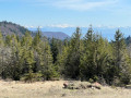

 Difficult
  Association / Club / Walk leader
 Easy
Easy