Country:

 City:
City:


Access: From Saint-Maurice-sur-Moselle, take the D90 towards Chaume du Rouge Gazon, the starting point of our walk.
(S/E) From the hotel, cross the car park and head up the access road (D90).
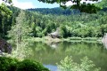
(1) After a short distance, you’ll find a path on the right that climbs gently through the pastures (marked with a Blue RectangleGR®531). Ignore two paths, one on the right and one on the left, and continue along the path. Further on, leave the path via a track branching off to the right (marked with a Blue RectangleGR®531). At the three-way junction, turn left and, at the next junction, carry on straight ahead. At the next three-way junction, turn left to quickly reach the track. Take the track to the right (still following the same signposting) to reach a pond below the ridge.
(2) Walk round the pond and take the path that descends to the left (Blue-White-Blue signposting) and runs alongside two other ponds. After the third pond, ignore the path branching off to the left and carry on straight ahead, parallel to the stream flowing down from the ponds. At the junction with a path leading downhill, take it to the left to quickly reach a wider track.
(3) Turn left, following the Yellow Ring markings.
(4) After crossing the stream, head slightly uphill to the left to visit the ‘Three Musketeers’ site. Then return and continue along the path to the left. Shortly afterwards, at the three-way junction, turn left and continue along this track. Further on, cross a stream via a bridge and, shortly afterwards, you’ll find a path on the right heading eastwards.
(5) Leave the track to take this path marked with the Yellow Ring and Red Ring. Continue along this path until you reach the track at the bottom of the valley.
(6) At the footbridge (Chalet Burner), cross the Grande Goutte stream and turn left onto the track that follows the stream, keeping to the same markings throughout.
(7) Just before crossing a small stream, leave the track and head up to the right along the Sybille path (marked with a Red Triangle), which starts furthest to the right and is also marked by a bench situated slightly above the track beneath a fir tree. Two-thirds of the way up the climb, at a three-way junction, leave the Red Triangle markings and take the path on the left (marked with a Yellow Ring). You’ll emerge onto a wide track (note a refuge at the bottom of the valley a few steps to the left, La Conche).
(8) You are now facing the ‘Roi Soleil’. Continue to the right along the wide path. After passing a valley, ignore a path branching off to the right and carry on straight ahead.
(9) Immediately afterwards, leave the track (and the Yellow Ring) to climb left onto a path (marked with Red Triangles). Carry on straight ahead along this path until you come out onto a track.
(10) Take this track to the left, following the Yellow Disc markings.
(11) Further on, ignore a path on the right and continue along the track to the Chalet des Crêtes. Go past the chalet to reach, a little further on, three closely spaced path junctions on the right.
(12) Take the third path. Immediately afterwards, at the three-way junction, turn left to climb up to the ridge. Continue straight on to the Tête de la Bouloie.
(13) From here, you’ll be treated to a 360° panoramic view. Further on, ignore a path branching off to the left and take the path that descends into the forest towards the west. You’ll emerge onto another path.
(14) Turn left to join a track (follow the Yellow Disc markings). Turn right onto this track. Further on, you’ll come to a path branching off to the right and back.
(15) Leave the track to follow this path (marked with a Blue Cross) towards the waterfalls and the Roche de l’Ours. After the waterfalls, continue along the same path, heading north, turning right at the junctions and always following the same markings. You’ll reach a crossroads above a reservoir.
(16) Ignore the track heading straight ahead and take a path on the right (marked Blue-White-Blue). Shortly afterwards, you’ll come out onto a track; follow it to the right. Continue along this track for about 1.5 km.
(17) Leave this track at a left-hand bend and head up to the right, following the path marked with a Yellow Cross. This path climbs steadily up the slope until it reaches the ridge.
(12) Turn left and carry on straight ahead.
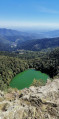
(11) You’ll reach the junction above the lake that you passed on the way out.
(2) Carry on straight ahead to return to the start of the walk at Rouge Gazon (S/E).


 Visorando Member

 Easy
Easy 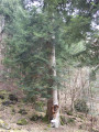
 Moderate