Country:

 City:
City:


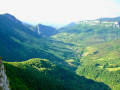
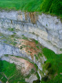
Access from the Isère Valley (A49 motorway, exit 9): pass through Saint-Roman then Saint-Jean-en-Royan and head towards Bouvante; pass through Bouvante-le-Bas then, via the Col de la Croix, reach Bouvant-le-Haut; cross the village and continue along the tarmac road to Les Grangettes until it ends: parking spaces available
(S/E) Leave the forest road as it winds away and take the forest track heading south-south-west along the left bank of the Ruisseau de Toulau, in the valley. You will soon join the stony forest track; follow this for 100 m before, in the Souillet area, taking a path heading south-west, which crosses the track further up; leave this immediately to take a new path continuing south-west.
Follow this forest track as it winds upwards, keeping to the main track at junctions, until you reach a crossroads at an altitude of 1,115 m. There is a small cairn at this crossroads.
(1) Turn right to ascend diagonally beneath the cliffs. The track becomes a path which, after a short hairpin bend, climbs to the Pas de Jean Sert, a pass on the Crête de Comblézine.
(2) The path disappears on the north-western slope: head off level towards the south-south-west, go round a rockfall and climb back up towards the ridge to enjoy a view of the Toulau.
The rest of the ridge is steeper; it is easier to descend slightly into the Bois de Comblézine to find gentler terrain and old forest tracks, which you should follow along gentle slopes to the south-west until you reach an ascent (nettles) leading to the Col de la Bataille road.
This entire section is off the beaten track and navigation is tricky, but as long as you take care to avoid climbing back up to the ridge, the terrain remains easy to traverse.
(3) From the tunnel entrance, turn left onto the well-marked path which passes over the tunnel and returns to the Col de la Bataille.
(4) Take the path that climbs directly south-east up the steep ridge of the Roc de Toulau (do not head off to the right) and, after a few steep sections, emerges onto the beautiful summit meadow: head straight south to reach the summit.
(5) Continue south along the ridge, then the path winds down the south-eastern slope via a few hairpin bends to reach the Col de Toulau.
(6) Follow the path, which soon turns south again; stay as close to the ridge as possible to descend to the Pas du Grouillat.
(7) Continue south, passing the Croix d’Ambel and then the Pas de la Garde.
(8) The path then climbs slightly to the ‘Les Sarnats’ signpost.
(9) Continue along the ridge path to the Tête de la Dame.
(10) Descend straight ahead, first south-eastwards to the edge of the plateau, then head north-eastwards back to the Pas de Rouisse.
(11) Continue as close as possible to the ridge as far as Les Moutons.
(12) Go round a paddock and rejoin the ridge path to the Pas d’Ambel.
(13) The path continues northwards, now mostly along the western flank of the ridge, to the Pas de la Couronne.
(14) Continue along the path as it climbs up the Montagne d’Ambel to reach the Pas de la Ferrière.
(15) Turn sharply left to begin a descent towards Tubanet: the path runs along the edge of the forest (markedGR®93) without losing much altitude until you reach the Pierre de l’Ours area.
(16) Continue on level ground towards the south, then, at the edge of the forest, turn west to descend to the Chemin de Tubanet.
(17) Take the path southwards through the mountain pasture for just under a kilometre, then (at an elevation of 1329) veer off onto tracks to the right to cross a fence surrounding the karstic cave of the Four Gorges.
(18) Visit this karstic cave, which is easily accessed via the lowest opening.
Back in the mountain pasture, head north-west off the beaten track: descend into the Combe de l’Aubasse and begin to climb diagonally up the grassy slopes of the Serre de la Gente to join, at the edge of the forest, theGR® path ascending from Tubanet.
If the mountain pastures are occupied and this crossing is impossible, return via the Chemin de Tubanet to the north as far as the Refuge de Tubanet and turn left onto theGR®93to climb up through the forest to the Serre de la Gente ridge.
(19) Follow theGR®93westwards then south-westwards; it passes over a ridge, then descends towards the Ferme d’Ambel as far as the Vernâtre junction.
(20) Turn right to head north down the Combe de la Louvaterre sheep track to the road (CD199) at the Gardiol Refuge.
(21) Cross the car park opposite and continue northwards along the valley floor, which becomes a cliff edge at the Saut de la Truite: cross the Fontaine du Pis stream and head right towards the spur offering unobstructed views of the waterfall.
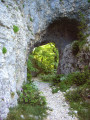
(22) Return to the signposted path and follow it northwards; it passes under a natural arch and continues along a wooded ridge, before veering left into the forest, beneath the cliffs of the Rochers de la Truite.
At the next bend, the old path becomes a wide, recently constructed forest track, which makes another hairpin bend; 100 metres before crossing the Ruisseau de Toulau, a green and yellow sign directs you to turn right onto a path which, after fording the stream, leads directly back to the car park where you started (S/E).



 Visorando Member
 Moderate
 Difficult
 Easy
Easy  Tourism professional