Maisonneuve Circular – Falaise du Conte

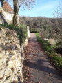
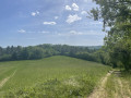
A short path takes you to explore the cliffs surrounding the campsite.

Details

55907959
Creation:
Last update:
Last review:
  • Walking
    Activity: Walking
  • ↔
    Distance: 1.99 mi
  • ◔
    Average duration: 1h 20 
  • ▲
    Difficulty: Easy

  • ⚐
    Back to start: Yes
  • ↗
    Ascent: + 443 ft
  • ↘
    Descent: - 443 ft

  • ▲
    Highest point: 673 ft
  • ▼
    Lowest point: 230 ft

Photos

Description of the walk

From Camping Maisonneuve in Castelnaud-la-Chapelle.

(S/E) Take the Route de l’Esparoutis (a cycle path that crosses the campsite) towards Saint-Cybranet. Follow the River Céou. At the first junction, turn left and take the Route du Randonneur.

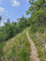
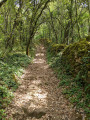
(1) Walk uphill for 150 metres and you’ll find a small path on your left which isn’t signposted but is marked on our walking maps.
Follow this path, using the app to ensure you don’t miss any turnings.

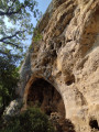
(2) After the Grotte des Fours, carry on straight for just over 100 metres until you reach a fork in the path.
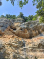
You’ll pass some climbers and you’ll be approaching the Falaise du Conte, which can be seen from the campsite.

(3) Head down to the left for 200 m until you reach another fork in the path.

(4) Turn left, heading south-east, and rejoin the path to the campsite (S/E).

Waypoints

  1. S/E : mi 0 - alt. 230 ft - Camping Maisonneuve
  2. 1 : mi 0.84 - alt. 276 ft - Path leading into the forest
  3. 2 : mi 1.58 - alt. 610 ft - Grotte des Fours. Falaise du Conte
  4. 3 : mi 1.68 - alt. 574 ft - Junction
  5. 4 : mi 1.79 - alt. 394 ft - Junction
  6. S/E : mi 1.99 - alt. 230 ft - Camping Maisonneuve - Céou (rivière)

Notes

You can download the maps of the walks we recommend by following the guide we’ve prepared for you on our website: Camping Maisonneuve -> Blogs -> Walks

Worth a visit

During the rainy season, we recommend that you take great care during your walks, as the path is dotted with mossy rocks that can be slippery.

Reviews and comments

4.2 / 5
Based on 3 reviews

Reliability of the description
4 / 5
Ease of following the route
4.3 / 5
Route interest
4.3 / 5
User 21831886

Overall rating : 4 / 5

Date of your route : Aug 24, 2026
Reliability of the description : ★★★★☆ Good
Ease of following the route : ★★★★☆ Good
Route interest : ★★★★☆ Good
Very busy route : No

A short, very pleasant walk, half of which follows the River Céou and the other half through the woodland covering the slopes of the cliffs.
The route passes through a climbing area; it was nice to watch the climbers tackling the rock face.

Machine-translated

Diaouldu
Diaouldu

Overall rating : 4.7 / 5

Date of your route : Nov 18, 2024
Reliability of the description : ★★★★☆ Good
Ease of following the route : ★★★★★ Very good
Route interest : ★★★★★ Very good
Very busy route : No

It’s easy to find the little path leading up to the cliffs (marked by an arrow on the road).
A very pleasant little walk, enjoyed in fine weather on 2 November 2024.
We extended it at the top by taking a short path to the prehistoric Vaufrey cave.
We’ll do it again in the spring, walking further along the cliffs.

Machine-translated

Saki7
Saki7
• Edited:

Overall rating : 4 / 5

Date of your route : Jul 15, 2024
Reliability of the description : ★★★★☆ Good
Ease of following the route : ★★★★☆ Good
Route interest : ★★★★☆ Good
Very busy route : No

A short route, which can be extended by leaving the car in the car park near the Castelnaud bridge.
There are some surprises further up the route (caves, cliffs, ‘climbing’ activities, etc.).
A lovely little climb to reach the top of the route.

Machine-translated

Other walks in the area

For more walks, use our search engine .

The GPS track and description are the property of this route's author. Please do not copy them without permission.