Circular walk around the Bois de Bas and Serre d’Abos hillsides

This very shaded circular route runs mainly through woodland. It offers lovely views of the Pyrenees and then of the Gave de Pau plain.
There is a fairly steep climb at 15 per cent (120 m elevation gain over 800 m); the rest of the route is straightforward. For approximately 6 km , this circular route follows the route of walk no. 18 from the old booklet, *32 walks and hikes in Miey-de-Béarn*, though it has a different starting point. The Tourisme 64 website still lists this walk under the name: Coteau du Bois de Bas, but the signposting has disappeared in certain key locations.

Details

n°103856792
Creation:
Last update:
Last review:
–
  • Walking
    Activity: Walking
  • ↔
    Distance: 6.78 mi
  • ◔
    Average duration: 3h 30 
  • ▲
    Difficulty: Moderate

  • ⚐
    Back to start: Yes
  • ↗
    Ascent: + 479 ft
  • ↘
    Descent: - 509 ft

  • ▲
    Highest point: 876 ft
  • ▼
    Lowest point: 404 ft
  • ⚐ Country: France
  • ⚐ City: Abos (64360)
  • ⚑
    Start/End: N 43.334814° / W 0.532056°
  • ❏
    IGN map(s): Ref. 1545ET, 1545SB
  • Hour-by-hour weather

Description of the walk

For directions to the car park, see the ‘Practical Information’ section. Park at the edge of the woodland on the D229.

(S/E) Head south-east, following the track for over 2 km until you reach a junction at the hamlet of Barraque.

(1) Take the steep track on the left; it becomes tarmac after a few hundred metres.
After 800 m, you’ll reach a crossroads on the ridge. Turn left onto Chemin Lapouble. Continue to the houses at Lahitte.

(2) Turn right, crossing the Ruisseau de l’Arrious. Follow the edge of the woodland until you reach a crossroads with several routes.

(3) Carry on straight ahead until you reach the Arbus-Parbayse Road, the D229. Take Rue du Château d’Abos on the left. The tarmac road then becomes a track. A little further on, pass a path on the right that is blocked by a barrier and you’ll soon reach a Fork in the road.

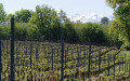
(4) Leave the mountain bike route and turn left onto the gently sloping track. When you reach a vineyard, turn left onto the track suitable for vehicles. Follow the vineyard along an almost level path. After a bend to the right, you’ll reach the end of the vineyard at the edge of a woodland.

(5) Continue straight on along the same track; the path remains largely level. After about 900 metres, you’ll reach a junction of forest tracks.

(6) Take the track leading down to the left, signposted ‘Sportez-vous bien n°2’. Continue along this track until
emerge onto a wide track suitable for vehicles, where you’ll see two signs: ‘Sportez-vous bien 1’ and ‘Sportez-vous bien 2’.

(7) Turn left, going in the opposite direction to the signs. Stay on this wide track at the foot of the hillside. Continue along the flat section.
You’ll reach the Arbus–Parbayse road, the D229. Take the path on the left that runs alongside the road to return to the car park at the edge of the woods on the D229 (S/E).

Waypoints

  1. S/E : mi 0 - alt. 440 ft - Gravel car park
  2. 1 : mi 1.42 - alt. 476 ft - Barraque
  3. 2 : mi 2.13 - alt. 840 ft - Lahitte
  4. 3 : mi 2.73 - alt. 702 ft - Crossroads with several directions
  5. 4 : mi 3.44 - alt. 692 ft - Fork in the road
  6. 5 : mi 4.17 - alt. 699 ft - End of the vineyard
  7. 6 : mi 4.75 - alt. 715 ft - Junction of forest tracks
  8. 7 : mi 5.49 - alt. 433 ft - End of the descent
  9. S/E : mi 6.78 - alt. 440 ft - Gravel car park

Notes

To return to the starting car park, take the D229 between Arbus and Parbayse. The car park is at the foot of the hillside in the countryside, at the start of a track suitable for vehicles.
Coming from Arbus, drive past the hillside; the car park is on the left-hand side of the road 2.5 km after Arbus.
If setting off from Parbayse, the car park is on the right, just before the hill.
Shorter alternative route:
(5) Take one of the two paths on the left to descend directly to the car park (S/E).

Worth a visit

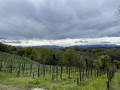
Before (2): a stunning view of the Pyrenees from the Chemin Lapouble, then further on, of the Gave de Pau plain.

Other walks in the area

For more walks, use our search engine .

The GPS track and description are the property of this route's author. Please do not copy them without permission.