The Las Hies Hills

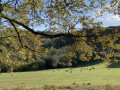
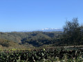
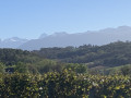
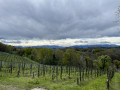
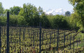
A short route along the Saint-Faust ridge road offering superb views of the Pyrenees mountain range with vineyards in the foreground.

Details

28459290
Creation:
Last update:
Last review:
  • Walking
    Activity: Walking
  • ↔
    Distance: 2.47 mi
  • ◔
    Average duration: 1h 35 
  • ▲
    Difficulty: Easy

  • ⚐
    Back to start: Yes
  • ↗
    Ascent: + 486 ft
  • ↘
    Descent: - 499 ft

  • ▲
    Highest point: 1,053 ft
  • ▼
    Lowest point: 587 ft
  • ⚐ Country: France
  • ⚐ City: Saint-Faust (64110)
  • ⚑
    Start/End: N 43.280267° / W 0.45577°
  • ❏
    IGN map(s): Ref. 1545ET, 1545SB
  • Hour-by-hour weather

Photos

Description of the walk

Park in the small car park beside the RD502, 177 Chemin des Crêtes – Saint-Faust B (right next to the former ‘Cité des Abeilles’).

(S/E) Head due south along the road to Saint-Faust. Superb views of the Pyrenees mountain range.

(1) Turn left onto the Côte de l’Église.

(2) Leave the road by taking the path on the right (southern entrance to the Chemin de l’Arrèc), a nature trail marked with signposts describing the local flora. Continue along the road that extends from the path until you reach a junction.

(3) Take a small path that climbs to the left 10 metres after the junction of the three tarmac roads. Carry on until, at the top of the climb, you reach a tarmac road: the Chemin de Massou.

(4) Follow this tarmac road and, at the junction, turn right to return to your car park (S/E).

Waypoints

  1. S/E : mi 0 - alt. 1,047 ft - Car park beside the D502
  2. 1 : mi 0.84 - alt. 945 ft - Saint-Faust
  3. 2 : mi 0.92 - alt. 915 ft - Fork in the path
  4. 3 : mi 1.54 - alt. 587 ft - Road junction
  5. 4 : mi 2.12 - alt. 928 ft - Chemin de Massou
  6. S/E : mi 2.47 - alt. 1,043 ft - Car park beside the D502

Reviews and comments

3.2 / 5
Based on 5 reviews

Reliability of the description
3.4 / 5
Ease of following the route
3.4 / 5
Route interest
2.8 / 5
Pimath
Pimath

Overall rating : 4 / 5

Date of your route : Jan 18, 2026
Reliability of the description : ★★★★★ Very good
Ease of following the route : ★★★★★ Very good
Route interest : ★★☆☆☆ Disappointing
Very busy route : No

A short route with little interest. A bit slippery after a rainy day.

Machine-translated

samuboss
samuboss
• Edited:

Overall rating : 1 / 5

Date of your route : Sep 01, 2024
Reliability of the description : ★☆☆☆☆ Very disappointing
Ease of following the route : ★☆☆☆☆ Very disappointing
Route interest : ★☆☆☆☆ Very disappointing
Very busy route : No

No hills, just posh types!

Dark and slippery path (dangerous)
We nearly fell over (not great with a dodgy knee!!!)
The hillsides with the view finally appear at the end along a stretch of (very busy) road
It’s a shame the walk was longer than stated; it was already dark
To be avoided at all costs....

Machine-translated

Tayuya
Tayuya

Overall rating : 5 / 5

Date of your route : Jan 29, 2024
Reliability of the description : ★★★★★ Very good
Ease of following the route : ★★★★★ Very good
Route interest : ★★★★★ Very good
Very busy route : No

A lovely walk with some lovely views along part of the route. No one else on the path. I’d recommend it.

Machine-translated

Mikall
Mikall

Overall rating : 4.7 / 5

Date of your route : Apr 21, 2023
Reliability of the description : ★★★★★ Very good
Ease of following the route : ★★★★★ Very good
Route interest : ★★★★☆ Good
Very busy route : No

A short path that winds down and back up through the woods from the centre of St Faust, ending with a short stretch of road to follow. Nice 👍

Machine-translated

CARDEILLAT
CARDEILLAT

Overall rating : 1.3 / 5

Date of your route : Dec 11, 2022
Reliability of the description : ★☆☆☆☆ Very disappointing
Ease of following the route : ★☆☆☆☆ Very disappointing
Route interest : ★★☆☆☆ Disappointing
Very busy route : No

A lot of (dangerous) driving on busy roads, despite it being daytime (Sunday) and on secondary roads.
The route wasn’t quite as described, so we turned back.
Yet it’s supposed to be an ‘easy’ route.
Very few landmarks.
Best avoided!

Machine-translated

Other walks in the area

For more walks, use our search engine .

The GPS track and description are the property of this route's author. Please do not copy them without permission.