Circular route through the Ousse valley via the woods

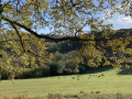
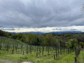
A circular route mainly through the countryside, passing through the village of Poey-de-Lescar.

Details

6785086
Creation:
Last update:
Last review:
  • Walking
    Activity: Walking
  • ↔
    Distance: 4.30 mi
  • ◔
    Average duration: 2h 05 
  • ▲
    Difficulty: Easy

  • ⚐
    Back to start: Yes
  • ↗
    Ascent: + 167 ft
  • ↘
    Descent: - 167 ft

  • ▲
    Highest point: 597 ft
  • ▼
    Lowest point: 469 ft

Description of the walk

Park to the east of the village of Poey-de-Lescar on Chemin du Pont-Long, just past the water tower.

(S/E) Turn right onto the country lane and then turn right again to reach the Cami Salie crossroads near Baptiste’s houses.

(1) Cross this road, walk a few steps straight on, then immediately turn left onto a footpath and enter the woods. At the next crossroads, veer left and continue along this path through the woods. Join the country lane, follow it to the right for a few metres, then turn left onto the narrow path to stay in the woods. Pass over a small pond and continue along the path opposite. You’ll come out onto the Cote des Maures track. Turn right onto it to quickly reach the D817 bypass.

(2) Turn right just before the bridge under the bypass. Follow the bypass along a path, then, as you move away from it, stay on the wider track that follows on from the path. You’ll reach the ford marked by a small footbridge.

(3) Do not cross it, but continue along the bank of the Ousse des Bois. At the bend, leave the bank and continue along the wide path to reach the school in the village of Poey-de-Lescar.

(4) Cross the road to stay on the protected section and head up the hill. Continue along the main road (D 208). You’ll reach the ‘herradé’, a place where cows and horses used to be shoed.

(5) Turn right, then a few hundred metres further on, take the Chemin du Malapet. You’ll reach the junction with the Chemin Las Senderos

(6) Turn left onto this track, which becomes a footpath and joins the Chemin Buros just before the motorway.

(7) Take this path on the left, then, after a 90° bend to the right, continue on to reach the car park on Chemin du Pont-Long (S/E).


Waypoints

  1. S/E : mi 0 - alt. 591 ft - Chemin du Pont-Long car park
  2. 1 : mi 0.41 - alt. 574 ft - Baptiste
  3. 2 : mi 1.41 - alt. 528 ft - D817 bypass
  4. 3 : mi 2.18 - alt. 486 ft - Ford at the - Ousse des Bois (rivière) - Affluent du Gave de Pau
  5. 4 : mi 3.02 - alt. 476 ft - Poey-de-Lescar School
  6. 5 : mi 3.33 - alt. 538 ft - The herradé
  7. 6 : mi 3.62 - alt. 541 ft - Chemin Las Senderos junction
  8. 7 : mi 3.96 - alt. 587 ft - Chemin Buros junction
  9. S/E : mi 4.3 - alt. 591 ft - Chemin du Pont-Long car park

Notes

No difficulty, but there may be a muddy patch between (2) and (3).
You follow the Way of St James in places.

Worth a visit

(5) The ‘herradé’ was used for shoeing cows and horses.

Reviews and comments

4.5 / 5
Based on 2 reviews

Reliability of the description
4.5 / 5
Ease of following the route
4.5 / 5
Route interest
4.5 / 5
dinezia
dinezia

Overall rating : 4 / 5

Date of your route : Apr 28, 2025
Reliability of the description : ★★★★☆ Good
Ease of following the route : ★★★★☆ Good
Route interest : ★★★★☆ Good
Very busy route : No

A lovely, pleasant and easy circular walk

Machine-translated

Lou Poeyou
Lou Poeyou

Thank you for your comment.

Machine-translated

Espinose
Espinose

Overall rating : 5 / 5

Date of your route : Oct 25, 2021
Reliability of the description : ★★★★★ Very good
Ease of following the route : ★★★★★ Very good
Route interest : ★★★★★ Very good
Very busy route : No

Every time I go out (for a walk or a hike), I print out the Visorando pages.
I’ve rarely been disappointed.

Machine-translated

Other walks in the area

For more walks, use our search engine .

The GPS track and description are the property of this route's author. Please do not copy them without permission.