Country:

 City:


Park in the Salle des Fêtes car park.
(S/E) On leaving the car park, turn left onto Rue de l’École towards Hauterive, then, at the well, turn right onto Route d’Hauterive.
(1) At the cross, continue along the road, still heading towards Hauterive.
(2) Turn right onto the farm track, which branches off to the left after 200 m. Follow this track, which runs parallel to and overlooks the river, and discover Les Revousses, a wetland area on the banks of the Grosne.
(3) After passing under the power line, turn right to head down towards the Grosne. Take in the poplar grove on the opposite bank of the Grosne, then turn immediately left (20, m) to continue towards the Hauterive mill (the hamlet is in sight).
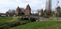
(4) At the Hauterive mill, continue for about 250 m along the road that passes in front of the mill towards Santilly as far as the automatic sluice bridge, then turn back.
(4) Opposite the mill, head up the road to the right until you reach the junction with the La Chapelle-Hauterive road. Turn right towards Hauterive en haut, then immediately take the farm track that climbs to the left until you reach the entrance to the woodland. As soon as you enter the woodland, this track branches off to the left. Continue until you reach the logging track between plots 70 and 72 (numbers written in red on the trees).
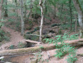
(5) Follow this logging track to the right until you reach the forest track (sommière), emerging opposite plots nos. 69 and 71. Take the sommière to the right for 100 metres, crossing the bridge over the Glandon.
(6) Turn left onto the logging track between plots 71 and 73, and follow it until you reach the RD6.
(7) Turn left and follow the RD6 until you reach the 200-year-old oak tree, at the foot of which there is a picnic area and an information board about the tree that witnessed the Revolution. Continue along the RD6 until you reach a track branching off to the right, known as the ‘Sommière la Brisée Curée’, before the high-voltage power line.
(8) Turn right and carry on to the hunting lodge. Cut across the ‘Sommière du Milieu’ and continue in the same direction until you reach the junction where a yellow sign on the left indicates ‘Bourg de La Chapelle-de-Bragny’.
(9) Turn right onto the path leading to the Étang des Reppes, which marks the boundary between the municipalities of La Chapelle-de-Bragny and Etrigny; the pond is in the municipality of Etrigny.
(10) Take the path on the left, opposite the pond’s embankment, which goes round the woodland and passes under the high-voltage power line. Then turn left onto the path (go round the iron barrier) which passes under the high-voltage power line.
(9) At this junction, this time turn right towards “Bourg de La Chapelle de Bragny”.
(11) Turn left onto the Chemin de Tallant, which leads to La Chapelle-de-Bragny. Cross the Sommière du Milieu again. About 400 m further on, and before the path descends towards the “Mouille du Chemin de Tallant”, take a detour along the path that branches off to the left to a small pond which I call the Bauge aux sangliers.
(12) Retrace your steps and turn left to reach the “Mouille du Chemin de Tallant” straight away.
(13) In wet weather, try to go round this spot as best you can on the left – otherwise you’ll get your shoes a bit muddy!
Continue along the path until it joins the RD6, turn right towards Lalheue, then left towards Messey-sur-Grosne. Turn left one last time opposite the church to arrive at the Salle des Fêtes (S/E).

 Association / Club / Walk leader
 Easy

 Visorando Member