23/08/2023: The walk has been modified.


 Country:

 City:
City:


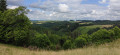
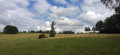
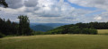
The walk starts at the northern edge of the village, at the junction between the Route du Oradel and the Chemin des Vignes. You can park at the side of the road, as there isn’t much traffic. It’s also possible to park freely in the village of Vergnolles. There is no designated car park in the village. Parking is free (please avoid blocking any doors or garages!)
(S/E) Head south along the Chemin des Vignes. At the end of the street, turn right onto the Chemin du Trel for about 50 metres until you reach a Fork in the road with another street on the left.
(1) Turn left and continue along a path that takes you onto theGRP® des Gabariers.
(2) Follow it to the right (red and yellow markings). Climb the gentle slope, keeping a south-south-easterly then south-easterly heading.
(3) Turn left to continue climbing along theGRP® on the ridge path (if you carry on straight ahead, you’ll head back down). In open terrain, you’ll reach a farm track, which you follow to the right for about 250 m.
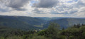
(4) You then leave the track and take a path on the right that runs between the fields (still following theGRP® marked in red and yellow). You pass close to some rocks (view of the Dordogne valley). You head back down, staying on the GRP®.
(5) When theGRP® takes a sharp left-hand bend, leave it and turn right.
(6) At the fork in the road just after the left-hand bend, take the left-hand branch. Descend, negotiating several bends. Stay on the main path and ignore the side tracks. At the bottom, you’ll come out onto the D116.
(7) Follow the road to the right and enter Vergnolles. Cross the village, staying on the D116 (Route du Temple then Route du Pradel), and return to the starting point (S/E).

 Visorando Member

 Difficult