Country:

 City:
City:


On the Berthiand road, 1 km from the pass on the Nurieux side, take the Vers road. Continue to the hamlet, walk through it to the fountain where there is a small car park for four cars, which is often free.
(S/E) Leave the car park, passing in front of the fountain. Turn left towards the north, heading for Napt. Pass in front of a wash house.
(1) After the leat, turn left towards Napt. Follow the path as it veers northwards and, about 500 metres further on, take the path on the left into the woods, keeping in the same direction.
(2) Leave the northerly direction and turn left onto the path which descends into the woods and reaches a track at the bottom of the Combe du Bois de l’Épinet. Follow this track northwards. Pass an old fountain, a washhouse and the Napt mill. Walk up to the village and turn right onto the main street, passing the bakery.
(3) After 150 m, head down to the right along a path towards the Mare de Napt, which you can see on your left. The path climbs eastwards in gentle switchbacks and joins a wide track signposted ‘car park’. Cross this track and continue opposite along a faint path which starts to the right of the sign marked ‘car park’. You’ll reach a wide track; follow this eastwards until you come to a track.
(4) Turn left onto this track and carry on straight ahead to the wash house and the Crépiat fountain. Then take Rue de la Fontaine on the right, heading south-east. You’ll reach the sign marking the village entrance, where a very wide path branches off to the left, heading east.
(5) Ignore this, carry on for a few dozen metres, then take a small, fairly steep path opposite which winds its way uphill. You’ll reach a water catchment tank, which you must go round to join a path that you follow southwards until it joins a track.
(6) Head down to the left for about 200 m.
(7) Turn right onto the path which climbs back up to the ridge and then curves to the left.
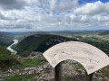
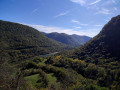
(8) At the junction, take the fairly steep path on the right which climbs to the summit of the Côte (799 m). Admire Lake Nantua and Mont Blanc to the left, as well as the Jura ridges.
(9) Head southwards, passing between the radio masts. Reach the pass on the Vers road, at a place called Goulet de Bois.
(10) Head down to the right towards the hamlet until you reach the car park (S/E).

 Visorando Member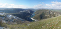
 Moderate
 Difficult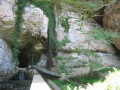
 Association / Club / Walk leader