Circular Rumont starting from Moivrons

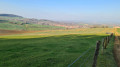
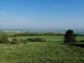
A pleasant and varied walk. Views over the Seille Valley, the Natagne Valley and the Mauchère Valley.

Details

509657
Creation:
Last update:
Last review:
  • Walking
    Activity: Walking
  • ↔
    Distance: 11.77 mi
  • ◔
    Average duration: 6h 15 
  • ▲
    Difficulty: Difficult

  • ⚐
    Back to start: Yes
  • ↗
    Ascent: + 971 ft
  • ↘
    Descent: - 971 ft

  • ▲
    Highest point: 1,339 ft
  • ▼
    Lowest point: 696 ft
  • ⚐ Country: France
  • ⚐ City: Moivrons (54760)
  • ⚑
    Start/End: N 48.824549° / E 6.253286°
  • ❏
    IGN map(s): Ref. 3315ET, 3414O
  • Hour-by-hour weather

Description of the walk

Park in Moivrons in the car park on the right-hand side of the church.

(S/E) Turn right onto Rue de la Gare. Continue to the junction with the street leading to the church.

(1) Turn sharply right onto this street, walk past the church and turn left immediately to reach Chemin de Breuil.

(2) Turn right onto it, cross Rue de Villers and take Chemin de Bratte. Continue along this path, passing under the power line. Walk alongside the Ruisseau de Guelotte at a distance, then veer away from it to reach the Col de Vassuchamp.

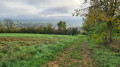
(3) Take the path on the left at the edge of the forest. Climb through the forest along this path until you reach the clearing (do not take the path on your right as you climb). You will reach a T-junction.

(4) Take the path on the right and continue straight on through the Bois de la Tremblouze. You’ll reach the junction with the track leading to the main track serving an antenna (the Bratte radar).

(5) Carry on straight ahead through the forest to reach the D90E road. Turn left onto it and proceed to a junction beneath the power line.

(6) Turn right onto the path to head straight up towards the Forêt de la Rumont. You’ll reach the main forest track at a T-junction.

(7) Turn left onto it, passing through the gate. Continue to the end of the track, then follow the path that continues from there to a four-way junction.

(8) Carry on straight ahead towards Malleloy. When you reach the Chemin des Combes, head down it to rejoin the Allée des Encloses further down.

(9) Turn left onto this path to reach the track at the crossing over the Mauchère.

(10) Cross the stream to the right and join the D90 further down.

(11) Turn right to cross the D90 and continue along the Mauchère Greenway towards Faulx
Carry on straight ahead along the Mauchère Greenway until you reach Leyr station.

(12) Turn left off the road; the path continues parallel to the road.

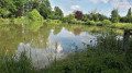
(13) Cross the D90f and continue along the Voie Verte to the Étang du Jardinet in Villers-lès-Moivrons (picnic tables).

(14) Continue along the Voie Verte until you reach the junction with the D10.

(15) Turn left and head up the Grand Rue to return to the car park (S/E).

Waypoints

  1. S/E : mi 0 - alt. 778 ft - Car park on the right-hand side of the church
  2. 1 : mi 0.18 - alt. 797 ft - Crossroads towards the church
  3. 2 : mi 0.35 - alt. 801 ft - Chemin du Breuil
  4. 3 : mi 1.41 - alt. 1,178 ft - Col de Vassuchamp
  5. 4 : mi 1.75 - alt. 1,322 ft - Clearing. View over the valley of the - Seille (Affluent de la Moselle)
  6. 5 : mi 2.12 - alt. 1,306 ft - Alternative route
  7. 6 : mi 2.95 - alt. 1,135 ft - Junction with Route de Bratte
  8. 7 : mi 3.55 - alt. 1,316 ft - Rumont crossroads
  9. 8 : mi 4.95 - alt. 1,073 ft - Sign for Malleloy
  10. 9 : mi 5.44 - alt. 705 ft - Allée des Encloses
  11. 10 : mi 5.7 - alt. 709 ft - D90
  12. 11 : mi 5.91 - alt. 722 ft - Mauchère Greenway
  13. 12 : mi 10.56 - alt. 823 ft - Leyr railway station
  14. 13 : mi 10.75 - alt. 817 ft - Leyr-Villers Greenway
  15. 14 : mi 11.33 - alt. 771 ft - Étang du Jardinet
  16. 15 : mi 11.64 - alt. 771 ft - D10, entrance to Moivrons
  17. S/E : mi 11.77 - alt. 778 ft - Car park on the right-hand side of the church

Reviews and comments

3.9 / 5
Based on 3 reviews

Reliability of the description
3.7 / 5
Ease of following the route
4.3 / 5
Route interest
3.7 / 5
erger
erger

Overall rating : 3.7 / 5

Date of your route : Apr 02, 2018
Reliability of the description : ★★★★☆ Good
Ease of following the route : ★★★★☆ Good
Route interest : ★★★☆☆ Average

lots of tracks that had been badly damaged (impassable on 1 April) by forestry and agricultural work, and 8 km along a greenway (a straight stretch running alongside the road)

Machine-translated

claude57530
claude57530

Overall rating : 4.3 / 5

Date of your route : Apr 27, 2017
Reliability of the description : ★★★★☆ Good
Ease of following the route : ★★★★★ Very good
Route interest : ★★★★☆ Good

:A lovely walk, varied scenery, an easy-to-follow path, and places to have a picnic.

Machine-translated

morlockbob
morlockbob

Overall rating : 3.7 / 5

Date of your route : Apr 23, 2017
Reliability of the description : ★★★☆☆ Average
Ease of following the route : ★★★★☆ Good
Route interest : ★★★★☆ Good

A pleasant and easy ride, contrary to the rating (no real climb)
It’s worth noting that half the walk follows a greenway which passes through villages and runs close to the road (which has little traffic). However, you’ll be out in the sun; it’s flat but less enjoyable if you’re looking to explore the heart of nature

Two points where we got a bit lost
The start: take Rue de l’Église (if you’re standing in front of the church facing the street); at the end of this short, uphill street, turn right and you’ll see a sign for ‘Bratte’ – you’ve arrived

4. The sign for the speed camera is misleading – ignore it. Carry on straight ahead along the track; do not take the small path on the left which leads to the speed camera and a rather tedious mini motocross route. Just in case, get back onto the tarmac track on the right and you’ll reach number 5 without any trouble

Machine-translated

Other walks in the area

For more walks, use our search engine .

The GPS track and description are the property of this route's author. Please do not copy them without permission.