Costa Teguise Circular Route

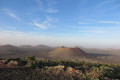
Walk around an ancient volcano, passing through its caldera without climbing it, as part of it has been completely eroded.
After a stretch through the desert, you’ll reach the coast with its beaches at the end of the route.

Details

n°64703090
Creation:
Last update:
Last review:
  • Walking
    Activity: Walking
  • ↔
    Distance: 7.48 mi
  • ◔
    Average duration: 3h 50 
  • ▲
    Difficulty: Moderate

  • ⚐
    Back to start: Yes
  • ↗
    Ascent: + 449 ft
  • ↘
    Descent: - 449 ft

  • ▲
    Highest point: 430 ft
  • ▼
    Lowest point: 10 ft

Photos

Description of the walk

Park at the Playa de los Charcos car park.

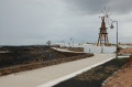
(S/E) From the car park, head back towards Avenida Islas-Canarias, turn right and, 100 metres further on, turn left. Go under the archway and follow the wide pedestrian walkway to reach Avenida Las Palmeras.

(1) Turn right, then take the first left onto Calle Atalaya. Walk up the street along the path that runs alongside it on the right, until you reach a sharp left-hand bend.

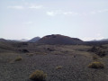
(2) Leave the street and continue straight on, following the path opposite, towards “Montande Tinaguache”. Keep heading along the path towards the old Tinaguache volcano crater, on the left-hand side of the summit. Further on, turn left at a right angle.

(3) Head off to the right towards the volcano and continue, keeping a general north-westerly direction.

(4) Once you reach the caldera, follow the path, which continues to climb slightly and curves widely, taking you round the crater on the right-hand side. The route takes you between two ancient craters: the Montaña de Tinaguache on the left and the Montaña Tejia on the right.

(5) You’ll come alongside the tarmac road, then turn off to the left.

(6) Leave the path to the right and head towards a junction. Cross over and join Calle Ruta del Norte. Cross the bridge over the wadi and, a few metres further on, take the path that starts on the left and runs alongside the dry riverbed. Further on, cross Calle de la Laguna and continue along the path opposite until you reach Avenida Las Palmeras.

(7) Turn right and walk along the avenue on the pavement. Continue for about 1 km until you reach a roundabout and the “Blue Bay Lanzarote” Hotel.

(8) Cross at the pedestrian crossing. About twenty metres further on, on the left, a path begins which immediately turns right and leads towards the seafront, gradually leaving behind the desert-like, even lunar, landscapes to rejoin the seaside town and its coastal promenade at Playa Bastián.

(9) Turn left and head towards Playa del Jablillo. Pass Punta de Tope and reach Playa de las Cucharas.

(10) Continue along the coast to reach Playa de las Charas, then the car park where you started (S/E).

Waypoints

  1. S/E : mi 0 - alt. 43 ft - Playa de los Charcos car park
  2. 1 : mi 0.38 - alt. 52 ft - Avenida Las Palmeras
  3. 2 : mi 0.95 - alt. 138 ft - Head towards “Montana Tinaguache”
  4. 3 : mi 1.55 - alt. 276 ft - Turn right at the fork
  5. 4 : mi 1.98 - alt. 364 ft - Caldeira
  6. 5 : mi 3.2 - alt. 236 ft - Tarmac road
  7. 6 : mi 3.59 - alt. 236 ft - Turn right at the fork
  8. 7 : mi 4.77 - alt. 66 ft - Avenida Las Palmeras
  9. 8 : mi 5.38 - alt. 85 ft - Pedestrian crossing
  10. 9 : mi 5.76 - alt. 30 ft - Playa Bastián Walk
  11. 10 : mi 7.04 - alt. 33 ft - Playa de la Cucharas
  12. S/E : mi 7.48 - alt. 43 ft - Return to the “Playa de los Charcos” car park

Notes

On the first part of the route, it is important to set off early to avoid the heat.
Take a bottle of water with you; there are no water points along the route.
It is recommended that you stick to the paths; they are lined with stones, and the sparse vegetation present is very fragile.
It is important to wear good walking shoes for the first part of the route, which is arid and stony.

Reviews and comments

5 / 5
Based on 1 review

Reliability of the description
5 / 5
Ease of following the route
5 / 5
Route interest
5 / 5
palmer jp
palmer jp

Overall rating : 5 / 5

Date of your route : Jan 27, 2025
Reliability of the description : ★★★★★ Very good
Ease of following the route : ★★★★★ Very good
Route interest : ★★★★★ Very good
Very busy route : No

a lovely walk
alternating between the walk towards the volcano
and a stroll along the coast

Machine-translated

Other walks in the area

For more walks, use our search engine .

The GPS track and description are the property of this route's author. Please do not copy them without permission.