From Vouzon to Les Quatre Vents

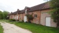
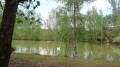
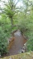
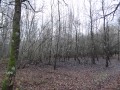
This route offers a taste of Sologne’s landscapes: ponds and streams, white sandy paths, conifers, birches and beech trees, with a mix of unspoilt countryside, farms and pretty villages boasting a few old houses.

Details

n°1089259
Creation:
Last update:
Last review:
  • Mountain biking
    Activity: Mountain biking
  • ↔
    Distance: 24.26 mi
  • ◔
    Duration according to the author: 5 hrs 
  • ▲
    Difficulty: Moderate

  • ⚐
    Back to start: Yes
  • ↗
    Ascent: + 266 ft
  • ↘
    Descent: - 262 ft

  • ▲
    Highest point: 469 ft
  • ▼
    Lowest point: 351 ft
  • ⚐ Country: France
  • ⚐
    Area: Sologne
  • ⚐ City: Vouzon (41600)
  • ⚑
    Start/End: N 47.646254° / E 2.05818°
  • ❏
    IGN map(s): Ref. 2220E, 2221SB

  • ◶
    Type of surface:
  •  
     
     
    ■ 33% Road ■ 34% Byway ■ 33% Path
  • ⇧
    Bike carrying: Not specified
  • ▲
    Difficulty: Not specified
  • Hour-by-hour weather

Photos

Description of the route

Start from the car park at the church square in Vouzon.

(S/E) From the car park, take the grassy lane on the left with your back to the church; turn right at the end of the lane, then left onto Rue de la Fontaine, which becomes Route de Souvigny D101 (take care).

(1) Turn left onto the path reserved for ‘Authorised Vehicles’, which is closed off by a barrier, shortly after the Tabardière farm on your right. The Allée de la Grillère runs through the Lamotte Beuvron state-owned forest.

(2) Pass through another barrier at the Carrefour de la Grillère, then turn slightly left. Cross the D125 (take care) then continue straight on towards the Ferme de la Grillère. Follow a path alongside the pond, then pass the farm and its pond mill on your left, which face the Château de la Grillère.

(3) At the crossroads, follow the sign for “Sennely 4.5 km” by turning right, which means ignoring the main track signposted “Ménestreau 6 km”. This forest track curves to the right, crosses a pond embankment, then turns left, heading north-north-east.

(4) At the junction with the D17 (take care), turn right, then left onto the grassy track which continues the path leading to La Guérinière. Continue along the track opposite, crossing the D64.

(5) Turn right where the path meets the lane leading to La Courtaille, then left after about fifty metres, at the edge of the forest. After 200 metres, turn left onto the cross-path running alongside the pond

(6) At the crossroads, turn left then immediately right onto theGR® de Pays de Sologne to follow the watercourse, which will have a leat on the right-hand side. Cross the Cosson.

(7) Follow the signs for “Ménestreau 9.5 km” to the left until you reach theGR®3C, marked in white and red. Look out for a beech tree over a hundred years old on your right.

(8) Leave theGR® by turning right at La Maugerie, towards La Belle Fontaine.

(9) Turn left onto the D12.

::10: Then turn left again onto the lane signposted “Les Quatre Vents” (sign attached to a tree).

(11) Turn right towards Les Quatre Vents, passing between two ponds. The lane turns left just after the farm.

(12) At the crossroads, turn right towards the north. This path turns left and then joins a main lane.

(13) Take the lane on the left towards La Bouillie. This lane crosses a stream, then turns right in front of the farm, heading west.

(14) At the crossroads, turn left towards La Rougerie and do not continue straight ahead as the sign for “La Rougerie, Menestreau 8 km” might suggest.

(15) At La Rougerie, pass the farm and then turn left onto the lane signposted “Ménestreau 7 km”.

(16) Turn right onto the side lane, as the main lane ends shortly afterwards. When you reach the D64 (take care), turn right then left onto the track signposted “Ménestreau 7 km” towards Les Foucault.

(17) At the three-way junction, continue straight ahead following the sign for “Ménestreau 6 km”, then take the path on the right and cross the Cosson. The route crosses the tarmac “Route de Vanne”, passes “Fay” on the left, then runs alongside the Étang de Lepaut on the right, followed by a marshy area on the left.

White-red markings (GR®3C)

(18) Turn right onto theGR®3C. This becomes the “Route de Sennely” as you approach Ménestreau en Villette. Cross the Route de Vouzon. In the village square, take the street running alongside the church, which can be spotted from a distance thanks to its bell tower.

(19) Turn left at the Fork in the road onto the Route des Moynards.

Yellow-red markings (GRP® de Sologne)

(20) Follow the sign for “Vouzon 9km”, heading left along the lovely avenue. This crosses the River Canne at the Pont de Chambouy.

(21) Stay on theGRP® by taking the path on the left leading to the village of Vouzon. Walk alongside the “Poteau” pond, then the Chastanière. The path widens as you approach the village, then becomes tarmac and is named Rue de Chambouy, then Rue de la Black Cross.

(22) Keep left at the junction with Rue des Crayers, then turn right onto the main street. This will take you to the church square (S/E).


Waypoints

  1. S/E : mi 0 - alt. 456 ft - Start at the church square
  2. 1 : mi 1.5 - alt. 463 ft - On the left, a barrier marked ‘Authorised vehicles only’
  3. 2 : mi 2.8 - alt. 449 ft - Barrier at the La Grillère crossroads
  4. 3 : mi 3.59 - alt. 413 ft - "Sennely 4.5 km" on the right
  5. 4 : mi 4.91 - alt. 417 ft - Turn right, then left onto a grassy path
  6. 5 : mi 6.43 - alt. 404 ft - Turn right where the lane meets the path, then left
  7. 6 : mi 6.75 - alt. 397 ft - Left/right at the fork in the road
  8. 7 : mi 7.13 - alt. 404 ft - On the left: “Ménestreau 9.5 km”
  9. 8 : mi 7.8 - alt. 394 ft - Turn right at La Maugerie
  10. 9 : mi 9.46 - alt. 466 ft - Turn left where it meets the D 12
  11. 10 : mi 9.99 - alt. 427 ft - Turn left towards “Les Quatre Vents”
  12. 11 : mi 10.56 - alt. 407 ft - Turn right between two ponds
  13. 12 : mi 11.03 - alt. 413 ft - Turn right towards the north
  14. 13 : mi 11.88 - alt. 423 ft - Turn left towards La Bouillie
  15. 14 : mi 13.6 - alt. 390 ft - Turn left towards La Rougerie
  16. 15 : mi 13.92 - alt. 390 ft - Turn left after the “Ménestreau 7 km” farm
  17. 16 : mi 14.05 - alt. 394 ft - Turn right onto the side lane
  18. 17 : mi 14.99 - alt. 446 ft - Opposite “Ménestreau 6 km”
  19. 18 : mi 17.49 - alt. 407 ft - Turn right onto the GR 3C
  20. 19 : mi 18.59 - alt. 390 ft - Turn left at the fork in the road
  21. 20 : mi 18.83 - alt. 381 ft - On the left: “Vouzon 9 km”
  22. 21 : mi 21.17 - alt. 381 ft - Turn left towards Vouzon
  23. 22 : mi 24.13 - alt. 463 ft - Turn left at the junction with Rue des Crayers
  24. S/E : mi 24.26 - alt. 456 ft - Finish at the church square

Notes

For the sake of simplicity, the route description omits the various adjacent private paths, which are always signposted. They are sometimes even redundant, and their location can be confusing on local paths.

The route requires a good sense of direction (or suitable equipment) along its entire unmarked section.
Some sections may be muddy after heavy rain, or even flooded.
Allow between 4 and 5 hours on a mountain bike.

You can stop off at Ménestreau (restaurants).

As access to the country lane that runs past the Quatre Vents farm is blocked by a mound of earth, the building can only be viewed by passing through the entrance to the property, which incorporates the said country lane.

Alternative route

It is possible to shorten the route (31.8 km) by staying on theGR®3Cat La Maugerie (8). To do this, head towards the Château de la Turpinière, then along the Allée d’Orléans; theGR®3C(also known asthe GRP® de Sologne) joins the route described at (18).

Worth a visit

During the walk, you’ll see:
- the lovely square at Ménestreau-en-Villette, the Quatre Vents farm, the Château de la Grillère (though closed off by a gate), its pond mill and its monumental farmhouse, a remnant of Napoleon III’s visit to Sologne,
- the state-owned forest at Lamotte-Beuvron,
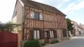
- the bell tower of Vouzon Church and its historic houses.

Always be cautious and plan ahead when you're outdoors. Visorando and the author of this route cannot be held responsible for any accidents occurring on this route.

The GR® and PR® markings are the intellectual property of the Fédération Française de Randonnée Pédestre.

Reviews and comments

5 / 5
Based on 1 review

Reliability of the description
5 / 5
Ease of following the route
5 / 5
Route interest
5 / 5
Jean-Louis Pinault
Jean-Louis Pinault

Thank you very much; I’ve made the changes by amending the layout and the description.
Have a good day,
Jean-Louis

Machine-translated

Didier-R
Didier-R

Please note that the gate at the exit from La Courtaille is now locked with a padlock. You must now turn right at point 5 and then left to rejoin the CR route, which joins the GR du Bond near the gate.

Machine-translated

Jean-Louis Pinault
Jean-Louis Pinault

Thank you all!!!

Machine-translated

jiap4631
jiap4631

Overall rating : 5 / 5

Date of your route : Aug 28, 2018
Reliability of the description : ★★★★★ Very good
Ease of following the route : ★★★★★ Very good
Route interest : ★★★★★ Very good

Thank you for suggesting such a lovely route

Machine-translated

For more walks, use our search engine .

The GPS track and description are the property of this route's author. Please do not copy them without permission.