Circular Oberschrammbach loop via Pfitscher Joch

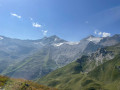
A superb hike in a beautiful high-mountain setting, at the foot of the Schrammacher and its glaciers. The first section consists of a steady, pleasant climb to a pass on the Austrian-Italian border. You then set off across the mountain flanks, down which several streams rush, through a rocky landscape. The descent passes close to small lakes that are ideal for a break.

Details

n°3143829
Creation:
Last update:
Last review:
  • Walking
    Activity: Walking
  • ↔
    Distance: 8.53 mi
  • ◔
    Average duration: 6h 10 
  • ▲
    Difficulty: Difficult

  • ⚐
    Back to start: Yes
  • ↗
    Ascent: + 2,582 ft
  • ↘
    Descent: - 2,585 ft

  • ▲
    Highest point: 8,038 ft
  • ▼
    Lowest point: 5,853 ft

Description of the walk

Access to the starting point:
In Ginzling, take the road leading up to the Schlegeisspeicher reservoir. From the Alpengastahaus Breitlahner, the road is narrow and features tunnels with alternating traffic. Leave the dam on your left, pass a few car parks along the road and park in the car park at the very end of the road, beside the River Zamserbach.

(S/E) At the end of the car park, cross the river. Turn right immediately and walk past a small shop. Follow Wanderweg 524 (hiking trail) and walk alongside the river on your right. Head up the valley along a gentle, steady slope.

(1) At a fork in the road, keep to the right, as close to the river as possible (ignore the entrance to an inn on the left). Soon, on the right, the river splits and forms a vast wetland area (shown as a lake on the Austrian map).

(2) Leave the main path and turn left onto a track. Keep parallel to the main path (west) then veer left. Climb southwards via a few hairpin bends. Several tracks criss-cross here; choose the one that suits you best. This will take you to the border pass known as Pfitscher Joch in Austria and Passo di Vizze in Italy.

(3) Then follow Wanderwegs 524 and 528 to the right (north-west) on a gentle descent. Shortly afterwards, at a small lake, turn left onto Wanderweg 528 (let 524 veer off to the right). Continue the gentle descent and cross two streams. Climb up the mountainside along a good, rocky path.

(4) Crossing the Oberschrammbach stream (Oberschrammbachbäche) requires a bit of care. Continue along the mountainside and go round a spur on the right (Ameiskopf on the OSM map, Ameiskogel on the Austrian map).

(5) Turn right and begin a steep descent (do not continue straight on along a path not shown on the map). Pass some small lakes on your left and arrive at a junction.

(6) Follow Wanderweg 525 to the right (east-north-east). Then turn right onto this path and descend (south-east) alongside a stream on your left. Cross the stream and continue descending (east). Walk past a few clumps of shrubs, ignore a path branching off to the right and continue straight on (east-north-east) to the car park (S/E).

Waypoints

  1. S/E : mi 0 - alt. 5,892 ft - Car park - Schlegeisspeicher
  2. 1 : mi 2.26 - alt. 6,696 ft - Fork
  3. 2 : mi 2.78 - alt. 6,880 ft - Junction – Zamserbach
  4. 3 : mi 3.27 - alt. 7,365 ft - Pfitscher Joch (Passo di Vizze)
  5. 4 : mi 5.44 - alt. 8,018 ft - Oberschrammbach stream
  6. 5 : mi 6.25 - alt. 7,972 ft - Junction
  7. 6 : mi 6.67 - alt. 7,431 ft - Crossroads – Unnamed lakes
  8. S/E : mi 8.53 - alt. 5,892 ft - Car park - Schlegeisspeicher

Notes

Hiking boots are essential. Bring warm clothing and rainwear.

Apart from the numerous streams (drinking water?), no water sources have been identified along the route. There is an inn at the Pfitscher Joch pass (3), on the Italian side.

A detailed map is required (at the very least the one accompanying this description, or, if possible, a local map).

Worth a visit

- A pleasant climb up to the Pfitscher Joch pass (3).
- High-mountain scenery, with rock and streams between the pass (3) and the highest point of the circular route (5).
- The unnamed lakes near (6) are ideal for a break.

Reviews and comments

5 / 5
Based on 1 review

Reliability of the description
5 / 5
Ease of following the route
5 / 5
Route interest
5 / 5
cantona33
cantona33

Overall rating : 5 / 5

Date of your route : Aug 10, 2024
Reliability of the description : ★★★★★ Very good
Ease of following the route : ★★★★★ Very good
Route interest : ★★★★★ Very good
Very busy route : No

The first part of the route along the river is fairly easy (bikes are allowed), with the gradient steepening over the last kilometre to the Pfitscherjoch Haus refuge.
The second half of the route is quite difficult, as you have to cross a number of rocky screes on the mountainside. But it's on the way back that you get a view of the lake. Just before starting the descent along a waterfall, there is a mini plateau with a beach where you can dip your feet, or even more, for the bravest.

Arrive early enough (before 9am) to find a space in the car park closest to the dam.

Machine-translated

For more walks, use our search engine .

The GPS track and description are the property of this route's author. Please do not copy them without permission.